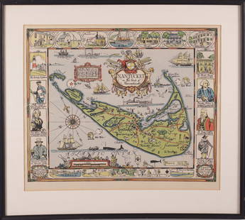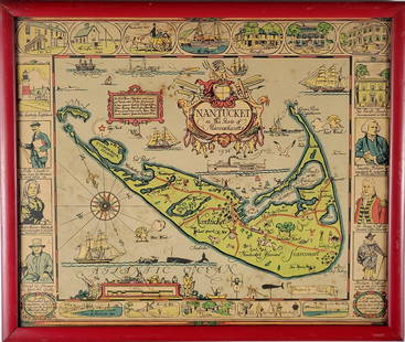
1940's Mayall Nantucket Island Map
Similar Sale History
View More Items in Maps & Atlases
Related Maps & Atlases
More Items in Maps & Atlases
View MoreRecommended Transportation & Travel Collectibles
View More


Item Details
Description
The Highways, By-ways and Notways Nantucket Island Massachusetts original map. By R. Newton Mayall 38" x 24" condition good. Provenance: The Larry & Julia Pollock collection of Shaker Hgts Ohio. Originally purchased from Through the Looking Glass in France .
Buyer's Premium
- 20%
1940's Mayall Nantucket Island Map
Estimate $250 - $350
8 bidders are watching this item.
Shipping & Pickup Options
Item located in Chesterland, OH, usSee Policy for Shipping
Payment

Related Searches
TOP


![Grecian Archipelago & Mediterranean Shores. Aegean islands. HUGHES 1859 map: CAPTION PRINTED BELOW PICTURE: The Grecian Archipelago. // the shores of the Mediterranean [The Adriatic, and the Black Sea] DATE PRINTED: 1859 IMAGE SIZE: Approx 37.0 x 54.0cm, 14.75 x 21.25 inches (](https://p1.liveauctioneers.com/5584/328641/177014339_1_x.jpg?height=310&quality=70&version=1715113718)


![1894 Johnston Map of Oceania [verso] Island in the Indian Ocean and Near Africa -- Oceania [verso]: Title: 1894 Johnston Map of Oceania [verso] Island in the Indian Ocean and Near Africa -- Oceania [verso] Madagascar; Mauritius; Seychelles; Cape Town; St. Helena and Ascension Islands; Socotra; Aden](https://p1.liveauctioneers.com/5584/328338/176911535_1_x.jpg?height=310&quality=70&version=1715113718)


![[Maps] Martin Zeiler, Itinerarium Italiae, 1640: [Maps] Martin Zeiler, Itinerarium Italiae, 1640, Martini Zeilleri. Itinerarium Italiae Nov-Antiquae: oder, Raiss-Beschreibung durch Italien, Matthaus Merian, Frankfurt, 40 plates, most double-page, in](https://p1.liveauctioneers.com/188/326797/176317459_1_x.jpg?height=310&quality=70&version=1713847031)
![[Maps] Gio. Ant. Magnini, Italia, 1620: [Maps] Gio. Ant. Magnini, Italia, 1620, Giovanni Antonio Magnini. Italia, data in luce da Fabio suo figliuolo al Serenissimo Ferdinado Gonzaga Duca di Matoua edi Monserrato etc. Bologna, for Sebastian](https://p1.liveauctioneers.com/188/326797/176317457_1_x.jpg?height=310&quality=70&version=1713847031)


![[MAP]. TODESCHI, Pietro. [Nova et Acurata Totius Americae Tabula auct. G.I. Blaeu] America quarta: [MAP]. TODESCHI, Pietro. [Nova et Acurata Totius Americae Tabula auct. G.I. Blaeu] America quarta pars orbis quam plerunq, nuvum orbem appellitant primo detecta est anno 1492 a Christophoro Columbo...](https://p1.liveauctioneers.com/197/329395/177650542_1_x.jpg?height=310&quality=70&version=1715364962)


