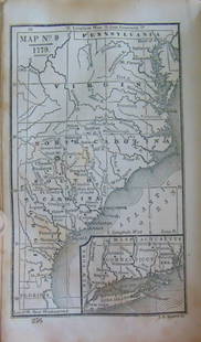
Kearney Map of Pensacola Harbor, Florida, 1822
Similar Sale History
View More Items in Maps & AtlasesRelated Maps & Atlases
More Items in American Maps & Atlases
View MoreRecommended Transportation & Travel Collectibles
View More


Item Details
Description
KEARNEY, Major James (Early 19th-century).
Pensacola Harbor and Bar, Florida, Surveyed 1822.
Lithographed map in four sheets.
Washington, 1822.
30" x 24 1/2"; 30" x 23 3/8"; 30" x 24 1/4"; 30" x 23 1/4" sheet.
This large, scarce, early survey of the bar, harbor and bay at Pensacola was conducted simultaneously with possession of the Florida Territory by the United States in 1822. This transfer from Spain had been authorized in 1819 by the Adams-Onis Treaty. Pensacola Bay had long been recognized as the best and most defensible harbor on the Gulf of Mexico, beginning with the attempted occupation by the Spanish in 1559 of the first European settlement in the United States.
After gaining control over Florida in the 1763 Treaty of Paris at the conclusion of the French and Indian War, Britain divided Florida into East and West colonies with Pensacola as the capital of West Florida. The largest battle ever fought in Florida was at Pensacola in May of 1781 with Spain defeating the English and thereafter taking control again over Florida. While the survey was concluded in 1822, it was not officially published until 1836 as an outgrowth of interest in establishing an inland canal from Pensacola to Mobile Bay, and from there a safe interior route to New Orleans and the Mississippi River. This map shows the area from the Grand Lagoon and Foster's Island (present-day Perdido Key) to the Corporation of Pensacola.
Drawn on a scale of 1" = 1/4 miles with great detail and hundreds of soundings. Also shown is the terminal of the proposed railroad from Columbus, GA. Four sheets joined and folding, as issued. This enormous, detailed survey is quite scarce, as it was not published in many copies of the government reports, and should not be confused with the smaller scale map reduction published in 1835, prior to official publication of this chart.
Buyer's Premium
- 25%
Kearney Map of Pensacola Harbor, Florida, 1822
Estimate $2,000 - $4,000
1 bidder is watching this item.
Shipping & Pickup Options
Item located in New York, NY, usOffers In-House Shipping
Local Pickup Available
Payment

Related Searches
TOP


![Mitchell: Antique Map of Florida & South Carolina, 1860: Map: 1860 Mitchell Map of Florida and South Carolina -- County Map of Florida [on sheet with] County Map of South Carolina Date Printed: 1860, Philadelphia Cartographer: S Mitchell Size: 9.1 x 10.6 in](https://p1.liveauctioneers.com/5584/109294/56069180_1_x.jpg?height=310&quality=70&version=1505338533)


![[MAP]. SARTINE, Antoine Plan de la Barre et du Havre de Charles-Town...1778. RARE REVOLUTIONARY WAR: [MAP]. SARTINE, Antoine (1729-1801). Plan de la Barre et du Havre de Charles-Town d'apres un plan Anglois leve en 1776... Paris: Depot de la Marine for M. de Sartine, 1778. Copperplate engraving, matt](https://p1.liveauctioneers.com/197/329395/177650540_1_x.jpg?height=310&quality=70&version=1715364962)


![[FLAGS]. 31-star American parade flag. Ca 1850-1859.: [FLAGS]. 31-star American parade flag. Ca 1850-1859. 22 x 36 1/2 in. cotton flag with 31 printed stars, configured in a double medallion surrounding a much larger central star, that is haloed in both](https://p1.liveauctioneers.com/197/329785/177758218_1_x.jpg?height=310&quality=70&version=1715625218)


