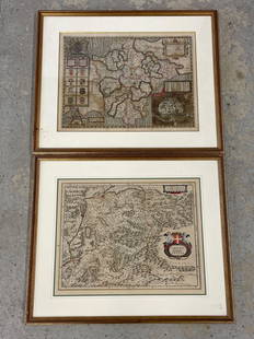
Two Early Maps of Poland
Similar Sale History
View More Items in Maps & AtlasesRelated Maps & Atlases
More Items in Maps & Atlases
View MoreRecommended Transportation & Travel Collectibles
View More


Item Details
Description
A map of Poland and Silesia, by W. & J. Blaeu circa 1640 and a map of Poland - Grodków and Nysa by J. Blaeu circa 1660.
Dimensions: The frames are 17" x 23" and 19" x 23".
Dimensions: The frames are 17" x 23" and 19" x 23".
Condition
Both appear to be in good condition with expected toning and foxing, not examined out of the frame. The frames have minor losses and wear.
Buyer's Premium
- 25%
Two Early Maps of Poland
Estimate $500 - $600
8 bidders are watching this item.
Shipping & Pickup Options
Item located in Pineville, PA, usSee Policy for Shipping
Local Pickup Available
Payment
Accepts seamless payments through LiveAuctioneers

Related Searches
TOP


![1894 Johnston Map of Oceania [verso] Island in the Indian Ocean and Near Africa -- Oceania [verso]: Title: 1894 Johnston Map of Oceania [verso] Island in the Indian Ocean and Near Africa -- Oceania [verso] Madagascar; Mauritius; Seychelles; Cape Town; St. Helena and Ascension Islands; Socotra; Aden](https://p1.liveauctioneers.com/5584/328338/176911535_1_x.jpg?height=310&quality=70&version=1715113718)


![[Maps] Gio. Ant. Magnini, Italia, 1620: [Maps] Gio. Ant. Magnini, Italia, 1620, Giovanni Antonio Magnini. Italia, data in luce da Fabio suo figliuolo al Serenissimo Ferdinado Gonzaga Duca di Matoua edi Monserrato etc. Bologna, for Sebastian](https://p1.liveauctioneers.com/188/326797/176317457_1_x.jpg?height=310&quality=70&version=1713847031)
![[Maps] Martin Zeiler, Itinerarium Italiae, 1640: [Maps] Martin Zeiler, Itinerarium Italiae, 1640, Martini Zeilleri. Itinerarium Italiae Nov-Antiquae: oder, Raiss-Beschreibung durch Italien, Matthaus Merian, Frankfurt, 40 plates, most double-page, in](https://p1.liveauctioneers.com/188/326797/176317459_1_x.jpg?height=310&quality=70&version=1713847031)


