


[KENTUCKY - MAPS]. SMITH, Karl. An Historical and
Similar Sale History
View More Items in Maps & Atlases


![[MAP]. SMITH, W.H., compiler. Smith’s Brooklyn Directory, f...: [MAP]. SMITH, W.H., compiler. Smith’s Brooklyn Directory, for the Year Ending May 1st, 1857. Being a Directory of the Inhabitants with an Avenue and Street Guide, and an Appendix. Brooklyn: Char](https://p1.liveauctioneers.com/928/274602/144224359_1_x.jpg?height=310&quality=70&version=1673894333)


Related Maps & Atlases


![Large Map of Kentucky and Tennessee: Large Map of Kentucky and Tennessee With map of North Dakota and South Dakota [separately] on versos Cartographer: George Franklin Cram Dated: Circa 1900 Type: Color Lithograph](https://p1.liveauctioneers.com/5614/330257/178045311_1_x.jpg?height=310&quality=70&version=1716032806)


More Items in Maps & Atlases
View More


![[MAP]. TODESCHI, Pietro. [Nova et Acurata Totius Americae Tabula auct. G.I. Blaeu] America quarta: [MAP]. TODESCHI, Pietro. [Nova et Acurata Totius Americae Tabula auct. G.I. Blaeu] America quarta pars orbis quam plerunq, nuvum orbem appellitant primo detecta est anno 1492 a Christophoro Columbo...](https://p1.liveauctioneers.com/197/329395/177650542_1_x.jpg?height=310&quality=70&version=1715364962)


![[MAPS]. HOMANN, Johann Baptist, HOMANN HEIRS, and Georg Matthäus SEUTTER. [Composite Atlas].: [MAPS]. HOMANN, Johann Baptist (1663-1724), HOMANN HEIRS, and Georg Matthäus SEUTTER (1678-1757). [Composite Atlas]. [Nuremberg, Augsburg, and others: Homann Heirs and others, maps dated between](https://p1.liveauctioneers.com/197/329395/177650530_1_x.jpg?height=310&quality=70&version=1715364962)
![[MAP]. ORTELIUS, Abraham. Americae Sive Novi Orbis, Nova Descriptio. 1573.: [MAP]. ORTELIUS, Abraham (1527-1598). Americae Sive Novi Orbis, Nova Descriptio. Antwerp, 1573. Engraved map with hand-coloring. Framed and double glazed, visible area 375 x 521 mm (unexamined out of](https://p1.liveauctioneers.com/197/329395/177650534_1_x.jpg?height=310&quality=70&version=1715364962)


![[MAP]. ORTELIUS, Abraham. Turcici Imperii Descriptio.1592.: [MAP]. ORTELIUS, Abraham (1527-1598). Turcici Imperii Descriptio. Antwerp, 1592. Engraved map with hand-coloring. Matted, framed, and double glazed, sight 406 x 521 mm (unexamined out of frame). Decor](https://p1.liveauctioneers.com/197/329395/177650538_1_x.jpg?height=310&quality=70&version=1715364962)

![[MAP]. ORTELIUS, Abraham. Aevi Veteris, Typus Geographicus. 1601.: [MAP]. ORTELIUS, Abraham (1527-1598). Aevi Veteris, Typus Geographicus. Antwerp, 1601. Engraved map with hand-coloring. Matted, framed, and double glazed, visible area 343 x 470 mm (unexamined out of](https://p1.liveauctioneers.com/197/329395/177650532_1_x.jpg?height=310&quality=70&version=1715364962)

Recommended Transportation & Travel Collectibles
View More


![[FLAGS]. 31-star American parade flag. Ca 1850-1859.: [FLAGS]. 31-star American parade flag. Ca 1850-1859. 22 x 36 1/2 in. cotton flag with 31 printed stars, configured in a double medallion surrounding a much larger central star, that is haloed in both](https://p1.liveauctioneers.com/197/329785/177758218_1_x.jpg?height=310&quality=70&version=1715625218)


![[KENTUCKY - MAPS]. SMITH, Karl. An Historical and](https://p1.liveauctioneers.com/197/227139/117328658_1_x.jpg?quality=1&version=1637622829&width=486)
![[KENTUCKY - MAPS]. SMITH, Karl. An Historical and](https://p1.liveauctioneers.com/197/227139/117328658_1_x.jpg?quality=80&version=1637622829)
Item Details
Description
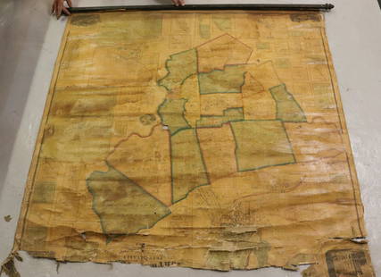
[KENTUCKY - MAPS]. SMITH, Karl. An Historical and Geographical Map of the State of Kentucky "The Dark and Bloody Ground."
Chromolithograph, 1933, image 22 1/8 x 12 3/4 in. (25 x 17 3/8 in. sheet), on wove paper. Vignettes of "Daniel Boone and Companions View Kentucky" and "George Washington Surveying Kentucky." The state is dotted with small illustrations showing cities, towns, forts, sites of battlegrounds, natural attractions, coal and minerals, and agricultural output. RARE: OCLC locates only 3 copies.
[With:] SMITH, Karl. Abraham Lincoln: A Pictorial Outline of the Life of the Sixteenth President of the United States. Chromolithograph, 1934, image 21 5/8 x 15 7/8 in. (25 x 19 1/8 in. sheet), on wove paper, small chip to margin. Vignettes from Lincoln's life geographically displayed, from his birth in Kentucky, his boyhood in Indiana, his adulthood in Illinois, and his presidency and assassination in Washington D.C.
Buyer's Premium
- 29% up to $400,000.00
- 24% up to $4,000,000.00
- 16% above $4,000,000.00
[KENTUCKY - MAPS]. SMITH, Karl. An Historical and
Estimate $150 - $300
2 bidders are watching this item.
Shipping & Pickup Options
Item located in Cincinnati, OH, usOffers In-House Shipping
Payment

Related Searches
TOP