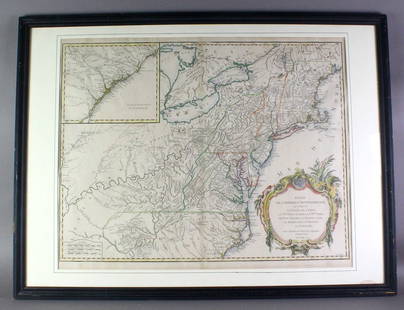
MAP, North America, Robert de Vaugondy
Similar Sale History
View More Items in Maps & AtlasesRelated Maps & Atlases
More Items in Maps & Atlases
View MoreRecommended Transportation & Travel Collectibles
View More


Item Details
Description
Colonial North America. Didier Robert de Vaugondy, Amerique Septentrionale, Dressee, sur les Relations les Plus Modernes des Voyageurs et Navigateurs, et Divisee Suivant les Differentes Possessions des Europeens, from Atlas Universel, 1750 (dated). Hand Color. This handsome map of the continent shows the colonial possessions with interesting configurations. There are numerous Indian names throughout the Mississippi River valley and the Spanish possessions in New Mexico, while the rest of the western region is largely blank. In the Pacific Northwest, the Entrée decouvert par Martin d'Aquilar alludes to a possible Northwest Passage. The large title cartouche features a river, Native Americans and a crocodile. This is the second state with a frame added around the distance scales and several place names added in Canada.
Condition
A sharp impression with contemporary outline color on a bright sheet with a small chapel watermark. There is minor toning along the centerfold, several printer's creases at top, and an archivally repaired centerfold separation at bottom. Grade: A
Dimensions
18.8 x 23.1 in
Buyer's Premium
- 20% up to $5,000.00
- 15% above $5,000.00
MAP, North America, Robert de Vaugondy
Estimate $500 - $650
1 bidder is watching this item.
Get approved to bid.
Shipping & Pickup Options
Item located in Richmond, VA, usOffers In-House Shipping
Local Pickup Available
Payment
Accepts seamless payments through LiveAuctioneers

TOP


![[MAPS - COLONIAL NORTH AMERICA]. VAUGONDY, Gilles Robert de...: [MAPS - COLONIAL NORTH AMERICA]. VAUGONDY, Gilles Robert de (1688-1766). Partie de l'Amerique Septentrionale qui Compred le Cours de l'Ohio… Paris, 1755. Large hand-colored engraved map (520 x 6](https://p1.liveauctioneers.com/928/301544/160920952_1_x.jpg?height=310&quality=70&version=1694462960)


![[Maps] Martin Zeiler, Itinerarium Italiae, 1640: [Maps] Martin Zeiler, Itinerarium Italiae, 1640, Martini Zeilleri. Itinerarium Italiae Nov-Antiquae: oder, Raiss-Beschreibung durch Italien, Matthaus Merian, Frankfurt, 40 plates, most double-page, in](https://p1.liveauctioneers.com/188/326797/176317459_1_x.jpg?height=310&quality=70&version=1713847031)
![[Maps] Gio. Ant. Magnini, Italia, 1620: [Maps] Gio. Ant. Magnini, Italia, 1620, Giovanni Antonio Magnini. Italia, data in luce da Fabio suo figliuolo al Serenissimo Ferdinado Gonzaga Duca di Matoua edi Monserrato etc. Bologna, for Sebastian](https://p1.liveauctioneers.com/188/326797/176317457_1_x.jpg?height=310&quality=70&version=1713847031)


![[MAP]. TODESCHI, Pietro. [Nova et Acurata Totius Americae Tabula auct. G.I. Blaeu] America quarta: [MAP]. TODESCHI, Pietro. [Nova et Acurata Totius Americae Tabula auct. G.I. Blaeu] America quarta pars orbis quam plerunq, nuvum orbem appellitant primo detecta est anno 1492 a Christophoro Columbo...](https://p1.liveauctioneers.com/197/329395/177650542_1_x.jpg?height=310&quality=70&version=1715364962)


