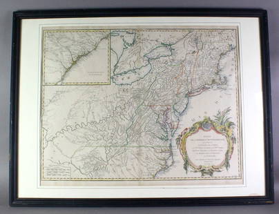
Amérique Méridionale. South America. ROBERT DE VAUGONDY 1750 old antique map
Similar Sale History
View More Items in Maps & AtlasesRelated Maps & Atlases
More Items in Maps & Atlases
View MoreRecommended Transportation & Travel Collectibles
View More


Item Details
Description
DATE PRINTED: 1750
IMAGE SIZE: Approx 50.0 x 62.0cm, 19.5 x 24.5 inches (Large); Please note that this is a folding map.
TYPE: Large antique 18th century atlas map, printed on thick, good quality paper with original outline hand colour/color and decorative title cartouche
CONDITION: Good; suitable for framing. However, please note: Light spotting. Please check the scan for any blemishes prior to making your purchase. Please contact us if you would like to arrange to view this map. Virtually all antiquarian maps and prints are subject to some normal aging due to use and time which is not obtrusive unless otherwise stated. We offer a no questions asked return policy.
AUTHENTICITY: This is an authentic historic map, published at the date stated above. It is not a modern copy.
VERSO: There is nothing printed on the reverse side, which is plain
FOLDING: This is a folding map.
ARTIST/CARTOGRAPHER/ENGRAVER: Robert de Vaugondy, Gilles & Didier
PROVENANCE: "Atlas Universel" par M. Robert, Geographe ordinaire du Roy et par M. Robert de Vaugondy son fils Geographe ord. du Roy et de S. M. Polonaise Duc de Lorraine et de Bar, et Associe de l'Academie Royale des Sciences et belles letters de Nancy. Avec privilege du Roy 1757. A Paris ches les auteurs, Quay de l'Horloge du Palaia Boudet Libraire Imprimeur du Roi, rue St. Jaques
Reserve: $185.00
Shipping:
Your purchase is protected:
Photos, descriptions, and estimates were prepared with the utmost care by a fully certified expert and appraiser. All items in this sale are guaranteed authentic.
In the rare event that the item did not conform to the lot description in the sale, Jasper52 specialists are here to help. Buyers may return the item for a full refund provided you notify Jasper52 within 5 days of receiving the item.
Buyer's Premium
- 15%
Amérique Méridionale. South America. ROBERT DE VAUGONDY 1750 old antique map
Estimate $200 - $250
1 bidder is watching this item.
Shipping & Pickup Options
Item located in United Kingdom$32 shipping in the US
Payment
Accepts seamless payments through LiveAuctioneers
See More Items From This Jasper52 Seller

Related Searches
TOP


![L'America Meridionale. South America. DE ROSSI / SANSON 1677 old antique map: Title: L'America Meridionale. South America. DE ROSSI / SANSON 1677 old antique map Description: L'America Meridionale [South America] by Published by Giovanni Giacomo de Rossi. G. Sansone, Giorgio Wi](https://p1.liveauctioneers.com/5584/299901/159842128_1_x.jpg?height=310&quality=70&version=1693338270)


![Amerique Méridionale'. South America. BELLIN/SCHLEY 1772 old antique map: Title: Amerique Méridionale'. South America. BELLIN/SCHLEY 1772 old antique map Description: Amerique Méridionale [South America]' by Jakob van der Schley & Jacques Nicolas Bellin (1772). Antiqu](https://p1.liveauctioneers.com/5584/299901/159842174_1_x.jpg?height=310&quality=70&version=1693338270)


![Carte de l'Empire romain. The Roman Empire. LAPIE 1832 old antique map chart: CAPTION PRINTED BELOW PICTURE: Carte de l'Empire romain [The Roman Empire] DATE PRINTED: The publication date of the atlas within which this map was printed is stated on the title page as 1829, howeve](https://p1.liveauctioneers.com/5584/328641/177014169_1_x.jpg?height=310&quality=70&version=1715113718)
![South-west Europe. Swiss Savoy. British Hanover. THOMSON 1817 old antique map: TITLE/CONTENT OF MAP: [South-west sheet of] A map of Europe, with the political divisions after the Peace of Paris and Congress of Vienna The map shows south west Europe after the Congress of Vienna.](https://p1.liveauctioneers.com/5584/328641/177014448_1_x.jpg?height=310&quality=70&version=1715113718)


![Carte de L'Europe. Map of Europe. MALTE-BRUN c1871 old antique plan chart: TITLE/CONTENT OF MAP: Carte de l'Europe [Map of Europe] DATE PRINTED: c1871 IMAGE SIZE: Approx 33.5 x 46.5cm, 13.25 x 18.25 inches (Large); Please note that this is a folding map. TYPE: Antique 19th c](https://p1.liveauctioneers.com/5584/328641/177014420_1_x.jpg?height=310&quality=70&version=1715113718)
![Isles de Corse et de Sardaigne. Corsica and Sardinia. BONNE 1787 old map: TITLE/CONTENT OF MAP: Isles de Corse et de Sardaigne [The islands of Corsica and Sardinia] DATE PRINTED: 1787 IMAGE SIZE: Approx 36.0 x 24.5cm, 14 x 9.75 inches (Large); Please note that this is a fol](https://p1.liveauctioneers.com/5584/328641/177014474_1_x.jpg?height=310&quality=70&version=1715113718)

![[Maps] Martin Zeiler, Itinerarium Italiae, 1640: [Maps] Martin Zeiler, Itinerarium Italiae, 1640, Martini Zeilleri. Itinerarium Italiae Nov-Antiquae: oder, Raiss-Beschreibung durch Italien, Matthaus Merian, Frankfurt, 40 plates, most double-page, in](https://p1.liveauctioneers.com/188/326797/176317459_1_x.jpg?height=310&quality=70&version=1713847031)
![[Maps] Gio. Ant. Magnini, Italia, 1620: [Maps] Gio. Ant. Magnini, Italia, 1620, Giovanni Antonio Magnini. Italia, data in luce da Fabio suo figliuolo al Serenissimo Ferdinado Gonzaga Duca di Matoua edi Monserrato etc. Bologna, for Sebastian](https://p1.liveauctioneers.com/188/326797/176317457_1_x.jpg?height=310&quality=70&version=1713847031)


![[MAP]. TODESCHI, Pietro. [Nova et Acurata Totius Americae Tabula auct. G.I. Blaeu] America quarta: [MAP]. TODESCHI, Pietro. [Nova et Acurata Totius Americae Tabula auct. G.I. Blaeu] America quarta pars orbis quam plerunq, nuvum orbem appellitant primo detecta est anno 1492 a Christophoro Columbo...](https://p1.liveauctioneers.com/197/329395/177650542_1_x.jpg?height=310&quality=70&version=1715364962)


