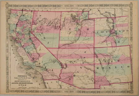
Fascinating 1852 map of U. S. w/western territories
Similar Sale History
View More Items in Maps & Atlases

Related Maps & Atlases
More Items in Maps & Atlases
View MoreRecommended Transportation & Travel Collectibles
View More


Item Details
Description
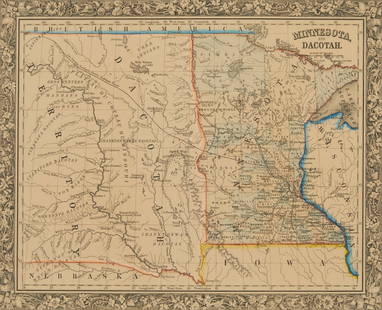
Important transitional map of the United States showing terrific western territorial borders including the important territorial acquisitions of the Mexican-American War, pre-Gadsden Purchase. Inset map “No. 6 Map of the Gold Region of California” shows the Gold Regions, naming Sutter’s Buttes, Sacramento City and all of the important creeks of the gold region feeding into the Sacramento and Feather Rivers. The large territories of Oregon and Washington extend to the Continental Divide. Minnesota Territory includes part of the Dakotas and the huge Missouri Territory is positioned between the Continental Divide and Minnesota, with Indian Territory bordering on the south. Indian Territory is in its largest configuration, stretching from Texas to Missouri Territory along the North Fork of the Platte River and extends westward all the way to South Pass and Utah Territory. Utah is also in its largest state, filling the region from California to Indian Territory along the Continental Divide. One of the more difficult transitional maps to find of the United States. From an 1852 edition of Mitchell’s school atlas. General soiling. Repaired centerfold split at bottom; repaired small tear at bottom edge. Couple of small stains. 10.5 x 16.75
Reserve: $165.00
Shipping:Domestic: Flat-rate of $5.00 to anywhere within the contiguous U.S. International: Foreign shipping rates are determined by destination. International shipping may be subject to VAT. Combined shipping: Please ask about combined shipping for multiple lots before bidding. Location: This item ships from Ohio
Your purchase is protected:
Photos, descriptions, and estimates were prepared with the utmost care by a fully certified expert and appraiser. All items in this sale are guaranteed authentic.
In the rare event that the item did not conform to the lot description in the sale, Jasper52 specialists are here to help. Buyers may return the item for a full refund provided you notify Jasper52 within 5 days of receiving the item.
Reserve: $165.00
Shipping:
Your purchase is protected:
Photos, descriptions, and estimates were prepared with the utmost care by a fully certified expert and appraiser. All items in this sale are guaranteed authentic.
In the rare event that the item did not conform to the lot description in the sale, Jasper52 specialists are here to help. Buyers may return the item for a full refund provided you notify Jasper52 within 5 days of receiving the item.
Condition
Good
Buyer's Premium
- 15%
Fascinating 1852 map of U. S. w/western territories
Estimate $200 - $250
6 bidders are watching this item.
Shipping & Pickup Options
Item located in Ohio, US$5 shipping in the US
Payment
Accepts seamless payments through LiveAuctioneers
See More Items From This Jasper52 Seller

Related Searches
TOP


![1898 Rand McNally Map of Texas [verso] Indian Territory and Oklahoma -- Texas [verso] Oklahoma and: Title: 1898 Rand McNally Map of Texas [verso] Indian Territory and Oklahoma -- Texas [verso] Oklahoma and Indian Territory Cartographer: Rand McNally Year / Place: 1898, Chicago Map Dimension (in.): 9](https://p1.liveauctioneers.com/5584/328338/176911581_1_x.jpg?height=310&quality=70&version=1715113718)


![1887 Cram Map of Texas [verso] Indian Territory [verso] Arkansas -- Texas [verso] Indian Ty. [verso]: Title: 1887 Cram Map of Texas [verso] Indian Territory [verso] Arkansas -- Texas [verso] Indian Ty. [verso] Arkansas Cartographer: G Cram Year / Place: 1887, Chicago Map Dimension (in.): 11.8 X 17 in.](https://p1.liveauctioneers.com/5584/328338/176911685_1_x.jpg?height=310&quality=70&version=1715113718)


![[Maps] Gio. Ant. Magnini, Italia, 1620: [Maps] Gio. Ant. Magnini, Italia, 1620, Giovanni Antonio Magnini. Italia, data in luce da Fabio suo figliuolo al Serenissimo Ferdinado Gonzaga Duca di Matoua edi Monserrato etc. Bologna, for Sebastian](https://p1.liveauctioneers.com/188/326797/176317457_1_x.jpg?height=310&quality=70&version=1713847031)
![[Maps] Martin Zeiler, Itinerarium Italiae, 1640: [Maps] Martin Zeiler, Itinerarium Italiae, 1640, Martini Zeilleri. Itinerarium Italiae Nov-Antiquae: oder, Raiss-Beschreibung durch Italien, Matthaus Merian, Frankfurt, 40 plates, most double-page, in](https://p1.liveauctioneers.com/188/326797/176317459_1_x.jpg?height=310&quality=70&version=1713847031)


