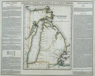
(MICHIGAN.) Maps and Report . . . for Ascertaining the
Similar Sale History
View More Items in Maps & AtlasesRelated Maps & Atlases
More Items in Maps & Atlases
View MoreRecommended Transportation & Travel Collectibles
View More


Item Details
Description
(MICHIGAN.) Maps and Report . . . for Ascertaining the Northern and Northwestern Boundary between the United States and Great Britain. 8 maps with hand-colored border in blue and red. 2 text leaves. Folio, 16 x 20 inches, original plain wrappers, worn with tape repairs; foxing and light soiling to title page, short tape repairs to final two maps, otherwise just minor wear; original owner's inscription on front wrapper.Washington, 18 March 1828A detailed survey of the newly negotiated land and water boundary under the Treaty of Ghent between Canada and what became Michigan, from Lake Erie down the St. Clair River and across Lake Huron to the eastern part of the Upper Peninsula. 3 of the 8 maps are devoted to the boundary at Detroit. The boundary was negotiated and finalized at Utica, NY in 1822, and this report was issued 6 years later. Provenance: Ward Hunt (1810-1886) of Utica, NY. Hunt spent most of his life in Utica before moving on to New York Court of Appeals in 1865; he later served on the United States Supreme Court.
Buyer's Premium
- 30%
(MICHIGAN.) Maps and Report . . . for Ascertaining the
Estimate $1,000 - $1,500
2 bidders are watching this item.
Shipping & Pickup Options
Item located in New York, NY, usOffers In-House Shipping
Local Pickup Available
Payment

Auction Curated By

Director, Books & Manuscripts
Related Searches
TOP


![Large Map of Michigan and Wisconsin: Large Map of Michigan and Wisconsin With map of Kansas and Nebraska [separately] on versos Cartographer: George Franklin Cram Dated: Circa 1900 Type: Color Lithograph Dimen](https://p1.liveauctioneers.com/5614/330257/178045309_1_x.jpg?height=310&quality=70&version=1716032806)


![Untitled. Midwest. [Map Issued With the Official Inter-State Railway Guide]: Title: Untitled. Midwest. [Map Issued With the Official Inter-State Railway Guide] Cartographer: ANONYMOUS Publisher: THE GUIDE PUBLISHING CO. Dimensions: Height: 16 Width: 20.75 Description: Regional](https://p1.liveauctioneers.com/5584/329422/177662238_1_x.jpg?height=310&quality=70&version=1715717898)


![[MAP]. TODESCHI, Pietro. [Nova et Acurata Totius Americae Tabula auct. G.I. Blaeu] America quarta: [MAP]. TODESCHI, Pietro. [Nova et Acurata Totius Americae Tabula auct. G.I. Blaeu] America quarta pars orbis quam plerunq, nuvum orbem appellitant primo detecta est anno 1492 a Christophoro Columbo...](https://p1.liveauctioneers.com/197/329395/177650542_1_x.jpg?height=310&quality=70&version=1715364962)


![[MAPS]. HOMANN, Johann Baptist, HOMANN HEIRS, and Georg Matthäus SEUTTER. [Composite Atlas].: [MAPS]. HOMANN, Johann Baptist (1663-1724), HOMANN HEIRS, and Georg Matthäus SEUTTER (1678-1757). [Composite Atlas]. [Nuremberg, Augsburg, and others: Homann Heirs and others, maps dated between](https://p1.liveauctioneers.com/197/329395/177650530_1_x.jpg?height=310&quality=70&version=1715364962)


