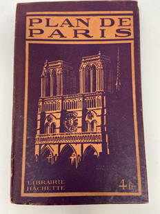
Sold2021PLAN DE PARIS Rues De Paris w/ MapLibrarie Hachette. "Liste Alphabetique Des Rues De Paris". Includes fold-out map by Imp Dufrenoy, Paris - "Grave chez Herisson Garin, 6, Rue Vercingetorix par E. Schwartz" in bottom left corner. Map mSee Sold Price
Sold2017Bellin: Antique Map Plan of Portobello, Panama, 1756Map: Plan de la Baye et Ville de Portobelo en 1736 Cartographer: Bellin Place & Date: Paris / 1756 Size: 12 7/8" x 7 5/8" Condition: b&w; overall age toning; with folds as issued Bellin's detailed chaSee Sold Price
Sold2018Haussard: Bay and Town of Portobelo, PanamaMap: Plan de la Baye et Ville de Portobelo en 1736 Cartograper: Haussard Place / Date: Paris / 1750s Size: 8 7/8" x 4 7/8" Condition: b&w. light overall age toning and a few minor spots and folds as iSee Sold Price
Sold2017Map of Paris Monuments Metropolitan Autobus, 1971Paris Map "Plan Commode de Paris/ Rues et Monuments Metropolitan Autobus". 1971. 4 x6 red boards. Paris Metro map tipped in at the front. Multi-fold map laid in, printed on both sides approx. 22 x 30,See Sold Price
Sold20221966 Limited Edition Plan De Turgot1966 Limited Edition Plan De Turgot . A complete set of prints of maps of Paris.Dimensions: Booklet; 11" by 15" Prints; 15" by 22.25". Hardcover; 15.75" by 23.375" Shipping is the buyer's responsibiliSee Sold Price
Sold2019Georges Peltier, old map of ParisGeorges Peltier, old map of Paris, "Plan de Paris a vol dóiseau", c. 1920-1940, colored lithograph on paper, 32.5"h x 41.5"w (sight), 33.5"h x 42.5"w (frame) Provenance: The Estate of Huguette ClarSee Sold Price
Sold2022Plan de Paris 1927 Made for Washington Sq. BookPlan de Paris map by Ilonka Karasz printed for sale at the Washington Square Bookshop in 1927. Measures 27.5 in. x 36 in. and folds to 14 in. x 9 in. Loose in a leatherette folio. Color with gilt on tSee Sold Price
Sold2017Bellin: Antique Plan of Cusco, 1754Map: Plan de Cusco Cartographer: Bellin Place & Date: Paris / 1754/1760 Size: 5 3/4" x 9 1/8" Condition: b&w; light overall age toning; a stain in the wide right margin; mounted on contemporary paperSee Sold Price
Sold2018Bellin: Chart of the Strait of Magellan 1760Map: Carte Reduite du Detroit de Magellan Cartographer: Bellin Place & Date: Paris / 1753/1760 Size: 13 1/2" x 9" Condition: b&w; old fold; margins extended with contemporary paper to fit the size ofSee Sold Price
Sold2018Therbu: Guadeloupe in the Seven Years’ WarReserve Reduced! Title of Map: Plan de la Guadeloupe Cartographer: Therbu Place / Date: Paris / 1775 Size: 9 1/4" x 14" Condition: b&w; some fraying along outer edges of margins, otherwise in excellenSee Sold Price
Sold2018Calmet: Antique Map of Malta, St Paul’s Shipwreck, 1728Map: Ancien Plan de l'Isle de Malte, ou S. Paul Aborda apres son Naufrage, Act XXVIII Cartographer: Calmet Place & Date: Paris / 1728 Size: 17" x 12" Condition: b&w; light overall age toning The verySee Sold Price
Sold2018Bellin: Antique Map Gulf of Mexico & West Indies, 1754Title/Content of Map: Carte du Golphe de Mexique et des Isles de l'Amerique Cartographer: Jacques Bellin Place & Date: Paris / 1754/1760 Size: 14 3/4" x 10 3/4" Condition: b&w; old folds as published;See Sold Price
Sold2018Bellin: Antique Map of Northern Atlantic Ocean, 1746Title/Content of Map: Carte de l'Ocean Occidental Cartographer: Bellin Place & Date: Paris / 1746/1760 Size: 18" x 12 1/2" Condition: b&w; old folds as published; light overall age toning Bellin's magSee Sold Price
Sold2024Barthelemy, Jean 1790 Map. Greece - Plan du Combat de SalamineCopper Engraved Map Published 1790, Paris for "Recueil de Cartes Geographiques, Plans, Vues et Medailles de L'Ancienne Grece, Relatifs Au Voyage du Jeune Anacharsis" by Jean Jacques Barthelemy. FoldsSee Sold Price
Sold2021[MAPS] SÉBASTIEN DE PONTAULT, CHEVALIER DE[MAPS] SÉBASTIEN DE PONTAULT, CHEVALIER DE BEAULIEU. Plan de la Ville, et Chateau de Valence... Paris: circa 1690. 17 1/2 x 21 inches, hand-colored engraving. Usual folds, generally a clean exampSee Sold Price
Sold2017Bellin: Antique Plan of Town of Siam (Ayutthaya), 1750Map: Plan de la Ville de Siam Cartographer: Bellin Place & Date: Paris / 1750/1760 Size: 10 1/4" x 7 1/2" Condition: b&w; light overall age toning; a few small spots; margins extended with contemporarSee Sold Price
Sold2018Bellin: Antique Map of Early Boston, 1757Title/Content of Map: Plan de la Ville de Boston et ses Environs Cartographer: Bellin Place & Date: Paris / 1757/1760 Size: 10 5/8" x 6 3/8" Condition: b&w; light overall age toning; a few spots in thSee Sold Price
Sold2018Bellin: Plan of Kyoto, JapanMap: Plan de la Ville de Meaco [Kyoto] Cartographer: Bellin Place & Date: Paris / 1752/1760 Size: 10 3/4" x 7 1/2" Condition: b&w; light overall age toning; margins extended with contemporary paper toSee Sold Price
Sold2017Mallet: Antique Miniature Santo Domingo Plan, 1683Map: Plan de la Ville de San-Domingo Cartographer: Mallet Place & Date: Paris / 1683 Size: 4 1/4" x 6" Condition: b&w; light overall age toning A charming bird's eye view of the old walled city of SanSee Sold Price
Sold2017Bellin: Antique Plan of Lopburi, Thai Capital, 1750Map: Plan de la Ville de Louvo Demeure ordinaire des Rois de Siam Cartographer: Bellin Place & Date: Paris / 1750/1760 Size: 10 3/8" x 9 1/8" Condition: b&w; light overall age toning; some minor spottSee Sold Price
Sold2019Prevost: Plan of Hangzhou, Chekiang Province, ChinaMap Title: Plan de la ville de Hang-Tcheou-Fou Cartographer: Bellin/van der Schley/Prevost d'Exile Place/Date: Paris/The Hague / 1755 Size: 6 1/8" x 4 1/4" Condition: b&w; overall age toning; a few spSee Sold Price
Sold2017Bellin: Antique Map of Island of Ceylon, 1750Map: Carte de l'Isle de Ceylan Cartographer: Bellin Place & Date: Paris / 1750/1760 Size: 10" x 9 1/2" Condition: b&w; light overall age toning; old folds; small stain in lower margin; margins extendeSee Sold Price
Sold2018Bellin: Antique Map of Course of the Amazon, 1754Title/Content of Map: Carte du Cours du Maragnon ou de la Grande Riviere des Amazones Cartographer: Bellin Place & Date: Paris / 1754/1760 Size: 14 5/8" x 6 7/8" Condition: b&w; old folds; light overaSee Sold Price
Jun 05TimeLine Auctions Ltd.Archaeological Books - Ancient Egyptian Research Discoveries - Various Titles£5
Jun 14DuMouchellesRigobert Bonne (French, 1727-1794) Hand Colored Engraving Ca. 18th Century, Les Etats Unis De$50
Jun 07Freeman's | Hindman[MAP]. SARTINE, Antoine Plan de la Barre et du Havre de Charles-Town...1778. RARE REVOLUTIONARY WAR$1,000(1 bid)
4 days LeftJasper52Large map engraving of Paris 1822 Auvray, Marchand d'Estampes , Quai Malaquais$480
Jun 09Worthington Galleries1705 Map LE COMBAT DE STEENKERKE [Battle of Steenkerque] by Nicolas de Fer$10
4 days LeftJasper521792 ANCIENT HISTORY of INDIA antique ILLUSTRATED w/ MAPS 18th CENTURY in FRENCH$170
Jun 07Freeman's | HindmanBELLIN, Jacques-Nicolas. Carte Reduite de L'Ocean Oriental ou Mer Des Indies. Paris, 1757. Second$150
5 days LeftBidhausChristian Dior Dior Women's Tote Bag Plan de Paris Book Medium Jacquard Canvas Black Embroidery$620(2 bids)


![[MAPS] SÉBASTIEN DE PONTAULT, CHEVALIER DE: [MAPS] SÉBASTIEN DE PONTAULT, CHEVALIER DE BEAULIEU. Plan de la Ville, et Chateau de Valence... Paris: circa 1690. 17 1/2 x 21 inches, hand-colored engraving. Usual folds, generally a clean examp](https://p1.liveauctioneers.com/292/204169/103522320_1_x.jpg?height=310&quality=70&version=1621026354)


![Bellin: Plan of Kyoto, Japan: Map: Plan de la Ville de Meaco [Kyoto] Cartographer: Bellin Place & Date: Paris / 1752/1760 Size: 10 3/4" x 7 1/2" Condition: b&w; light overall age toning; margins extended with contemporary paper to](https://p1.liveauctioneers.com/5584/119622/60966656_1_x.jpg?height=310&quality=70&version=1522802109)


![[MAP]. SARTINE, Antoine Plan de la Barre et du Havre de Charles-Town...1778. RARE REVOLUTIONARY WAR (1 of 1)](https://p1.liveauctioneers.com/197/329395/177650540_1_x.jpg?height=282&quality=70&version=1715364962)


![1705 Map LE COMBAT DE STEENKERKE [Battle of Steenkerque] by Nicolas de Fer (1 of 1)](https://p1.liveauctioneers.com/6084/330420/178181962_1_x.jpg?height=282&quality=70&version=1716391551)


![[Paris] - Stanford, Edward (1 of 1)](https://p1.liveauctioneers.com/94/330664/178342455_1_x.jpg?height=282&quality=70&version=1716466933)


