Sold2023New Haven Ct. Quadrangle Topographic Map FramedNew Haven Ct. Quadrangle Topographic Map Framed. 28 inchews x 22 inchesSee Sold Price
Sold20231860 Grafton County New Hampshire Topographic MapImmerse yourself in the rich history of Grafton County, New Hampshire, with this captivating Framed Topography Map from 1860. This vintage map offers a glimpse into the past, showcasing the intricateSee Sold Price
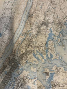
Sold2023Group lot of NEW YORK State Topographical MapsGroup lot of NEW YORK State Topographical Maps, maps measure 17 x 21 inches, wear consistent with age and use. not framed. Art, wall art, artwork, home decor, maps, topographic, topography, New York SSee Sold Price
Sold2022Group lot of NEW YORK State Topographical MapsGroup lot of NEW YORK State Topographical Maps, maps measure 17 x 21 inches, wear consistent with age and use. not framed. Art, wall art, artwork, home decor, maps, topographic, topography, New York SSee Sold Price
Sold2020City & Vicinity of New Haven, CT US Coast SurveyMap of the city of New Haven. City Engineers Department 1877. paper size: H 30", W 24"; frame size: H 27", W 33-1/4". Professionally framed. Collection of Laura Mitler. Please see link for high res phSee Sold Price
Sold2020(2pc) EARLY 19th CENTRY MAPS of the HEMISPHERESh. 8-1/4 w. 11 in., sight overall: 13 x 19-3/4 in. (largest, framed) both French, including one dated 1828 (8-1/2 x 15 in., sight) Provenance: from the collection of an important New Canaan, CT gentleSee Sold Price
Sold2022Antique NEW YORK CITY MAP - FramedAntique New York City Map. 28” x 16” New York City map, circa 1860, hand-colored, double matted and framed to 38 ½” x 26”.See Sold Price
Sold2017Map: Hudson's Bay in North America, 1782, J. BewA framed map: New and Accurate Chart of Hudson's Bay in North America. Published, London Nov. 1782, By J. Bew, Pater Noster Row. Hand colored map, sight measurement 7.25" x 9.25". Framed and matted unSee Sold Price
Sold2019Vintage New Canaan Map C 1868Vintage New Canaan map, 1868, framed. 13 1/4" H x 10" W.See Sold Price
Sold2021Reverse Painting of Main Street in New Canaan CTReverse Painting Over Print of Main Street in New Canaan CT. Gilt framed. Measures 9 x 14 inches.See Sold Price
Sold20171778 PROVINCE of NEW JERSEY FRAMED MAPAntique map of New Jersey, issued by William Faden in 1778 and drawn from Bernard Ratzer’s survey made in 1769 just prior to the American Revolutionary War. This is a second edition that includes thSee Sold Price
Sold2017Allen: Framed Map of New Jersey Ocean Resorts, 1898Title/Content of Map: New Jersey Ocean Resorts on the Pennsylvania Railroad Date Printed: 1898 Cartographer: Allen, Lane, and Scott Size (inches): 12 x 16 Lithographed color Antique lithographed birdsSee Sold Price
Sold20231846 Framed "A New Map of New York" State MapHand colored map by Mitchell of 1846. Drawn on French marble paper, hand finished frame with gold leaf. Frame measures approximately 24.5" x 22.25". Estimated shipping cost for this auction lot is $50See Sold Price
Sold2023Framed Map of New Belgium by Nicholas John VischerFramed Map of New Belgium by Nicholas John Vischer. The Frame measures 18 5/8" x 22 5/8", and the Sight measures 14" x 17". On the bottom left of the piece, it has "New Belgium, New England, and VirgiSee Sold Price
Sold2023A. Johnson New York/Brooklyn framed map, 1866A. Johnson New York/Brooklyn framed map, 1866 Approximate Dimensions: 17.5 inches W by 24 inches H sight to mat, Frame 25 inches W by 31 inches HSee Sold Price
Sold2021ROBERT WILKINSON Antique Map framed. A New Map of IrelaROBERT WILKINSON Antique Map framed. A New Map of Ireland from the best Authorities 1791.-- Dimensions: Image Size: H: 11.5 inches: W: 9 inches -- FRAME SIZE: Frame Height 18 inches - Frame Width 14 iSee Sold Price
Sold2017Vintage Framed Map of New JerseyFramed detailed map of the state of New Jersey. "Entered according to Act of Congress in the year 1868, by G.W. & C.B. Colton & Co. in the Clerks Office of the District Court of The United States forSee Sold Price
Sold20174 Framed Geological Topographic Maps of Maine4 Simply Framed Geological Topographic Maps of Maine. Included is one loose, unframed map in same series. All frames measure 21 x 17 inches.See Sold Price
Sold2021Lot of 3 New York Framed MapsLot of 3 New York Framed Maps - One Homemade. One is from 1961. They measure between 17.5" x 11.5" - 24" x 32". This sale will be broadcast live on sale day with an auctioneer and caller calling fullSee Sold Price
3 days LeftDonny Malone AuctionsSusan Grisell, American, Oil Painting on Board New York City Street Scene, Signed, Framed$20(2 bids)
May 22Thomaston Place Auction GalleriesHAND COLORED MAP OF PERU & COUNTRY OF THE AMAZONS, 1747, BY EMANUEL BOWEN, FRAMED$250
1 day LeftCrescent City Auction GalleryWilliam H. Williams (1817-1886), New Orleans "Map of the Sixth District and Carrollton," 1871, H.-$650
4 days LeftAkiba Galleries(2 Pc) Allain Manesson Mallet Description De L'Univers 2 Vol. German Translation$200(1 bid)