Sold2022Maps of Michigan Lansing and Milford TopographyMaps of Michigan Lansing and Milford Topography These two maps we have are the surroundings of Lansing and Milford Michigan. these maps were made by surveys taken in 1907-1910. These maps show a detaiSee Sold Price
Sold20202 Hand Colored Maps - MichiganTwo Gray's Atlas Maps on one sheet - Michigan & Lake Superior and the Northern Part of Michigan Depicts railroad lines, common roads, canals, topography, etc. Maps are on eaSee Sold Price
Sold2017Jeremiah Greenleaf: Michigan MapMap: Michigan Description: This is a map of the young Michigan with Greenleaf's keyboard-style border, detailing the topography, color-coded counties, roads, towns and villages, and more. The countiesSee Sold Price
Sold2023Vintage Washington State Maps Topography MapsVintage Washington State Maps Topography Maps This is a set of 5 Washington State Topography Maps that show Surveys from the early 1900s. These are vintage reprints of the initial surveys done. TheseSee Sold Price
Sold20201771 Naples Pompeii Vesuvius and Map TopographyAn interesting study on the "Nature of the Soil of Naples and its Neighborhood", by William Hamilton to the Royal Society. Extracted from Philosophical Transactions for 1771 numbered 1-47 and a largeSee Sold Price
Sold20211854 Geological Map Michigan & Lake Superior"Geological map of the district between Keweenaw Bay and Chocolate River, Lake Superior, Michigan". J.W. Foster & J.D. Whitney, U.S. geologists. Section and diagram illustrating the geology of the regSee Sold Price
Sold20211858 OLD TINTED MAP, MICHIGAN & WISCONSIN, MITCHELL1858 OLD TINTED MAP, MICHIGAN & WISCONSIN, MITCHELL SCHOOL & FAMILY GEOGRAPHY 1858 OLD TINTED MAP, MICHIGAN & WISCONSIN, MITCHELL SCHOOL & FAMILY GEOGRAPHY Description 1858 Antique Map by S. AugustusSee Sold Price
Sold2024New York Walk Book, Illust. Amer Geo Society, 1923Antique Map and trail soft cover book, illustrated with maps , topography in color and in black and white. Westchester, Rockland , Nassau counties,Manhattan, Bronx, up state NY and northern New JerseySee Sold Price
Sold2017Tanner: Antique Map of Michigan, 1843Title/Content of Map: Michigan by Tanner Date Printed: 1843 Cartographer: based on the work of H.C. Tanner Material/Medium: Paper Size: 17" x 14" Hand colored engraved Map. From the first edition publSee Sold Price
Sold2022PERRIER Vintage Motor Map of Scotland XLPERRIER Vntg Motor Map of Scotland, measures approx 42 x 48 inches. Wear to map. Artwork, Home Decor, Wall Art, Educational Map, Topography. Art Print, Map Print, antique map, collectible antique map,See Sold Price
Sold2020Michigan 1903Title/Content of Map: Michigan 1903 Date Printed: 1903 Material/Medium: Paper Size: approx 21x16 inches Peerless Atlas, Crowell Publishing Co. Ohio Reserve: $30.00 Shipping: Domestic: Flat-rate of $1See Sold Price
Sold2020Michigan, Wisconsin 1886Title/Content of Map: Michigan, Wisconsin 1886 Date Printed: 1886 Material/Medium: paper Size: approx 13.5x21 inches Additional Info: The People's Unrivaled Family Atlas of the World. People's PublishSee Sold Price
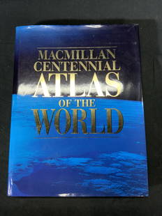
Sold2022Macmillan Centennial Atlas of the World BookMacmillan Centennial Atlas of the World. Published by Macmillan, 1997. Wear to cover and jacket consistent with exposure. Measures approx. 12 x 15.5 inches. Atlas, map, topography, photo book, referenSee Sold Price
Sold2021(MICHIGAN.) Maps and Report . . . for Ascertaining the(MICHIGAN.) Maps and Report . . . for Ascertaining the Northern and Northwestern Boundary between the United States and Great Britain. 8 maps with hand-colored border in blue and red. 2 text leaves. FSee Sold Price
Sold2023Bart Reiter 5 string banjo, serial number 1036, Lansing, Michigan circa 1990. Hard case.Bart Reiter 5 string banjo, serial number 1036, Lansing, Michigan circa 1990. Hard case.See Sold Price
Sold2023Lovely vintage pre-Civil War RR map of MichiganFascinating, highly detailed map of Michigan with original full hand-coloring. Cowperthwait produced some of the most attractive state maps of the period and this one is particularly nice. PositionedSee Sold Price
Sold2016Detroit / Lansing Michigan Central Baggage TagA nickle plated baggage tag used on the Michigan Central; Railroad. The tag was used by passengers traveling to from Lansing and Detroit. It is number 848. It measures 1 1/2" by 1 5/8". It has a WilcoSee Sold Price
Sold2021Vintage Topography Maps of CaliforniaVintage Topography Maps of California These maps are Topography Maps of California made by the department of the interior in the early 1900s. The maps we have were reprinted throughout the 1920s-1950sSee Sold Price
Sold2024Lamb Fur Coat, Capitol Furs Lansing Michigan Brown lamb fur coat, label reads Capitol Furs LansingBrown lamb fur coat, label reads Capitol Furs Lansing Michigan. Hook and loop closures, some loose threads in the lining. Measurements lying flat are: Neck: 4 1/2 inches Chest: 21 inches Waist: 22 1/2See Sold Price
Sold2022Vintage Florida Topography Maps War DepartmentVintage Florida Topography Maps War Department This is a set of four Topography Florida survey maps done by the War Department Corps of Engineers in the 1910s. These are vintage reprints of the 1910sSee Sold Price
Sold2022Three Railroad and City Maps - Chicago, Michigan, Toledo, OhioGroup of three railroad and city maps. Includes 1875 O.W Gray and Sons Railroad Map of Michigan measuring 17" x 24", unmarked early map of Chicago measuring 17 1/2" x 21 1/2", and 1920 Wagners DirectoSee Sold Price
Sold2022Vintage County Maps of Texas Topography Maps TexasThese are vintage maps that were first made in 1915 and 1921. These maps are a great glance into the early official mapping of the Americas. The two maps in this lot are of Texas. (1) Topography map oSee Sold Price
Sold2023Maps of New York Topography MapsMaps of New York Topography Maps This lot has two vintage maps of New York that show surveys that were done in the late 1800s and early 1900s. These maps are in good condition with a few small tears oSee Sold Price
Sold2021Vintage Maps of Maine Topography MapsVintage Maps of Maine Topography Maps These two maps were drawn out in the early 1900s and then reprinted. The maps we have are vintage reprints and educational with information on how to read topograSee Sold Price
Featured3 days LeftJasper521864 Johnson Map of Michigan and Wisconsin -- Johnson's Michigan and Wisconsin$85
Featured3 days LeftJasper521831 Woodbridge Map of South America and Africa -- Comparative, Geographical & Statistical Map of$70
3 days LeftJasper521747 Homann Map of Czech Rep., Silesia and Parts of Germany -- Regni Bohemiae, Duc. Silesiae,$110
Featured3 days LeftJasper521758 Akerman Map of Germanic States -- Area Belli Germanici Praesentis…$80
3 days LeftJasper521803 Poirson Map of Europe -- L'Europe divisee en ses Principaux Etats et d'apres le Traite de Paix$95
3 days LeftJasper521898 Cram Map of Victoria [verso] South Australia and Northern Terr. [verso] Queensland -- Map of$40


![1898 Cram Map of Victoria [verso] South Australia and Northern Terr. [verso] Queensland -- Map of (1 of 3)](https://p1.liveauctioneers.com/5584/331064/178466379_1_x.jpg?height=282&quality=70&version=1716924723)


