Sold2022Vintage Florida Topography Maps War DepartmentVintage Florida Topography Maps War Department This is a set of four Topography Florida survey maps done by the War Department Corps of Engineers in the 1910s. These are vintage reprints of the 1910sSee Sold Price
Sold2021Vintage Topography Maps of CaliforniaVintage Topography Maps of California These maps are Topography Maps of California made by the department of the interior in the early 1900s. The maps we have were reprinted throughout the 1920s-1950sSee Sold Price
Sold2023FRAMED 19TH C. JOHNSON'S FLORIDA MAP1863 Civil War Era Colored Map of Florida, by Alvin Jewett Johnson (1827-1884), published by Johnson & Ward, New York, in a gilded and green painted wooden frame with mat, glazed, OS: 19 1/2" x 23 1/2See Sold Price
Sold2023HILTON HEAD ISLAND IN CIVIL WAR Union NavyDEPARTMENT OF THE SOUTH : HILTON HEAD ISLAND - SC. by Robert Carse 1961 First Edition, many vintage illustrations, map endpapers, 156pp, Index. Lincoln established the Union's Depertment Of The SouthSee Sold Price
Sold2022Erie, Pennsylvania Vintage Topography MapErie, Pennsylvania Vintage Topography Map Printed in 1923, based on a survey done in 1899 of Erie Pennsylvania. The map is in good condition with one small tear at the top of the map. Approximate sizeSee Sold Price
Sold2022Kentucky Lock Port Vintage Topography MapKentucky Lock Port Vintage Topography Map Printed in 1922, based on a survey done in 1906 of the Lockport Quadrangle in Kentucky. Map is in good condition with some tears around the edges. ApproximateSee Sold Price
Sold2021Green City Missouri Vintage Topography Map 1922Green City Missouri Vintage Topography Map 1922 Printed in 1922, based on a survey done in 1906 of the Green City Quadrangle in Missouri. Map is in good condition with some tears around the edges andSee Sold Price
Sold2022Vintage Topography Map of Wasatch National Park UtahVintage Topography Map of Wasatch National Park Utah This is a vintage map from a land survey from 1885. This is old Salt Lake Utah with National Forests. This is called a Reconnaissance map. This mapSee Sold Price
Sold2022Vintage WWII Era War Department Japanese Phrase BookPhrase book plus ephemera letter. A Japanese farewell note to an American occupation soldier being discharged and returning home to US. A farewell from Kinue Nagatomo, Mieho Tojo and Hisako Suzuki, naSee Sold Price
Sold2016Rare Vintage Map of Afghanistan War Rug: 5'9'' x 7'3''Rare Vintage Afghanistan War Rug showing map of world with Afghanistan at its center from refugee camp in Peshawar, Pakistan. 1997. Size: 5'9'' x 7'3'' (175 x 221 cm). An outstanding and large exampleSee Sold Price
Sold2021Explorations and Surveys. War Department. Map No. 1 RioTitle: Explorations and Surveys. War Department. Map No. 1 Rio Colorado of the West, - Map No.2. Rio Colorado of the West, Publication Date:1858 Cartographer: EGLOFFSTEIN, FRIEDRICH WILHELM, freiherrSee Sold Price
Sold2020VINTAGE FRAMED FLORIDA TAPESTRY MAPFramed Florida tapestry original linen textile map. Marked Davisco lower right. Measures 44.5" x 37" w/ frame.See Sold Price
Sold20171876 U.S. War Department Map of Belmont, MO Civil WarTitle/Content of Map: 1876 U.S. War Department Map of Belmont, MO Civil War Battle -- Map of the Battlefield near Belmont, Missouri ... Commanded by Brig. Gen. U.S. Grant, Nov. 7th 1861 Date Printed:See Sold Price
Sold2022RARE Vintage 1960s 'FLORIDA STATE MAP' Souvenir Kid's T-ShirtStyle #: V3PT44 Label: TROPIX OF MIAMI Manufactured: USA Fabric: 100% Cotton Color: White | Multi Condition: Excellent Lightly Used Vintage Size: 14 Kid's Bust: 15" Shoulder: 5" Sleeve Length: 5 1/2"See Sold Price
Sold2023Antique Map of Kansas Nebraska Colorado and DakotaMEDIUM: Commercially Printed on Paper DIMENSIONS:14 x 11.5 inches CIRCA: 1861 ATTRIBUTION: Augustus Mitchell DESCRIPTION: This antique, Civil War vintage map of the far west graphically illustrates thSee Sold Price
Sold2019Cohasset harbor map and chartWAR DEPARTMENT MAP AND CHART OF COHASSET HARBOR. Detailed map of the South Shore from Boston to Cohasset showing harbors and coves including Whitehead, Bailey Creek, Bassing Beach etc.. Framed . DimenSee Sold Price
Sold20161760 French + Indian War Map Louisiana + FloridaHistoric Maps French & Indian War Era Map of Louisiana & Florida c. 1760 French & Indian War Era, Historic Map Titled, “Carte de la Louisiane, et de la Floride. Par M. Bonne, Ingenieur-Hydrographe dSee Sold Price
Sold2023Vintage Washington State Maps Topography MapsVintage Washington State Maps Topography Maps This is a set of 5 Washington State Topography Maps that show Surveys from the early 1900s. These are vintage reprints of the initial surveys done. TheseSee Sold Price
Sold2021Vintage Maps of Maine Topography MapsVintage Maps of Maine Topography Maps These two maps were drawn out in the early 1900s and then reprinted. The maps we have are vintage reprints and educational with information on how to read topograSee Sold Price
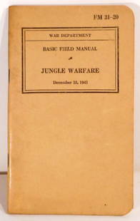
Sold2023Vintage Military Intelligence and War Department Manuels Circa 1940sVintage Military Intelligence and War Department Manuels Circa 1940sSee Sold Price
Sold2022WESTERN FRONT MAIN BATTLE LINES. Vintage map. WW1 First World War. Flanders 1920TITLE/CONTENT OF MAP: 'The main battle lines of the Western front' DATE PRINTED: 1920 IMAGE SIZE: Approx 15.0 x 23.0cm, 5.75 x 9 inches (Medium); Please note that this is a folding map. TYPE: VintageSee Sold Price
Sold2023War Department Weather MapTitle: War Department Weather Map Publication Date: c1872 Cartographer: U.S. ARMY CORPS OF ENGINEERS Publisher: VAN ANTWERP, BRAGG & CO. Height: 11.1 Width: 8.3 "Washington, Saturday, Sept. 28, 1872 -See Sold Price
Sold201910 Antique War Department/Survey Maps of the West[Ten Antique War Department/Survey Maps of the Western United States], 19th c., incl. "Sketch of the Country...of Kansas", "Colorado Territory"; "From the Pimas Villages to Fort Fillmore", "From FortSee Sold Price
6 days LeftRapid Estate Liquidators and Auction GalleryRare Vintage Kutani 1960's Hand Painted Porcelain Gods of Good Fortune Figure Bishamonten$5
Jun 20The Ross Art GroupOriginal Vintage WWII Defense Bonds Poster You Buy Em We'll Fly Em by Wilkinson Medium 1942$350
Jun 20The Ross Art GroupOriginal Vintage WWII Poster To Have and To Hold War Bonds by Vic Guinnell 1944 American Flag Medium$400
Jun 08Simpson Galleries, LLC.JULIUS BIEN (1826-1909) AN AMERICAN CIVIL WAR RECONNAISSANCE MAP, "Map of Texas and Part of New$100
Jun 08Early American History AuctionsLot of Miscellaneous Printed Articles and Reproduction Souvenier Continental Army USA Design Buttons$100
6 days LeftRapid Estate Liquidators and Auction Gallery1856 Mississippi Map & Info Published By J.H. Colton & Co. No.172 William St. New York$5
6 days LeftJasper52Africae / Africa by Bertius / Langenes 1603 old antique vintage map plan chart$260
5 hrs LeftFreeman's | Hindman[CIVIL WAR]. LEE, Robert E. (1807-1870). Autograph free frank ("R.E. Lee"), as Lieutenant ("Lt.").$300
5 days LeftJasper521893 Civil War Map of Knoxville Area -- Topographical Map of the Approaches and Defences of$70


![10 Antique War Department/Survey Maps of the West: [Ten Antique War Department/Survey Maps of the Western United States], 19th c., incl. "Sketch of the Country...of Kansas", "Colorado Territory"; "From the Pimas Villages to Fort Fillmore", "From Fort](https://p1.liveauctioneers.com/268/141383/71622475_1_x.jpg?height=310&quality=70&version=1556895875)


![[CIVIL WAR]. LEE, Robert E. (1807-1870). Autograph free frank ("R.E. Lee"), as Lieutenant ("Lt."). (1 of 3)](https://p1.liveauctioneers.com/197/329785/177758244_1_x.jpg?height=282&quality=70&version=1715625218)

