Sold2020Guide to Mother Lode with map & text 1939Heading: (California - Mother Lode) Author: Ramsey, R. S. Title: Guide through the Old Mining Regions of Central California Place Published: No place Publisher: Date Published: 1939 DeSee Sold Price
Sold2017Mother Lode Map of California & Nevada, 1931Mother Lode Map incorporating Mother Lodes of California and Nevada scenes of the "Romantic Days of Gold" 1931. A humorous cartoon map of the California and Nevada gold regions. Chico, CA on the northSee Sold Price
Sold2022Pictorial map of mother lode California & NevadaHeading: (California - Mother Lode) Author: Cormak, Robert Title: Mother Lode Map Incorporating Mother Lodes of California and Nevada, Scenes of the "Romantic Days of Gold" Place Published: Berkeley,See Sold Price
Sold20181946 Wintle Map of the Gold Districts of California --Title/Content of Map: 1946 Wintle Map of the Gold Districts of California -- California's Golden Chain… the Mother Lode Highway Date: 1946, Oakland Cartographer: W Wintle Size: 21.5 X 17 in. unfoldeSee Sold Price
Sold2017Wells Fargo MemorabiliaWells Fargo memorabilia. [Wells Fargo]. California 1872. The envelope is in plastic sleeve and mounted on tan background with a printed map of Wells Fargo Express Routes to the Mother Lode. Please notSee Sold Price
Sold2020[CHICAGO -- PRE-FIRE]. A Guide to the City of Chicago.[CHICAGO -- PRE-FIRE]. A Guide to the City of Chicago. Chicago: T. Ellwood Zell & Co., 1868. 12mo. Folding map, 188pp. text (paginated 9-196), 8pp. advertisements (paginated 1-8, 197); 26 plates. (SSee Sold Price
Sold20211939 New York World's Fair Guide Book, foldout map and1939 New York World's Fair Guide Book, foldout map and souvenirSee Sold Price
Sold2022Pinnock & Archer 1833 Celestial Map. Constellations"A Contemplative View of the Heavens" Woodblock Published 1833, London for "The Guide to Knowledge" Edited by W. Pinnock. Maps by Joshua Archer. Text to reverse. Paper Size: 10.5 x 7.5 inch (27 x 19cmSee Sold Price
Sold2022Pinnock & Archer 1833 Map of London in the Roman Times"Londinium Augusta" Woodblock Published 1833, London for "The Guide to Knowledge" Edited by W. Pinnock. Maps by Joshua Archer. Text to reverse. Paper Size: 10.5 x 7.5 inch (27 x 19cm) Good ConditionSee Sold Price
Sold2022Pinnock & Archer 1833 Rivers & Fountains ChartWoodblock Published 1833, London for "The Guide to Knowledge" Edited by W. Pinnock. Maps by Joshua Archer. Text to reverse. Paper Size: 10.5 x 7.5 inch (27 x 19cm) Good Condition overallSee Sold Price
Sold2022California Antique Tourist BookTourist Illustrated Guide to the Celebrated Summer and Winter Resorts of California. Southern Pacific Company, Sunset Route, 1885. Illustrated book of famous sites/ Text, illustrations, and maps. CoveSee Sold Price
Sold2022Pinnock & Archer 1833 British Map. OxfordshireWoodblock Published 1833, London for "The Guide to Knowledge" Edited by W. Pinnock. Maps by Joshua Archer. Reverse side blank. Paper Size: 10.5 x 7.5 inch (27 x 19cm) Text offsetting in top margin. GoSee Sold Price
Sold2022Pinnock 1833 Lot of 8 Astronomy Celestial Sheets8 Illustrated Sheets - Woodblocks with surrounding and verso text Published 1833, London for "The Guide to Knowledge" Edited by W. Pinnock. Maps by Joshua Archer. Reverse side blank. Paper Size: 10.5See Sold Price
Sold2021MID-20TH CENTURY GUIDE MAP OF CAPE COD, FEATURINGEDAVILLE RAILROAD. HAND PAINTED ON BOARD. FRAMED. OVERALL SIZE 93 1/2" X 50 1/2". OVERALL GOOD CONDITION.See Sold Price
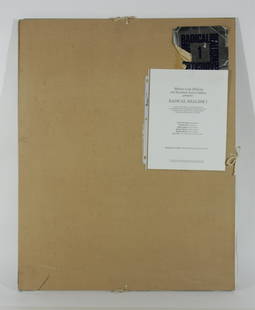
Sold2022Mother Lode Editions - RADICAL REALISM IMother Lode Editions & Hundred Acres Gallery present RADICAL REALISM I. Edition169 of 200. Includes six signed and numbered screenprints by John Clem Clarke, Richard Estes, Ralph Goings, Richard McLeaSee Sold Price
Sold2023Mother Lode of NOS VT Railroad TicketsEnormous quantity of new old stock (NOS) unused Vermont railroad tickets, many varieties, including Central VT, St J & LC, Montpelier & Wells, etc (1000 to 2000 pcs)See Sold Price
Sold2018New Orleans Mother-Lode Mint 1oz .999 Fine Silver BarNew Orleans Mother-Lode Mint 1oz .999 Fine Silver BarSee Sold Price
Sold2021San Antonio Conservation Society 1926 MapVintage 1926 San Antonio Conservation Society historic guide map of San Antonio de Bexar, drawn by Emily Edwards, portrays San Antonio from 1682-1721, unframed 39 x 28"; Provenance: A Schertz, TX EsSee Sold Price
Sold2022San Antonio Conservation Society 1926 MapVintage 1926 San Antonio Conservation Society historic guide map of San Antonio de Bexar, drawn by Emily Edwards, portrays San Antonio from 1685-1721, framed, dated 1926 41"h x 30"w Provenance: A SSee Sold Price
Sold2022Bancroft's large folding map of S.F. 1887Heading: -1887 Author: Title: Bancroft's Official Guide Map of City and County of San Francisco, Compiled from Official Maps in Surveyor's Office Place Published: San Francisco Publisher:The BancroftSee Sold Price
Sold2023WWII U.S. MILITARY FIELD MAPS 1939-1945 - (4)170301 WWII U.S. MILITARY FIELD MAPS 1939-1945 - (4) WWII U.S. military field maps 1939- 1945 to include one East and West Omaha beach scanned "Bigot" Field maps, one France (12500) Isigny field map,See Sold Price
Sold2023Ting Shao Kuang (B. 1939): Mother and Childcold-painted and gilt bronze, mounted to black stone base; signed in casting, numbered 45/99, foundry mark "Segal Fine Art" Overall: 21 1/4 x 19 1/2 x 8 1/2 in. (54 x 49.5 x 21.6 cm.)See Sold Price
Sold2022WYTFLIET, CORNELIS VAN Granata Nova et California. [Louvain or Douai: circa 1597-1611].WYTFLIET, CORNELIS VAN Granata Nova et California. [Louvain or Douai: circa 1597-1611]. Copper-engraved map, without text on verso. Plate marks 9 1/8 x 11 1/4 inches (23 x 29 cm ), with larger marginsSee Sold Price
Sold2018Blaeu: Antique Map of Europe, 1650Title/Content of Map: Highly decorative Map by Blaeu Date Printed: c1650 Cartographer: W. Blaeu Material/Medium: Paper Size: 19" x 24" Hand colored engraved Map. French text on Verso. Magnificent examSee Sold Price
4 days LeftPotter & Potter AuctionsRCA Victor Radio, Amusement and Educational Map of the Worl...$100
May 22Thomaston Place Auction GalleriesCOLLECTION OF TRAVEL EPHEMERA, BROCHURES, BOOKLETS, MAPS 1900-1950$100
4 days LeftPotter & Potter AuctionsBOLLMANN, Hermann (1911 – 1971). Map of New York City. 1962.$100
Jun 07Freeman's | Hindman[MAP]. ORTELIUS, Abraham. Americae Sive Novi Orbis, Nova Descriptio. 1573.$1,000(1 bid)
4 days LeftPotter & Potter AuctionsBATE, Neel (1916 – 1989). Jimmy and Sally in Mother Goose L...$200


![Wells Fargo Memorabilia: Wells Fargo memorabilia. [Wells Fargo]. California 1872. The envelope is in plastic sleeve and mounted on tan background with a printed map of Wells Fargo Express Routes to the Mother Lode. Please not](https://p1.liveauctioneers.com/5584/109018/55924894_1_x.jpg?height=310&quality=70&version=1504907038)
![[CHICAGO -- PRE-FIRE]. A Guide to the City of Chicago.: [CHICAGO -- PRE-FIRE]. A Guide to the City of Chicago. Chicago: T. Ellwood Zell & Co., 1868. 12mo. Folding map, 188pp. text (paginated 9-196), 8pp. advertisements (paginated 1-8, 197); 26 plates. (S](https://p1.liveauctioneers.com/197/168691/85058463_1_x.jpg?height=310&quality=70&version=1589391499)


![WYTFLIET, CORNELIS VAN Granata Nova et California. [Louvain or Douai: circa 1597-1611].: WYTFLIET, CORNELIS VAN Granata Nova et California. [Louvain or Douai: circa 1597-1611]. Copper-engraved map, without text on verso. Plate marks 9 1/8 x 11 1/4 inches (23 x 29 cm ), with larger margins](https://p1.liveauctioneers.com/292/250642/130213778_1_x.jpg?height=310&quality=70&version=1654271664)


![[POTTERY]. [NELSON, Lord Horatio (1758-1805), subject]. Eng... (1 of 2)](https://p1.liveauctioneers.com/928/328184/176813314_1_x.jpg?height=282&quality=70&version=1714496988)


![[MAP]. ORTELIUS, Abraham. Romani Imperii Imago. 1592. (1 of 2)](https://p1.liveauctioneers.com/197/329395/177650537_1_x.jpg?height=282&quality=70&version=1715364962)


![[MAP]. SPEED, John. A New Mappe of the Romane Empire. 1676. (1 of 2)](https://p1.liveauctioneers.com/197/329395/177650541_1_x.jpg?height=282&quality=70&version=1715364962)
![[MAP]. ORTELIUS, Abraham. Aevi Veteris, Typus Geographicus. 1601. (1 of 3)](https://p1.liveauctioneers.com/197/329395/177650532_1_x.jpg?height=282&quality=70&version=1715364962)


![[MAP]. ORTELIUS, Abraham. Americae Sive Novi Orbis, Nova Descriptio. 1573. (1 of 2)](https://p1.liveauctioneers.com/197/329395/177650534_1_x.jpg?height=282&quality=70&version=1715364962)
![[MAP]. ORTELIUS, Abraham. Turcici Imperii Descriptio.1592. (1 of 2)](https://p1.liveauctioneers.com/197/329395/177650538_1_x.jpg?height=282&quality=70&version=1715364962)


