Sold20241839 Europe Map by MoninTitle: 1839 Europe Map by Monin Date/Period: 1839 Materials: Hand colored, engraved Size: 17 1/2” x 12 1/2” 1839. By V. Monin. Paris. Hand-colored, engraved. Good condition, with some foxiSee Sold Price
Sold20241839 Germany and Central Europe by MoninTitle/Content: 1839 Germany and Central Europe by Monin Date: 1839 Medium: Hand colored, engraved Description: Map of Germany and all of Central Europe. Including the Austrian Empire. 1839. By V. MoniSee Sold Price
Sold20241839. Ancient Germania and Central Europe by MoninTitle/Content: 1839. Ancient Germania and Central Europe by Monin Date: 1839 Medium: Hand colored, engraved Dimensions: 17 1/2" x 12 1/2" Description: Map of Ancient tribal Germany and Central Europe.See Sold Price
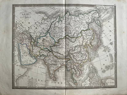
20241839 Asia Map by MoninTitle: 1839 Asia Map by Monin Date/Period: 1839 Materials: Hand colored, engraved Size: 17 1/2 x 12 1/2" This map is an interesting depiction of Asia in 1839 when the continent was still largely unexpSee Sold Price
Sold20241839 Italy Map by MoninTitle: 1839 Italy Map by Monin Date/Period: 1839 Materials: Hand colored, engraved Size: 17 1/2” x 12 1/2” 1839. By V. Monin. Paris. Hand-colored, engraved. Good condition, with some foxinSee Sold Price
Sold20231839 Russia Map by MoninTitle: 1839 Russia Map by Monin Date/Period: 1839 Materials: Hand colored, engraved Size: 17 1/2” x 12 1/2” 1839. By V. Monin. Paris. Hand-colored, engraved. Good condition, with some foxiSee Sold Price
Sold20241839 Known Ancient World Map by MoninTitle: 1839 Known Ancient World Map by Monin Date/Period: 1839 Materials: Hand colored, engraved Size: 17 1/2 x 12 1/2" This map is a fascinating illustration of the world as known to the ancient GreeSee Sold Price
Sold20241839. Map of Australia and Pacific by MoninTitle: 1839. Map of Australia and Pacific by Monin Date/Period: 1839 Materials: Hand colored, engraved Size: 17 1/2 x 12 1/2" This is a map of Australia and the Pacific in 1839 when the continent wasSee Sold Price
Sold20241839 Map of Netherlands and Belgium by MoninTitle: 1839 Map of Netherlands and Belgium by Monin Date/Period: 1839 Materials: Hand colored, engraved Size: 17 1/2” x 12 1/2” Netherlands and Belgium with Luxembourg. 1839. By V. Monin.See Sold Price
Sold20231839 Map of United Kingdom and Ireland by MoninTitle: 1839 Map of United Kingdom and Ireland by Monin Date/Period: 1839 Materials: Hand colored, engraved Size: 17 1/2” x 12 1/2” 1839. By V. Monin. Paris. Hand-colored, engraved. Good coSee Sold Price
Sold20241839 Map of North America with the Republic of Texas. By MoninTitle: 1839 Map of North America with the Republic of Texas. By Monin Date/Period: 1839 Materials: Hand colored, engraved Size: 17 1/2 x 12 1/2" This map is a stunning representation of North AmericaSee Sold Price
Sold20241839 Map of Norway and Sweden with insert of Iceland by MoninTitle: 1839 Map of Norway and Sweden with insert of Iceland by Monin Date/Period: 1839 Materials: Hand colored, engraved Size: 17 1/2” x 12 1/2” 1839. By V. Monin. Paris. Hand-colored, engSee Sold Price
Sold2023Russell & Barclay 1839 Hand Col Map. Russia in EuropeHand Colored Copper Engraved Map Published 1823-40, by Fisher & Son, "A Complete Atlas of the World" by John Russell et al. A Very Rare Work which is compiled from the same plates used in different edSee Sold Price
Sold2024Two Maps of Europe. Europe in 1815 and The Empire of Charlemagne. By MoninTitle: Two Maps of Europe. Europe in 1815 and The Empire of Charlemagne. By Monin Date/Period: 1839 Materials: Hand colored, engraved Size: 17 1/2” x 12 1/2” Two maps of Europe, Empire ofSee Sold Price
Sold2016Map of Italy. Europe. 1835.Print of hand colored steel engraving titled „Italie“.Author C. V. Monin.Engraved by unknown.From the „Atlas Universel de Geography“ by C. V. Monin. Parsi. 1835.Italy officially the Italian ReSee Sold Price
Sold20231839 Beauties of Bosphorus TURKISH Ottoman Empire Sultans Danube MAP Bartlett ART1839 Beauties of Bosphorus TURKISH Ottoman Empire Sultans Danube MAP Bartlett ART “Picturesque Europe” is was a popular 19th-century collection of works of art depicting iconic and famousSee Sold Price
Sold2015Map of Ancient Italy. Europe. 1835.Print of hand colored steel engraving titled Italie Ancienne“.Author C. V. Monin.Engraved by unknown.From the Atlas Universel de Geography“ by C. V. Monin. Parsi. 1835.Italy officially the ItalianSee Sold Price
Sold20241839. Ancient France (Gaul) by MoninTitle: 1839. Ancient France (Gaul) by Monin Date/Period: 1839 Materials: Hand colored, engraved Size: 17 1/2” x 12 1/2” Map of Ancient France, GAUL. 1839. By V. Monin. Paris. Hand-colored,See Sold Price
Sold20241839. World’s Rivers and Mountains By MoninTitle: 1839. World’s Rivers and Mountains By Monin Date/Period: 1839 Materials: Hand colored, engraved Size: 17 1/2 x 12 1/2" This map is a magnificent illustration of the world's mountains andSee Sold Price
Sold20241839 Balkans with Greece. By MoninTitle: 1839 Balkans with Greece. By Monin Date/Period: 1839 Materials: Hand colored, engraved Size: 17 1/2” x 12 1/2” Map of the entire Balkans with a newly independent Greece. 1839. By V.See Sold Price
Sold20211839 MAP OF ULSTER COUNTY, NEW YORK, BY DAVID H. BURR,1839 MAP OF ULSTER COUNTY, NEW YORK, BY DAVID H. BURR, STONE & CLARK PUBLISHERS, ITHICA, N.Y. NICELY FRAMED, FROM PROMINENT ELLENVILLE, N.Y. ATTORNEYS OFFICE. MAP MEASURES 22" X 23", NICELY FRAMED, ANSee Sold Price
Sold2023Antique Map Print - Europe - Map of Ancient Sicily - Italy - Philipp CluverTitle: Antique Map Print - Europe - Map of Ancient Sicily - Italy - Philipp Cluver Date: 1701 Material: Paper Dimensions: 15 cm x 13 cm Description: A detailed small map from ”Introductionis inSee Sold Price
Sold2024Antique Europe Map/ France. Pieced down in sections. Sight size 26-1/2 x 36 inches. Overall framedAntique Europe Map/ France. Pieced down in sections. Sight size 26-1/2 x 36 inches. Overall framed size is 32 x 42 inchesSee Sold Price
Sold2023Antique Map Print - Europe - Map of Silesia - Poland - Czech Republic - WroclawDescription: Map of Silesia. Silesia is a historical region of Central Europe that lies mostly within Poland, with small parts in the Czech Republic and Germany. Date: 17th Century Material: Paper DimSee Sold Price
Jun 09Worthington GalleriesAntique H/C Map EUROPE SOUS CHARLEMAGNE EN 814: EMPIRES D'OCCIDENT ET D'ORIENT$25
7 days LeftMark Louis Weseloh Estate LiquidationsSix - 17th c. Maps of Europe, Asia, England, Germany x2, Crete, Greece.8 1/4" x 6 5/8".$300
Jun 18DOYLE Auctioneers & AppraisersA block puzzle with maps of Europe, England, Ireland, Scotland, America and the World$100
Jun 04Jasper521803 Poirson Map of Europe -- L'Europe divisee en ses Principaux Etats et d'apres le Traite de Paix$95
Jun 30Global Auctions CompanyHand Colored Engraved Map of Europe, Jean Baptiste Bourguignon Anville 1754$450
Jun 07Freeman's | HindmanMURCHISON, Roderick Impey, Sir. The Silurian System. 1839. COMPLETE WITH VERY RARE HAND-COLORED$1,500
Jun 04Jasper521775 d'Anville Map of Middle Ages Europe -- Germany, France, Italy, Spain, British Isles, In an$70