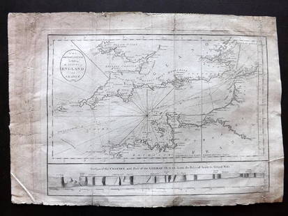
Cary, John 1787-90 Pair of Maps of Staffrodshire, UK
Similar Sale History
View More Items in Maps & AtlasesRelated Maps & Atlases
More Items in Maps & Atlases
View MoreRecommended Transportation & Travel Collectibles
View More


Item Details
Description
Hand Colored Copper Engraved Maps Published 1787, Lond for "Cary's New & Correct English Atlas" Together with a smaller Map of Staffordshire Published 1790, London for "Cary's Traveller's Companion" both by John Cary. Paper Size: 6 x 4 inch (15 x 10cm) and 13 x 9 inch (33 x 23cm) The larger map in good condition, the smaller map with mat burn and small margin tears/chips. Slightly trimmed margins
Buyer's Premium
- 22%
Cary, John 1787-90 Pair of Maps of Staffrodshire, UK
Estimate $40 - $50
2 bidders are watching this item.
Shipping & Pickup Options
Item located in Chesterfield, ukOffers In-House Shipping
Payment

TOP


![CARY, JOHN. A New Map of North America. [and] A New Map of America.: CARY, JOHN. A New Map of North America. [and] A New Map of America. Together two engraved maps of the western hemisphere. 22x25½ inches each sheet size, wide margins; nice original hand-color in](https://p1.liveauctioneers.com/199/251723/130782287_1_x.jpg?height=310&quality=70&version=1655133895)


![The rare first state of Speed's 1626 map of the Americas: [MAP - AMERICAS] SPEED, JOHN. America with those known parts in the unknowne world… [London:] G. Humble, 1626 [published 1627, state 1 per Burden]. Hand-colored engraved map on laid paper](https://p1.liveauctioneers.com/292/326828/175962854_1_x.jpg?height=310&quality=70&version=1713473479)


![Gossage, John [SIGNED]; The Thirty-Two Inch Ruler / Map of Babylon [SIGNED TWICE - FINE COPY]: SIGNED COPY Steidl, Gottingen. 2010. Hardcover in dust jacket. First edition, first printing. First book in color by Gossage. 80 pages, 180 colour plates. Essays by John Gossage and Gerhard Steidl. SI](https://p1.liveauctioneers.com/8658/325945/175540043_1_x.jpg?height=310&quality=70&version=1712964944)
![One of the rarest Manhattan maps: [MAP-MANHATTAN] DRIPPS, MATTHEW. Map of the City of New-York Extending Northward to Fiftieth Street. New York: M. Dripps, 1851. First edition. Surveyed and drawn by John F. Harrison. Lithograph](https://p1.liveauctioneers.com/292/326828/175962866_1_x.jpg?height=310&quality=70&version=1713473479)


