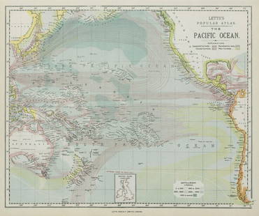
Map of the Pacific Ocean La Perouse's Atlas ca. 1
Similar Sale History
View More Items in Maps & Atlases

Related Maps & Atlases
More Items in Maps & Atlases
View MoreRecommended Transportation & Travel Collectibles
View More


Item Details
Description
"Carte du Grand Ocean ou Mer du Sud Dressee pour la Relation du Voyage de Decouvertes faites par les Fregates Francaises la Boussole et l'Astrolabe dans les Annees 1785, 86, 87 et 88," Paris, ca. 1788. This map of the Pacific Ocean shows the voyage of exploration undertaken by Jean-Francois de Galaup La Perouse (1741-1788) and his crew, which provided a wealth of cartographic information for the French. From La Perouse's Atlas. Dimensions: Sheet; height: 21 1/2 in x width: 31 1/2 in.
SKU: 03481
Condition
Good condition, some vertical and horizontal creases, some small tears along the extreme edges of creases, some soiling, and toning.
Buyer's Premium
- 28%
Map of the Pacific Ocean La Perouse's Atlas ca. 1
Estimate $300 - $400
3 bidders are watching this item.
Shipping & Pickup Options
Item located in St. Paul, MN, usSee Policy for Shipping
Payment

TOP


![Coronelli Map of the Pacific Ocean: CORONELLI, Vincenzo Maria (1650-1718). [Pacific] Mare Del Sud... Engraved map. Venice, c.1691. 19" x 26 1/4" sheet. This splendid map of the Pacific Ocean shows most of the coastlines of the Americas](https://p1.liveauctioneers.com/1968/330639/178336624_1_x.jpg?height=310&quality=70&version=1716827770)


![1857 Emory Maps of Magnetic Declanation Lines and Sections along the US Mexican Border -- United: Title: 1857 Emory Maps of Magnetic Declanation Lines and Sections along the US Mexican Border -- United States & Mexican Boundary Survey [with] Section Constructed from Surveys Under the Direction of](https://p1.liveauctioneers.com/5584/331064/178466398_1_x.jpg?height=310&quality=70&version=1716924723)


![[MAP]. TODESCHI, Pietro. [Nova et Acurata Totius Americae Tabula auct. G.I. Blaeu] America quarta: [MAP]. TODESCHI, Pietro. [Nova et Acurata Totius Americae Tabula auct. G.I. Blaeu] America quarta pars orbis quam plerunq, nuvum orbem appellitant primo detecta est anno 1492 a Christophoro Columbo...](https://p1.liveauctioneers.com/197/329395/177650542_1_x.jpg?height=310&quality=70&version=1715364962)


![[MAPS]. HOMANN, Johann Baptist, HOMANN HEIRS, and Georg Matthäus SEUTTER. [Composite Atlas].: [MAPS]. HOMANN, Johann Baptist (1663-1724), HOMANN HEIRS, and Georg Matthäus SEUTTER (1678-1757). [Composite Atlas]. [Nuremberg, Augsburg, and others: Homann Heirs and others, maps dated between](https://p1.liveauctioneers.com/197/329395/177650530_1_x.jpg?height=310&quality=70&version=1715364962)


![[MAP]. ORTELIUS, Abraham. Americae Sive Novi Orbis, Nova Descriptio. 1573.: [MAP]. ORTELIUS, Abraham (1527-1598). Americae Sive Novi Orbis, Nova Descriptio. Antwerp, 1573. Engraved map with hand-coloring. Framed and double glazed, visible area 375 x 521 mm (unexamined out of](https://p1.liveauctioneers.com/197/329395/177650534_1_x.jpg?height=310&quality=70&version=1715364962)
![Set of Twelve Satirical Anthropomorphic Maps of Europe: [SATIRICAL MAPS] A set of twelve satirical anthropomorphic maps of Europe. London: circa 1868. A set of 12 (believed complete) lithographed maps by Vincent Brooks, Day & Son, London, each offering](https://p1.liveauctioneers.com/292/330597/178279264_1_x.jpg?height=310&quality=70&version=1716409282)


![[MAP]. ORTELIUS, Abraham. Turcici Imperii Descriptio.1592.: [MAP]. ORTELIUS, Abraham (1527-1598). Turcici Imperii Descriptio. Antwerp, 1592. Engraved map with hand-coloring. Matted, framed, and double glazed, sight 406 x 521 mm (unexamined out of frame). Decor](https://p1.liveauctioneers.com/197/329395/177650538_1_x.jpg?height=310&quality=70&version=1715364962)


![[FLAGS]. 31-star American parade flag. Ca 1850-1859.: [FLAGS]. 31-star American parade flag. Ca 1850-1859. 22 x 36 1/2 in. cotton flag with 31 printed stars, configured in a double medallion surrounding a much larger central star, that is haloed in both](https://p1.liveauctioneers.com/197/329785/177758218_1_x.jpg?height=310&quality=70&version=1715625218)


