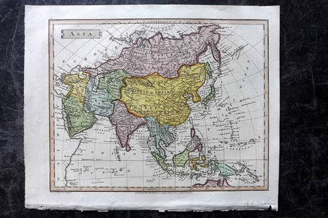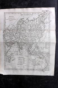
Henri Abraham Chatelain Map of Asia ca. 1700
Similar Sale History
View More Items in Maps & AtlasesRelated Maps & Atlases
More Items in Maps & Atlases
View MoreRecommended Transportation & Travel Collectibles
View More


Item Details
Description
Henri Abraham Chatelain (1684-1743), "Carte des Indes, de la Chine & des Iles de Sumatra, Java &c, Dresee sur la Memoires les plus nouveaux & sur les meillures observations, tirees des Relations les plus fideles," Amsterdam, ca. 1700. This hand colored map depicting the continent of Asia is from Chatelain's "Atlas Historique." Dimensions: Sheet; height: 22 1/4 in x width: 21 in.
SKU: 03498
Condition
Good condition, vertical crease, adhered along the upper corners, and some minor foxing.
Buyer's Premium
- 28%
Henri Abraham Chatelain Map of Asia ca. 1700
Estimate $300 - $400
6 bidders are watching this item.
Shipping & Pickup Options
Item located in St. Paul, MN, usSee Policy for Shipping
Payment

TOP


![[maps] Chatelain, Mappe-monde: Henri Abraham Chatelain, Mappe-monde pour connoitre les progrés & le conquistes les plus Remarquables des provinces-Unies. 1708-1721. Incisione in rame. mm 335x460. Foglio: mm 445x550. Titolo in](https://p1.liveauctioneers.com/1306/122788/62497211_1_x.jpg?height=310&quality=70&version=1527839290)

![EUROPAE. [Ortelius, Ca. 1584-1612.] Map.: [Ortelius, Abraham] EUROPAE. [C. 1584-1612.] Engraved map by Ortelius based on Jenkinson’s Russia map and Gastaldi’s maps of Africa and Asia, Gerard Mercator’s 1564 map of Britain, a map of Scan](https://p1.liveauctioneers.com/179/82189/42599765_1_x.jpg?height=310&quality=70&version=1447864785)


![[Maps] Gio. Ant. Magnini, Italia, 1620: [Maps] Gio. Ant. Magnini, Italia, 1620, Giovanni Antonio Magnini. Italia, data in luce da Fabio suo figliuolo al Serenissimo Ferdinado Gonzaga Duca di Matoua edi Monserrato etc. Bologna, for Sebastian](https://p1.liveauctioneers.com/188/326797/176317457_1_x.jpg?height=310&quality=70&version=1713847031)
![[Maps] Martin Zeiler, Itinerarium Italiae, 1640: [Maps] Martin Zeiler, Itinerarium Italiae, 1640, Martini Zeilleri. Itinerarium Italiae Nov-Antiquae: oder, Raiss-Beschreibung durch Italien, Matthaus Merian, Frankfurt, 40 plates, most double-page, in](https://p1.liveauctioneers.com/188/326797/176317459_1_x.jpg?height=310&quality=70&version=1713847031)


