Homann's map of the Holy Land, 1707
Similar Sale History
View More Items in Maps & AtlasesRelated Maps & Atlases
More Items in Maps & Atlases
View MoreRecommended Transportation & Travel Collectibles
View More


Item Details
Description
Heading:
Author: Homann, Johann Baptiste
Title: Iudaea seu Palaestina ob Sacratissima Redemtoris Vestigia Hodie Dicta Terra Sancta Prout Olim in Duodecim Tribus Divisa Separatis ab Invicem Regnis Iuda et Israel...
Place Published: Nuremberg
Publisher:
Date Published: 1707
Description:
Author: Homann, Johann Baptiste
Title: Iudaea seu Palaestina ob Sacratissima Redemtoris Vestigia Hodie Dicta Terra Sancta Prout Olim in Duodecim Tribus Divisa Separatis ab Invicem Regnis Iuda et Israel...
Place Published: Nuremberg
Publisher:
Date Published: 1707
Description:
Copper-engraved map, hand-colored in outline; two fully colored pictorial cartouches. 49x57 cm (19¼x22½").
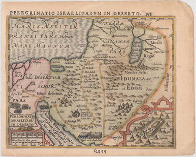
As noted in the subtitle, Homann based this map of the Holy Land on the cartography of Guillaume Sanson, presenting the region divided among the twelve tribes of Israel, and covering from Sidon to Sirbonis Lake in the Egyptian desert. Kishon River is shown as connecting the Mediterranean Sea with the Sea of Galilea. The dramatic title cartouche features Moses receiving the Ten Commandments and inset in the opposite corner is a map showing the Exodus and Wandering surrounded by a finely engraved scene including Moses, Aaron, and the two spies of Moses bearing a huge bunch of grapes.
Condition
Stains in upper corners from earlier tape on verso, repair at top centerfold on verso; very good or better.
Buyer's Premium
- 25%
Homann's map of the Holy Land, 1707
Estimate $400 - $600
2 bidders are watching this item.
Shipping & Pickup Options
Item located in Berkeley, CA, usSee Policy for Shipping
Payment

Related Searches
TOP


![1550 Munster Map of Holy Land and Cyprus -- [Holy Land and Cyprus]: Title: 1550 Munster Map of Holy Land and Cyprus -- [Holy Land and Cyprus] Cartographer: S Munster Year / Place: 1550, Basel Map Dimension (in.): 10.8 X 6.7 in. This a superb woodblock map of the Holy](https://p1.liveauctioneers.com/5584/265564/138674312_1_x.jpg?height=310&quality=70&version=1666735666)


![[MAP]. ORTELIUS, Abraham. Presbiteri Iohannis, sive, Abissinorum Imperii Descriptio. 1592.: [MAP]. ORTELIUS, Abraham. (1527-1598). Presbiteri Iohannis, sive, Abissinorum Imperii Descriptio. Antwerp, 1592. Engraved map with hand-coloring. Matted, framed, and double glazed, visible area 406 x](https://p1.liveauctioneers.com/197/329395/177650536_1_x.jpg?height=310&quality=70&version=1715364962)


![[Maps] Gio. Ant. Magnini, Italia, 1620: [Maps] Gio. Ant. Magnini, Italia, 1620, Giovanni Antonio Magnini. Italia, data in luce da Fabio suo figliuolo al Serenissimo Ferdinado Gonzaga Duca di Matoua edi Monserrato etc. Bologna, for Sebastian](https://p1.liveauctioneers.com/188/326797/176317457_1_x.jpg?height=310&quality=70&version=1713847031)
![[Maps] Martin Zeiler, Itinerarium Italiae, 1640: [Maps] Martin Zeiler, Itinerarium Italiae, 1640, Martini Zeilleri. Itinerarium Italiae Nov-Antiquae: oder, Raiss-Beschreibung durch Italien, Matthaus Merian, Frankfurt, 40 plates, most double-page, in](https://p1.liveauctioneers.com/188/326797/176317459_1_x.jpg?height=310&quality=70&version=1713847031)


![[MAP]. TODESCHI, Pietro. [Nova et Acurata Totius Americae Tabula auct. G.I. Blaeu] America quarta: [MAP]. TODESCHI, Pietro. [Nova et Acurata Totius Americae Tabula auct. G.I. Blaeu] America quarta pars orbis quam plerunq, nuvum orbem appellitant primo detecta est anno 1492 a Christophoro Columbo...](https://p1.liveauctioneers.com/197/329395/177650542_1_x.jpg?height=310&quality=70&version=1715364962)


