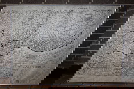
Geography of China with woodcut maps, 1712
Similar Sale History
View More Items in Maps & Atlases
![Ambrosius Macrobius's Commentary on Cicero's The Dream of Scipio , with Rare Woodcut Map: Ambrosius Macrobius's Commentary on Cicero's The Dream of Scipio, with Rare Woodcut MapAmbrosius Macrobius. MACROBII AURELII THEODOSII VIRI CONSULARIS. [First half of the 16th century] (Edition not co](https://p1.liveauctioneers.com/250/326513/175791442_1_x.jpg?height=310&quality=70&version=1713302913)
Related Maps & Atlases
More Items in Maps & Atlases
View MoreRecommended Transportation & Travel Collectibles
View More


Item Details
Description
Heading: (China)
Author:
Title: Three volumes on Chinese geography from the Wakan Sansai Zue ("Illustrated Sino-Japanese Encyclopedia")
Place Published: Japan
Publisher:
Date Published: 1712
Description:
Author:
Title: Three volumes on Chinese geography from the Wakan Sansai Zue ("Illustrated Sino-Japanese Encyclopedia")
Place Published: Japan
Publisher:
Date Published: 1712
Description:
3 volumes. Printed on double leaves. With 16 double-page maps of Chinese provinces. 27x18.5 cm (10½x7¼"), wrappers, sewn, with paper cover labels.
Three volumes from this illustrated Japanese "leishu" encyclopedia published in 1712 in the Edo period. It consists of 105 volumes in 81 books, and was compiled by Terashima (or Terajima). The three volumes present are on the geography of China, with double-page woodcut maps.
Condition
Some staining and wear to wrappers, some of the labels chipped and lacking portions; some internal mostly marginal worming, else very good.
Buyer's Premium
- 25%
Geography of China with woodcut maps, 1712
Estimate $3,000 - $5,000
5 bidders are watching this item.
Shipping & Pickup Options
Item located in Berkeley, CA, usSee Policy for Shipping
Payment

TOP


![Africa.- Fries (Lorenz) [Tabula Nova Partis Africae], woodcut map, [c. 1525].: Africa.- Fries (Lorenz) [Tabula Nova Partis Africae], rare Ptolemaic map of Southern Africa, a reduced version of Waldseemuller's map of 1513, from 'Claudii Ptolemaei Geographicae...', woodcut with fu](https://p1.liveauctioneers.com/5458/260724/135800393_1_x.jpg?height=310&quality=70&version=1662479034)
![MUNSTER, SEBASTIAN Tabula Britanniae. [Basel: circa 1571]. Woodcut map on laid paper set with a: MUNSTER, SEBASTIAN Tabula Britanniae. [Basel: circa 1571]. Woodcut map on laid paper set with a trapezoidal border, paginated 120/121, with signature mark k5 to lower corner, Latin text on verso. Shee](https://p1.liveauctioneers.com/292/250642/130213678_1_x.jpg?height=310&quality=70&version=1654271664)


![[MAP]. TODESCHI, Pietro. [Nova et Acurata Totius Americae Tabula auct. G.I. Blaeu] America quarta: [MAP]. TODESCHI, Pietro. [Nova et Acurata Totius Americae Tabula auct. G.I. Blaeu] America quarta pars orbis quam plerunq, nuvum orbem appellitant primo detecta est anno 1492 a Christophoro Columbo...](https://p1.liveauctioneers.com/197/329395/177650542_1_x.jpg?height=310&quality=70&version=1715364962)


![[MAPS]. HOMANN, Johann Baptist, HOMANN HEIRS, and Georg Matthäus SEUTTER. [Composite Atlas].: [MAPS]. HOMANN, Johann Baptist (1663-1724), HOMANN HEIRS, and Georg Matthäus SEUTTER (1678-1757). [Composite Atlas]. [Nuremberg, Augsburg, and others: Homann Heirs and others, maps dated between](https://p1.liveauctioneers.com/197/329395/177650530_1_x.jpg?height=310&quality=70&version=1715364962)


![[MAP]. ORTELIUS, Abraham. Turcici Imperii Descriptio.1592.: [MAP]. ORTELIUS, Abraham (1527-1598). Turcici Imperii Descriptio. Antwerp, 1592. Engraved map with hand-coloring. Matted, framed, and double glazed, sight 406 x 521 mm (unexamined out of frame). Decor](https://p1.liveauctioneers.com/197/329395/177650538_1_x.jpg?height=310&quality=70&version=1715364962)
![[MAP]. ORTELIUS, Abraham. Americae Sive Novi Orbis, Nova Descriptio. 1573.: [MAP]. ORTELIUS, Abraham (1527-1598). Americae Sive Novi Orbis, Nova Descriptio. Antwerp, 1573. Engraved map with hand-coloring. Framed and double glazed, visible area 375 x 521 mm (unexamined out of](https://p1.liveauctioneers.com/197/329395/177650534_1_x.jpg?height=310&quality=70&version=1715364962)


![[FLAGS]. 31-star American parade flag. Ca 1850-1859.: [FLAGS]. 31-star American parade flag. Ca 1850-1859. 22 x 36 1/2 in. cotton flag with 31 printed stars, configured in a double medallion surrounding a much larger central star, that is haloed in both](https://p1.liveauctioneers.com/197/329785/177758218_1_x.jpg?height=310&quality=70&version=1715625218)


