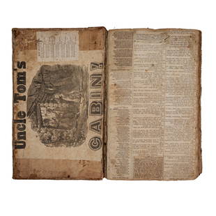
1800 Geography ATLAS MAPS John Walker India Asia World
John Walker Sale History
View Price Results for John WalkerRelated Books
More Items from John Walker
View MoreRecommended Books, Magazines & Papers
View More


Item Details
Description
1800 Geography ATLAS MAPS John Walker India Asia World Map
John Walker’s ‘Elements of Geography’ is an incredibly late 18th-century English atlas known for its impressive folding maps. This atlas, which reached a charming third edition in 1800, includes 24 maps that are regularly extracted from this work to be displayed. It is incredibly rare to find each of these maps included in the book itself.
This 1800 edition of Walker’s ‘Elements of Geography’ features each of the 24 maps; maps that include views of India, Italy, Netherlands, and Turkey, as well as maps of full continents and a large world map.
Item number: #6590
Price: $750
WALKER, John
Elements of geography : and of natural and civil history. Containing. I. The order of the spheres. II. The economy of the sublunary works of creation, inanimate and living. III. Picturesque and general sketches of the different parts of the Earth ; and the varied appearances and manners of it's inhabitants. IV. The rise, revolution, and fall, of the principal empires of the world. V. Changes through different ages in the manners of mankind. VI. VII. VIII. IX. Description of the different quarters of the world ; Europe, Asia, Africa, and America. Their cities, provinces, &c. Their climates, soils, animals, plants, minerals, mountains, rivers, lakes, canals, commerce, manufactures, curiosities, schools, learning, literati, religious professions, language, government, history, &c.
London : Printed for Darton and Harvey, Longman and Rees, H.D. Symonds, Vernor and Hood, J. Walker, J. Cuthell, J. Scatcherd, Lackington, Allen and Co. Otridge and Son, R. Faulder, R. Lea, Ogilvy and Son, C. Law, T. Hurst, J. Wright, Crosby and Letterman, J. Wallis. and West and Hughtes. Printed by Darton and Harvey, GraceChurch-Street, 1800.
Details:
Collation: Complete with all pages
[viii], [4], 620, [2]
Illustrated with 24 maps and 6 engravings
References: ESTC N 31498;
William Procter, 1825; a notable Quaker.
Language: English
Binding: Leather; tight and secure
Size: ~8.5in X 5.5in (21.5cm x 13.5cm)
Our Guarantee:
Very Fast. Very Safe. Free Shipping Worldwide.
Customer satisfaction is our priority! Notify us with 7 days of receiving, and we will offer a full refund without reservation!
6590
Condition
Excellent.
Buyer's Premium
- 0%
1800 Geography ATLAS MAPS John Walker India Asia World
Estimate $750 - $1,500
16 bidders are watching this item.
Shipping & Pickup Options
Item located in Columbia, MO, usSee Policy for Shipping
Payment

TOP


