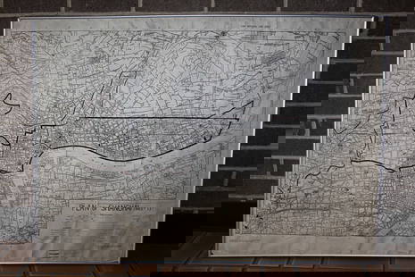
Ortelius Antique Map: Culiacanae, Hispaniolae, Cubae,
Abraham Ortelius Sale History
View Price Results for Abraham OrteliusRelated Maps & Atlases
More Items in Maps & Atlases
View MoreRecommended Transportation & Travel Collectibles
View More


Item Details
Description
250 copies originally printed. Few loose copies remaining. Copies of this map consistently sell at auction starting at $600 or $700. More background: Map of Culiacan and Western Mexico, Cuba, Hispaniola, and the West Indies, along with Southern Florida . Title: CVLIACANÆ, A:|MERICÆ REGIO:|NIS, DESCRIPTIO - HISPANIOLÆ, CVBÆ, ALIARVMQVE INSVLA:|RVM CIRCVMIACIENTIVM, DELINEATIO. [A representation of Culiacan, a region of America - An Outline of Hispaniola, Cuba and of other islands lying around them] (top middle:) "Cum Imp. et Regio. | priuilegio decennali. | 1579". [With Imperial and Royal privilege for ten years. 1579.] Cartouche top left: "Sciat lector; Auctorem Anonijmum, qui | hanc Culiacanam regionem, et has insulas pelus:|trauit, er descripsit longitudines non ut | Ptolemæus, alijaque solent; à Fortunacis insulis, versus | Orientem sumsiße: sed à Toleto Hispaniæ vmbilico, | Occidentem, ex eclypsibus ab ipsomet obseruatis | depræ: hendisse". [The reader should know that an anonymous author who drew these islands and determined the longitudes of this region of Culiacana did not take the Fortunate Isles as his measure, as Ptolemæus and others have the habit to do, but took them from Toledo in the middle of Spain toward the west, based on eclipses he observed by himself]. (From leading Ortelius scholar Marcel van den Broecke.)
Abraham Ortelius (1527 - 1598) was a Flemish cartographer & geographer, celebrated as the creator of the first modern atlas, the Theatrum Orbis Terrarum (Theatre of the World). Ortelius' work, the Theatrum Orbis Terrarum, was the first uniformly sized, systematic collection of maps; this work can therefore be called the first atlas (although the term was not used until 20 years later by Mercator).
No Reserve:
This lot starts at $1 and has no reserve as a courtesy so that collectors can determine the true market value on this authentic item.
Shipping:
Your purchase is protected:
Photos, descriptions, and estimates were prepared with the utmost care by a fully certified expert and appraiser. All items in this sale are guaranteed authentic.
In the rare event that the item did not conform to the lot description in the sale, Jasper52 specialists are here to help. Buyers may return the item for a full refund provided you notify Jasper52 within 5 days of receiving the item.
Condition
Very good condition, water staining around margins mostly not affecting map image, two tiny wormholes on top centerfold.
Buyer's Premium
- 15%
Ortelius Antique Map: Culiacanae, Hispaniolae, Cubae,
Estimate $600 - $800
7 bidders are watching this item.
Shipping & Pickup Options
Item located in New York, USSee Policy for Shipping
Payment
See More Items From This Jasper52 Seller

TOP


![[MAP]. ORTELIUS, Abraham. Romani Imperii Imago. 1592.: [MAP]. ORTELIUS, Abraham (1527-1598). Romani Imperii Imago. Antwerp, 1592. Engraved map with hand-coloring. Matted, framed, and double glazed, visible area 381 x 521 mm (unexamined out of frame). 6 de](https://p1.liveauctioneers.com/197/329395/177650537_1_x.jpg?height=310&quality=70&version=1715364962)
![[MAP]. ORTELIUS, Abraham. Peregrinationis Divi Pauli Typus Corographicus. 1592.: [MAP]. ORTELIUS, Abraham (1527-1598). Peregrinationis Divi Pauli Typus Corographicus. Antwerp, 1592. Engraved map with hand-coloring. Matted, framed, and double glazed, visible area 381 x 533 mm (unex](https://p1.liveauctioneers.com/197/329395/177650535_1_x.jpg?height=310&quality=70&version=1715364962)
![[MAP]. ORTELIUS, Abraham. Presbiteri Iohannis, sive, Abissinorum Imperii Descriptio. 1592.: [MAP]. ORTELIUS, Abraham. (1527-1598). Presbiteri Iohannis, sive, Abissinorum Imperii Descriptio. Antwerp, 1592. Engraved map with hand-coloring. Matted, framed, and double glazed, visible area 406 x](https://p1.liveauctioneers.com/197/329395/177650536_1_x.jpg?height=310&quality=70&version=1715364962)
![[MAP]. ORTELIUS, Abraham. Americae Sive Novi Orbis, Nova Descriptio. 1573.: [MAP]. ORTELIUS, Abraham (1527-1598). Americae Sive Novi Orbis, Nova Descriptio. Antwerp, 1573. Engraved map with hand-coloring. Framed and double glazed, visible area 375 x 521 mm (unexamined out of](https://p1.liveauctioneers.com/197/329395/177650534_1_x.jpg?height=310&quality=70&version=1715364962)
![[MAP]. ORTELIUS, Abraham. Aevi Veteris, Typus Geographicus. 1601.: [MAP]. ORTELIUS, Abraham (1527-1598). Aevi Veteris, Typus Geographicus. Antwerp, 1601. Engraved map with hand-coloring. Matted, framed, and double glazed, visible area 343 x 470 mm (unexamined out of](https://p1.liveauctioneers.com/197/329395/177650532_1_x.jpg?height=310&quality=70&version=1715364962)
![[MAP]. ORTELIUS, Abraham. Turcici Imperii Descriptio.1592.: [MAP]. ORTELIUS, Abraham (1527-1598). Turcici Imperii Descriptio. Antwerp, 1592. Engraved map with hand-coloring. Matted, framed, and double glazed, sight 406 x 521 mm (unexamined out of frame). Decor](https://p1.liveauctioneers.com/197/329395/177650538_1_x.jpg?height=310&quality=70&version=1715364962)
![[MAP]. ORTELIUS, Abraham. Africae Tabula Nova. 1592.: [MAP]. ORTELIUS, Abraham (1527-1598). Africae Tabula Nova. Antwerp, 1592. Engraved map with hand-coloring. Matted, framed, and double glazed, visible area 406 x 533 mm (unexamined out of frame). Strap](https://p1.liveauctioneers.com/197/329395/177650533_1_x.jpg?height=310&quality=70&version=1715364962)
![[MAPS]. ORTELIUS, Abraham. A group of 3 engraved maps with hand-coloring.: [MAPS]. ORTELIUS, Abraham (1527-1598). A group of 3 engraved maps with hand-coloring, comprising: Gallia Vetus. Antwerp, 1592. Latin text on verso. Van den Broecke Ort194 (1592L5). -- Wirtenberg Ducat](https://p1.liveauctioneers.com/197/329395/177650539_1_x.jpg?height=310&quality=70&version=1715364962)


![[MAP]. TODESCHI, Pietro. [Nova et Acurata Totius Americae Tabula auct. G.I. Blaeu] America quarta: [MAP]. TODESCHI, Pietro. [Nova et Acurata Totius Americae Tabula auct. G.I. Blaeu] America quarta pars orbis quam plerunq, nuvum orbem appellitant primo detecta est anno 1492 a Christophoro Columbo...](https://p1.liveauctioneers.com/197/329395/177650542_1_x.jpg?height=310&quality=70&version=1715364962)


![[MAPS]. HOMANN, Johann Baptist, HOMANN HEIRS, and Georg Matthäus SEUTTER. [Composite Atlas].: [MAPS]. HOMANN, Johann Baptist (1663-1724), HOMANN HEIRS, and Georg Matthäus SEUTTER (1678-1757). [Composite Atlas]. [Nuremberg, Augsburg, and others: Homann Heirs and others, maps dated between](https://p1.liveauctioneers.com/197/329395/177650530_1_x.jpg?height=310&quality=70&version=1715364962)


