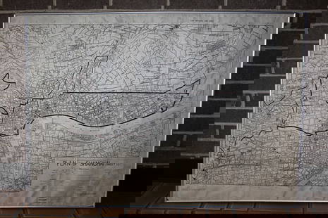
Bellin map of the west coast of South America 1771
Similar Sale History
View More Items in Maps & AtlasesRelated Maps & Atlases
More Items in Maps & Atlases
View MoreRecommended Transportation & Travel Collectibles
View More


Item Details
Description
Heading:
Author: Bellin, Jacques Nicolas
Title: Nieuwe en Hette Kaart van de Stille of Zuid-See Volgens de opgaven der beste Lootsen end stuurlieden op die Zee...
Place Published: No place
Publisher:
Date Published: 1771
Description:
Author: Bellin, Jacques Nicolas
Title: Nieuwe en Hette Kaart van de Stille of Zuid-See Volgens de opgaven der beste Lootsen end stuurlieden op die Zee...
Place Published: No place
Publisher:
Date Published: 1771
Description:
Copper-engraved map, hand-colored (later?). 33x53 cm (13x20¾").
Uncommon Dutch edition of Bellin's map of Mexico, Central America, and the west coast of South America, with large inset of its southern portion including Patagonia and the Straits of Magellan, and a smaller inset of the Baai van St. Francois on the tip of Tierra del Fuego. Well engraved by T. van Tagen, and printed on thick paper. Provenance: H. Lawrence Wilsey of Pebble Beach, California.
Condition
Old folds, remains of paper stub on verso; very good or better.
Buyer's Premium
- 25%
Bellin map of the west coast of South America 1771
Estimate $800 - $1,200
Get approved to bid.
Shipping & Pickup Options
Item located in San Francisco, CA, usSee Policy for Shipping
Payment

Related Searches
TOP


![Map of West Indies, Cuba & South America: Map of West Indies and Island of Cuba PLUS South America on verso Two maps on one sheet. (back to back). Hand colored. [See photos] Maker: No ca](https://p1.liveauctioneers.com/5614/161325/81425362_1_x.jpg?height=310&quality=70&version=1581106272)


![Amerique Méridionale'. South America. Brazil Argentina &c. BELLIN 1756 map: CAPTION PRINTED BELOW PICTURE: Amerique Méridionale [South America] DATE PRINTED: 1756 IMAGE SIZE: Approx 21.5 x 16.5cm, 8.5 x 6.5 inches (Medium) TYPE: Antique copperplate map CONDITION: Good; s](https://p1.liveauctioneers.com/5584/330116/177980523_1_x.jpg?height=310&quality=70&version=1716324705)

![La Partie la plus Méridionale de l’Amérique'. Patagonia. Chile. BELLIN 1753 map: CAPTION PRINTED BELOW PICTURE: Carte réduite de la Partie la plus Méridionale de l’Amérique [Map of the southernmost part of America] DATE PRINTED: 1753 IMAGE SIZE: Approx 24.0 x](https://p1.liveauctioneers.com/5584/330116/177980519_1_x.jpg?height=310&quality=70&version=1716324705)
![Carte des Provinces de Tierra Firme, Darien…' Panama Colombia. BELLIN 1756 map: CAPTION PRINTED BELOW PICTURE: Carte des Provinces de Tierra Firme, Darien, Cartagene et Nouvelle Grenade [Map of the provinces of Tierra Firme, Darien, Cartagena and New Granada] DATE PRINTED: 1756 I](https://p1.liveauctioneers.com/5584/330116/177980524_1_x.jpg?height=310&quality=70&version=1716324705)
![Cartagène, Ste. Marthe et Venezuela'. Colombia. Cartagena. BELLIN 1754 map: CAPTION PRINTED BELOW PICTURE: Carte des Provinces de Cartagène, Ste. Marthe et Venezuela [Map of Provinces of Cartagena, Santa Marta and Venezuela] DATE PRINTED: 1754 IMAGE SIZE: Approx 20.5 x 3](https://p1.liveauctioneers.com/5584/330116/177980520_1_x.jpg?height=310&quality=70&version=1716324705)
![Tabasco, Chiapa, Verapaz, Guatimala, Honduras & Yucatan' Mexico BELLIN 1754 map: CAPTION PRINTED BELOW PICTURE: Carte des Provinces de Tabasco, Chiapa, Verapaz, Guatimala, Honduras et Yucatan [Map of the provinces of Tabasco, Chiapas, Verapaz, Guatemala, Honduras and Yucatan] DATE](https://p1.liveauctioneers.com/5584/330116/177980521_1_x.jpg?height=310&quality=70&version=1716324705)
![Carthagene des Indes'. Cartagena de Indias city plan, Colombia. BELLIN 1756 map: CAPTION PRINTED BELOW PICTURE: Plan de la Ville de Carthagene des Indes [Plan of the city of Cartagena de Indias] DATE PRINTED: 1756 IMAGE SIZE: Approx 19.5 x 33.5cm, 7.75 x 13.25 inches (Large); Plea](https://p1.liveauctioneers.com/5584/330116/177980525_1_x.jpg?height=310&quality=70&version=1716324705)


![[MAP]. TODESCHI, Pietro. [Nova et Acurata Totius Americae Tabula auct. G.I. Blaeu] America quarta: [MAP]. TODESCHI, Pietro. [Nova et Acurata Totius Americae Tabula auct. G.I. Blaeu] America quarta pars orbis quam plerunq, nuvum orbem appellitant primo detecta est anno 1492 a Christophoro Columbo...](https://p1.liveauctioneers.com/197/329395/177650542_1_x.jpg?height=310&quality=70&version=1715364962)


![[MAPS]. HOMANN, Johann Baptist, HOMANN HEIRS, and Georg Matthäus SEUTTER. [Composite Atlas].: [MAPS]. HOMANN, Johann Baptist (1663-1724), HOMANN HEIRS, and Georg Matthäus SEUTTER (1678-1757). [Composite Atlas]. [Nuremberg, Augsburg, and others: Homann Heirs and others, maps dated between](https://p1.liveauctioneers.com/197/329395/177650530_1_x.jpg?height=310&quality=70&version=1715364962)


![[MAP]. ORTELIUS, Abraham. Turcici Imperii Descriptio.1592.: [MAP]. ORTELIUS, Abraham (1527-1598). Turcici Imperii Descriptio. Antwerp, 1592. Engraved map with hand-coloring. Matted, framed, and double glazed, sight 406 x 521 mm (unexamined out of frame). Decor](https://p1.liveauctioneers.com/197/329395/177650538_1_x.jpg?height=310&quality=70&version=1715364962)
![[MAP]. ORTELIUS, Abraham. Americae Sive Novi Orbis, Nova Descriptio. 1573.: [MAP]. ORTELIUS, Abraham (1527-1598). Americae Sive Novi Orbis, Nova Descriptio. Antwerp, 1573. Engraved map with hand-coloring. Framed and double glazed, visible area 375 x 521 mm (unexamined out of](https://p1.liveauctioneers.com/197/329395/177650534_1_x.jpg?height=310&quality=70&version=1715364962)


![[FLAGS]. 31-star American parade flag. Ca 1850-1859.: [FLAGS]. 31-star American parade flag. Ca 1850-1859. 22 x 36 1/2 in. cotton flag with 31 printed stars, configured in a double medallion surrounding a much larger central star, that is haloed in both](https://p1.liveauctioneers.com/197/329785/177758218_1_x.jpg?height=310&quality=70&version=1715625218)


