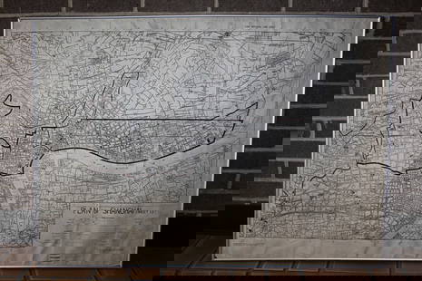
Vaugondy: Antique Map of Hispaniola & Martinique, 1750
Similar Sale History
View More Items in Maps & AtlasesRelated Maps & Atlases
More Items in Maps & Atlases
View MoreRecommended Transportation & Travel Collectibles
View More


Item Details
Description
Saint Domingue ou Hispaniola et...Martinique'. Santo Domingo. The map shows the French colonies in the West Indies of Hispaniola (which at the time was part French and part Spanish) - today comprising Haiti and the Dominican Republic - and the island of Martinique
Date Printed: 1750 (This date is printed on the map) Image Size: Approx 51.5 x 54.5cm, 20.25 x 21.25 inches (Large); Please note that this is a folding map. Type: Large antique 18th century atlas map, printed on thick, good quality paper with original outline hand colour/color and decorative title & scale cartouches Condition: Very Good; suitable for framing. Verso: There is nothing printed on the reverse side, which is plain Folding: This is a folding map. Artist/Cartographer/Engraver: Robert de Vaugondy Provenance: The map was extracted from a composite atlas of early 18th century maps, the latest of which was dated c1754
Gilles Robert de Vaugondy (1688–1766) was one of the leading cartographers in France during the 18th century, along with his son Didier Robert de Vaugondy. Together, they published one of the most important atlases of the 18th century, "The Atlas Universel". In this atlas, old sources were verified and corrected by integrating innovations in astronomical observations, as well as modern longitues and latitudes.
Shipping: Domestic: Flat-rate of $24.00 to anywhere within the contiguous U.S. International: Foreign shipping rates are determined by destination. Location: This item ships from United Kingdom
Your purchase is protected:
Photos, descriptions, and estimates were prepared with the utmost care by a fully certified expert and appraiser. All items in this sale are guaranteed authentic.
In the rare event that your purchase from this auction does not meet your expectations, Jasper52 specialists are here to help. If the item did not conform to the lot description in the sale, U.S. buyers may return the item for a full refund provided you notify Jasper52 within 5 days of receiving the item.
Gilles Robert de Vaugondy (1688–1766) was one of the leading cartographers in France during the 18th century, along with his son Didier Robert de Vaugondy. Together, they published one of the most important atlases of the 18th century, "The Atlas Universel". In this atlas, old sources were verified and corrected by integrating innovations in astronomical observations, as well as modern longitues and latitudes.
Shipping:
Your purchase is protected:
Photos, descriptions, and estimates were prepared with the utmost care by a fully certified expert and appraiser. All items in this sale are guaranteed authentic.
In the rare event that your purchase from this auction does not meet your expectations, Jasper52 specialists are here to help. If the item did not conform to the lot description in the sale, U.S. buyers may return the item for a full refund provided you notify Jasper52 within 5 days of receiving the item.
Condition
Very Good; suitable for framing.
Buyer's Premium
- 10%
Vaugondy: Antique Map of Hispaniola & Martinique, 1750
Estimate $220 - $250
3 bidders are watching this item.
Shipping & Pickup Options
Item located in United KingdomSee Policy for Shipping
Payment
See More Items From This Jasper52 Seller

Auction Curated By

Maps Expert
TOP


![Antique Map of Scotland: [Antique Map of Scotland] "A New and Correct Map of Scotland or North Britain. with all the Post and Military roads, divisions & ca. Drawn from the most approved surveys, Illustrated with many additio](https://p1.liveauctioneers.com/268/328386/176967773_1_x.jpg?height=310&quality=70&version=1714748870)


![[Maps] Gio. Ant. Magnini, Italia, 1620: [Maps] Gio. Ant. Magnini, Italia, 1620, Giovanni Antonio Magnini. Italia, data in luce da Fabio suo figliuolo al Serenissimo Ferdinado Gonzaga Duca di Matoua edi Monserrato etc. Bologna, for Sebastian](https://p1.liveauctioneers.com/188/326797/176317457_1_x.jpg?height=310&quality=70&version=1713847031)
![[Maps] Martin Zeiler, Itinerarium Italiae, 1640: [Maps] Martin Zeiler, Itinerarium Italiae, 1640, Martini Zeilleri. Itinerarium Italiae Nov-Antiquae: oder, Raiss-Beschreibung durch Italien, Matthaus Merian, Frankfurt, 40 plates, most double-page, in](https://p1.liveauctioneers.com/188/326797/176317459_1_x.jpg?height=310&quality=70&version=1713847031)


![[MAP]. TODESCHI, Pietro. [Nova et Acurata Totius Americae Tabula auct. G.I. Blaeu] America quarta: [MAP]. TODESCHI, Pietro. [Nova et Acurata Totius Americae Tabula auct. G.I. Blaeu] America quarta pars orbis quam plerunq, nuvum orbem appellitant primo detecta est anno 1492 a Christophoro Columbo...](https://p1.liveauctioneers.com/197/329395/177650542_1_x.jpg?height=310&quality=70&version=1715364962)


