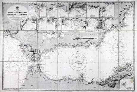
Bonne: Antique Chart Map of Normandy & Brittany, 1778
Similar Sale History
View More Items in Maps & AtlasesRelated Maps & Atlases
More Items in European Maps & Atlases
View MoreRecommended Transportation & Travel Collectibles
View More


Item Details
Description
Fine antique miniature nautical chart from 1778 of France's Normandy and Brittany coastline along the English Channel. Coverage at sea includes the Channel Islands of Guernsey, Jersey, and Alderney. Ports and towns shown include St. Malo, Avranche, Cherbourg, Barfleur, Bayeux, Caen, Havre du Grace (La Havre). This scarce chart was published during the golden age for miniature maps and is one of the few miniature charts printed during that period. From Rigobert Bonne's miniature nautical atlas "Atlas maritime ou Cartes réduites de toutes les Côtes de France avec des cartes particulières des isles voisines les plus considérables, suivies des plans des principales villes maritimes de ce royaume." One of 12 miniature charts published in the Atlas Maritime. Published by Lattre from Paris. With the royal privilege. No. 3.
Rigobert Bonne (1727-1795) was one of the most important cartographers of the late 18th century, succeeding Jacques Nicolas Bellin as Royal Cartographer to France in 1773. Bonne’s work represents a distinct step away from the decorative work popular during the 17th and early 18th century towards a more detail oriented and practical aesthetic. He focused mostly on coastal regions during his career.
Shipping:
Your purchase is protected:
Photos, descriptions, and estimates were prepared with the utmost care by a fully certified expert and appraiser. All items in this sale are guaranteed authentic.
In the rare event that your purchase from this auction does not meet your expectations, Jasper52 specialists are here to help. If the item did not conform to the lot description in the sale, U.S. buyers may return the item for a full refund provided you notify Jasper52 within 5 days of receiving the item.
Condition
Very Good. On strong, heavy solid paper with one vertical fold as issued. A few small spots. Trace of binder's stub on verso. Slight, attractive age toning.
Buyer's Premium
- 10%
Bonne: Antique Chart Map of Normandy & Brittany, 1778
Estimate $100 - $115
1 bidder is watching this item.
Shipping & Pickup Options
Item located in South Carolina, USSee Policy for Shipping
Payment
See More Items From This Jasper52 Seller

Auction Curated By

Maps Expert
TOP


![Mount & Page: Antique Coast Profile of Ireland, 1749: Title/Content of Map: '[A description of the sea coast of Ireland]' The following places are shown or referred to on the coastal profile chart: Galloway (Galway) Aran Islands Limerick Date Printed: 17](https://p1.liveauctioneers.com/5584/110608/56777156_1_x.jpg?height=310&quality=70&version=1507840413)


![Janssonius: Antique Map of Portugal, 1645: Title: Portugallia et Algarbia quae olim Lusitania. Attractive mid-17th century map of Portugal Map maker: Jan Janssonius Place and Year: Amsterdam, [c.1645] Dimensions: 38.5 x 49.5 cm (15¼ x 19½ in](https://p1.liveauctioneers.com/5584/110975/56961897_1_x.jpg?height=310&quality=70&version=1508432804)


![Carte de l'Empire romain. The Roman Empire. LAPIE 1832 old antique map chart: CAPTION PRINTED BELOW PICTURE: Carte de l'Empire romain [The Roman Empire] DATE PRINTED: The publication date of the atlas within which this map was printed is stated on the title page as 1829, howeve](https://p1.liveauctioneers.com/5584/328641/177014169_1_x.jpg?height=310&quality=70&version=1715113718)


![L'Europe. Ferro/El Hierro Meridien. BUFFIER c1818 old antique map plan chart: CAPTION PRINTED BELOW PICTURE: L'Europe [Europe] DATE PRINTED: c1818 IMAGE SIZE: Approx 14.5 x 18.5cm, 5.75 x 7.25 inches (Medium); Please note that this is a folding map. TYPE: Antique engraved map C](https://p1.liveauctioneers.com/5584/328641/177014211_1_x.jpg?height=310&quality=70&version=1715113718)


![The Shores of the Mediterranean Sea. HUGHES 1860 old antique map plan chart: CAPTION PRINTED BELOW PICTURE: The shores of the Mediterranean [The Adriatic, and the Black Sea] DATE PRINTED: 1860 IMAGE SIZE: Approx 36.5 x 26.0cm, 14.5 x 10 inches (Large); Please note that this is](https://p1.liveauctioneers.com/5584/328641/177014447_1_x.jpg?height=310&quality=70&version=1715113718)


![[Maps] Gio. Ant. Magnini, Italia, 1620: [Maps] Gio. Ant. Magnini, Italia, 1620, Giovanni Antonio Magnini. Italia, data in luce da Fabio suo figliuolo al Serenissimo Ferdinado Gonzaga Duca di Matoua edi Monserrato etc. Bologna, for Sebastian](https://p1.liveauctioneers.com/188/326797/176317457_1_x.jpg?height=310&quality=70&version=1713847031)


![[Maps] Martin Zeiler, Itinerarium Italiae, 1640: [Maps] Martin Zeiler, Itinerarium Italiae, 1640, Martini Zeilleri. Itinerarium Italiae Nov-Antiquae: oder, Raiss-Beschreibung durch Italien, Matthaus Merian, Frankfurt, 40 plates, most double-page, in](https://p1.liveauctioneers.com/188/326797/176317459_1_x.jpg?height=310&quality=70&version=1713847031)

