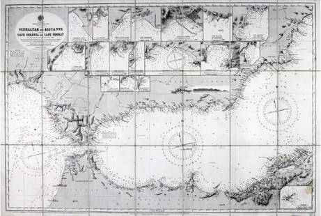
Willyams: Antique Map of the Mediterranean Sea, 1802
Similar Sale History
View More Items in Maps & AtlasesRelated Maps & Atlases
More Items in European Maps & Atlases
View MoreRecommended Transportation & Travel Collectibles
View More


Item Details
Description
Antique chart of the Mediterranean Sea related to the Battle of the Nile in 1798. A General Chart of the Mediteranean with the tracks of the British Fleet Commanded by Rear Admiral Sir Horatio Nelson K.B. and of the French Fleet Commanded by Admiral Bruyes till they met in the Bay of Aboukir off the Nile On the First of August 1798.
Date Printed: 1802 Cartographer: Willyams, Cooper Size: 18 x 8 Condition: Good. Clean. Right and left margins at 1/4". Archivally repaired small marginal tears from verso not impacting the image. Very slight toning at vertical centerfold.
Striking, detailed, and unusual aquatint map showing the track of the Royal Navy at the command of Horatio Nelson and the tracks of the Imperial French Navy at the Command of Napoleon I from Europe to Egypt, before and during the Battle of the Nile at Aboukir Bay, in Egypt. The map includes three oval views: 1. The Rock of Gibraltar from the Spanish Lines. 2. The Devil's Tower. 3. Ceuta Point bearing S by E 3/4 East. From Willyam's "A Voyage Up the Mediterranean in His Majesty's Ship the Swiftsure" an eye-witness account of the Battle of the Nile in 1798, Admiral Nelson's greatest triumph. The Rev. Cooper Willyams (1762 – 1816) was a clergyman and a British artist. The son of a navy commander and formerly chaplain to Admiral St. Vincent, Willyams was a veteran of several campaigns, having accompanied the expedition to the West Indies which ended in a British defeat of the French in 1794.
Shipping: Domestic: Flat-rate of $20.00 to anywhere within the contiguous U.S. International: Foreign shipping rates are determined by destination. Location: This item ships from South Carolina
Your purchase is protected:
Photos, descriptions, and estimates were prepared with the utmost care by a fully certified expert and appraiser. All items in this sale are guaranteed authentic.
In the rare event that your purchase from this auction does not meet your expectations, Jasper52 specialists are here to help. If the item did not conform to the lot description in the sale, U.S. buyers may return the item for a full refund provided you notify Jasper52 within 5 days of receiving the item.
Striking, detailed, and unusual aquatint map showing the track of the Royal Navy at the command of Horatio Nelson and the tracks of the Imperial French Navy at the Command of Napoleon I from Europe to Egypt, before and during the Battle of the Nile at Aboukir Bay, in Egypt. The map includes three oval views: 1. The Rock of Gibraltar from the Spanish Lines. 2. The Devil's Tower. 3. Ceuta Point bearing S by E 3/4 East. From Willyam's "A Voyage Up the Mediterranean in His Majesty's Ship the Swiftsure" an eye-witness account of the Battle of the Nile in 1798, Admiral Nelson's greatest triumph. The Rev. Cooper Willyams (1762 – 1816) was a clergyman and a British artist. The son of a navy commander and formerly chaplain to Admiral St. Vincent, Willyams was a veteran of several campaigns, having accompanied the expedition to the West Indies which ended in a British defeat of the French in 1794.
Shipping:
Your purchase is protected:
Photos, descriptions, and estimates were prepared with the utmost care by a fully certified expert and appraiser. All items in this sale are guaranteed authentic.
In the rare event that your purchase from this auction does not meet your expectations, Jasper52 specialists are here to help. If the item did not conform to the lot description in the sale, U.S. buyers may return the item for a full refund provided you notify Jasper52 within 5 days of receiving the item.
Condition
Good. Clean. Right and left margins at 1/4". Archivally repaired small marginal tears from verso not impacting the image. Very slight toning at vertical centerfold.
Buyer's Premium
- 10%
Willyams: Antique Map of the Mediterranean Sea, 1802
Estimate $275 - $325
2 bidders are watching this item.
Get approved to bid.
Shipping & Pickup Options
Item located in South Carolina, USSee Policy for Shipping
Payment
Accepts seamless payments through LiveAuctioneers
See More Items From This Jasper52 Seller

Auction Curated By

Maps Expert
TOP


![Mount & Page: Antique Coast Profile of Ireland, 1749: Title/Content of Map: '[A description of the sea coast of Ireland]' The following places are shown or referred to on the coastal profile chart: Galloway (Galway) Aran Islands Limerick Date Printed: 17](https://p1.liveauctioneers.com/5584/110608/56777156_1_x.jpg?height=310&quality=70&version=1507840413)


![Janssonius: Antique Map of Portugal, 1645: Title: Portugallia et Algarbia quae olim Lusitania. Attractive mid-17th century map of Portugal Map maker: Jan Janssonius Place and Year: Amsterdam, [c.1645] Dimensions: 38.5 x 49.5 cm (15¼ x 19½ in](https://p1.liveauctioneers.com/5584/110975/56961897_1_x.jpg?height=310&quality=70&version=1508432804)


![Chinese Japanese Korean Ports sea chart. lighthouses mail routes. LARGE 1927 map: TITLE/CONTENT OF MAP: Chinese and Japanese Ports [inset Port Arthur & Dalny; Approaches to Shanghai; Wei-hai-wei; Kiao-chow; Kobe; Tokyo Bay; Yokohama] DATE PRINTED: 1927 IMAGE SIZE: Approx 50.5 x 70.](https://p1.liveauctioneers.com/5584/329387/177649259_1_x.jpg?height=310&quality=70&version=1715717898)


![[Maps] Gio. Ant. Magnini, Italia, 1620: [Maps] Gio. Ant. Magnini, Italia, 1620, Giovanni Antonio Magnini. Italia, data in luce da Fabio suo figliuolo al Serenissimo Ferdinado Gonzaga Duca di Matoua edi Monserrato etc. Bologna, for Sebastian](https://p1.liveauctioneers.com/188/326797/176317457_1_x.jpg?height=310&quality=70&version=1713847031)
![[Maps] Martin Zeiler, Itinerarium Italiae, 1640: [Maps] Martin Zeiler, Itinerarium Italiae, 1640, Martini Zeilleri. Itinerarium Italiae Nov-Antiquae: oder, Raiss-Beschreibung durch Italien, Matthaus Merian, Frankfurt, 40 plates, most double-page, in](https://p1.liveauctioneers.com/188/326797/176317459_1_x.jpg?height=310&quality=70&version=1713847031)


