


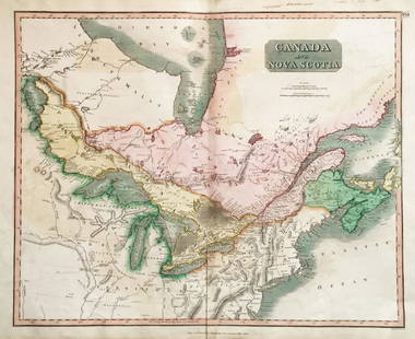
Thomson: Map of Canada & Nova Scotia, 1817
Similar Sale History
View More Items in Maps & Atlases


Related Maps & Atlases


![South-west & Central Europe. Switzerland includes Haute-Savoie. THOMSON 1830 map: TITLE/CONTENT OF MAP: [Europe after the Congress of Vienna - South-west sheet] An oddly-misshapen Switzerland erroneously includes what is now the French departement of Haute Savoie and part of Savoie](https://p1.liveauctioneers.com/5584/328641/177014316_1_x.jpg?height=310&quality=70&version=1715113718)


![South-west & Central Europe. Switzerland includes Haute-Savoie. THOMSON 1817 map: CAPTION PRINTED BELOW PICTURE: [Europe after the Congress of Vienna - South-west sheet] An oddly-misshapen Switzerland erroneously includes what is now the French departement of Haute Savoie and part](https://p1.liveauctioneers.com/5584/328641/177014438_1_x.jpg?height=310&quality=70&version=1715113718)
More Items in Maps & Atlases
View More


![[Maps] Gio. Ant. Magnini, Italia, 1620: [Maps] Gio. Ant. Magnini, Italia, 1620, Giovanni Antonio Magnini. Italia, data in luce da Fabio suo figliuolo al Serenissimo Ferdinado Gonzaga Duca di Matoua edi Monserrato etc. Bologna, for Sebastian](https://p1.liveauctioneers.com/188/326797/176317457_1_x.jpg?height=310&quality=70&version=1713847031)
![[Maps] Martin Zeiler, Itinerarium Italiae, 1640: [Maps] Martin Zeiler, Itinerarium Italiae, 1640, Martini Zeilleri. Itinerarium Italiae Nov-Antiquae: oder, Raiss-Beschreibung durch Italien, Matthaus Merian, Frankfurt, 40 plates, most double-page, in](https://p1.liveauctioneers.com/188/326797/176317459_1_x.jpg?height=310&quality=70&version=1713847031)


Recommended Transportation & Travel Collectibles
View More


Item Details
Description
Please note that this lot has a confidential reserve. When you leave a bid in advance of the auction, submit your maximum. Jasper52 will bid on your behalf as much as necessary to ensure that you meet the reserve price or that you remain in the lead, up to your maximum. The bidder who has submitted the highest bid wins the lot, provided the bid exceeds the reserve price.
Shipping:
Authenticity:
Photos, descriptions, and estimates were prepared with the utmost care by a fully certified expert and appraiser. All items in this sale are guaranteed authentic. Please contact us if there is a misrepresentation so that the item can be returned.
Your purchase is protected:
In the rare event that your purchase from this auction does not meet your expectations, Jasper52 specialists are here to help. If the item did not conform to the lot description in the sale, U.S. buyers may return the item for a full refund provided you notify Jasper52 within 5 days of receiving the item.
Condition
Good; suitable for framing. Spot in left hand margin. Toning in upper and lower margins.
Buyer's Premium
- 10%
Thomson: Map of Canada & Nova Scotia, 1817
Estimate $250 - $300
Get approved to bid.
Shipping & Pickup Options
Item located in United KingdomSee Policy for Shipping
Payment
Accepts seamless payments through LiveAuctioneers
See More Items From This Jasper52 Seller

TOP