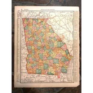
1804 MAP OF SOUTH CAROLINA - JOHN CONRAD
Similar Sale History
Recommended Items


Item Details
Description
Framed Map Engraving of South Carolina from the 1804 New and Elegant General Atlas. Drawn by S. Lewis. Engraved by D. Fairman. (Published by John Conrad & Co., Philadelphia. 1804). Engraved map, uncolored. Relief shown by hachures. Prime meridians: Philadelphia and London. A new and elegant general atlas, comprising all the new discoveries, to the present time. Containing sixty-three maps, drawn by Arrowsmith and Lewis. Published by John Conrad & Co., Philadelphia; M. & J. Conrad & Co., Baltimore; Rapin, Conrad & Co., Washington City; Somervell & Conrad, Petersburg; Bonsal, Conrad & Co., Norfolk. 1804. PROVENANCE: The Estate of a Charleston SC Art Dealer / Gallery Owner. Map measures 9.8"x7.9". In frame measures 18"x16"x1". Weight is 3 pds 5 oz.
Condition
good
Buyer's Premium
- 18% up to $50,000.00
- 10% up to $1,000,000.00
- 5% above $1,000,000.00
1804 MAP OF SOUTH CAROLINA - JOHN CONRAD
Estimate $150 - $200
10 bidders are watching this item.
Shipping & Pickup Options
Item located in Mt. Pleasant, SC, usSee Policy for Shipping
Payment
Accepts seamless payments through LiveAuctioneers

TOP


![[Map] The State of South Carolina 1796: Tanner, Benjamin. "The State of South Carolina: from the best Authorities." New York: John Reid, [ca. 1796.] On heavy laid. Measuring from neat-lines 17" x 15". Lower edge remargined, mild toning, one](https://p1.liveauctioneers.com/3532/146911/74242458_1_x.jpg?height=310&quality=70&version=1564368564)


![Emanuel Bowen Map North & South Carolina, Georgia: [Emanuel Bowen Map of North & South Carolina and Georgia] , "A New & Accurate Map of the Provinces of North & South Carolina Georgia & c. Drawn from late Surveys and regulated by Astron Observat. By E](https://p1.liveauctioneers.com/268/293228/155705053_1_x.jpg?height=310&quality=70&version=1687296979)


