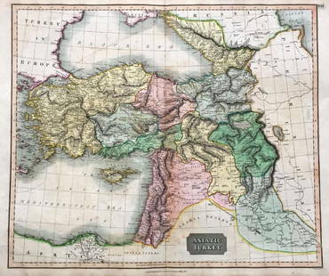
Map of Empire of Persia. 1854.
Similar Sale History
View More Items in Maps & AtlasesRelated Maps & Atlases
More Items in Maps & Atlases
View MoreRecommended Transportation & Travel Collectibles
View More


Item Details
Description
Print of hand colored steel engraving titled „Empire des Perses“.
Drawn by L. Dussieux.
Engraved by unknown.
From „Atlas General De Geographie physique, politique et historique par L. Dussieux. Atlas de Geographie ancienne, du moyen age et Moderne“. Paris. 1854.
Louis-Étienne Dussieux, born April 5, 1815 in Lyon and died February 11, 1894 in Paris. He was a French historian-geographer.
The Persian Empire is any of a series of imperial dynasties centered in Persia (Iran). The first of these was established by Cyrus the Great in 550 BC, with the Persian conquest of Media, Lydia and Babylonia. Several later dynasties "claimed to be heirs of the Achaemenids".Persian dynastic history was interrupted by the Islamic conquest (651 AD) and later by the Mongol invasion.The main religion of ancient Persia was Zoroastrianism, but after the 7th century this was replaced by Islam.
Condition
Approx. image size 26, 8 x 20, 2/31, 7 x 22 cm.
Condition: good.
Buyer's Premium
- 0%
Map of Empire of Persia. 1854.
Estimate €7 - €9
Get approved to bid.
Shipping & Pickup Options
Item located in Vilnius, ltSee Policy for Shipping
Payment

TOP


![Ptolemy / Russcelli Map of Asia Showing Iran: After PTOLEMAEUS, Claudius (After 83- c.168 AD), RUSCELLI, Girolamo (1500-1566). [Persia / Iran] Tabula Asiae V. Engraved map. Venice: Ruscelli, 1561. 9" x 12 1/8" sheet. Ptolemaic map of the region b](https://p1.liveauctioneers.com/1968/330639/178336643_1_x.jpg?height=310&quality=70&version=1716827770)


![West Africa. Sahara caravan routes. Tribes Kingdoms Empires. LIZARS 1842 map: Title: West Africa. Sahara caravan routes. Tribes Kingdoms Empires. LIZARS 1842 map Description: Part of Africa [north-west sheet] by William Home Lizars (1842). Antique 19th century atlas map with or](https://p1.liveauctioneers.com/5584/330582/178266304_1_x.jpg?height=310&quality=70&version=1716924723)


![[MAP]. ORTELIUS, Abraham. Turcici Imperii Descriptio.1592.: [MAP]. ORTELIUS, Abraham (1527-1598). Turcici Imperii Descriptio. Antwerp, 1592. Engraved map with hand-coloring. Matted, framed, and double glazed, sight 406 x 521 mm (unexamined out of frame). Decor](https://p1.liveauctioneers.com/197/329395/177650538_1_x.jpg?height=310&quality=70&version=1715364962)
![[MAP]. ORTELIUS, Abraham. Romani Imperii Imago. 1592.: [MAP]. ORTELIUS, Abraham (1527-1598). Romani Imperii Imago. Antwerp, 1592. Engraved map with hand-coloring. Matted, framed, and double glazed, visible area 381 x 521 mm (unexamined out of frame). 6 de](https://p1.liveauctioneers.com/197/329395/177650537_1_x.jpg?height=310&quality=70&version=1715364962)


![Abissinorum Imperium. Bertius/Langenes. Abyssinian Empire. East Africa 1603 map: Title: Abissinorum Imperium. Bertius/Langenes. Abyssinian Empire. East Africa 1603 map Description: Descriptio Abissinorum / Abissinorum Imperium [The Empire of Abyssinia]. Drawn by Petrus Bertius, fr](https://p1.liveauctioneers.com/5584/330582/178266299_1_x.jpg?height=310&quality=70&version=1716924723)

![[MAP]. TODESCHI, Pietro. [Nova et Acurata Totius Americae Tabula auct. G.I. Blaeu] America quarta: [MAP]. TODESCHI, Pietro. [Nova et Acurata Totius Americae Tabula auct. G.I. Blaeu] America quarta pars orbis quam plerunq, nuvum orbem appellitant primo detecta est anno 1492 a Christophoro Columbo...](https://p1.liveauctioneers.com/197/329395/177650542_1_x.jpg?height=310&quality=70&version=1715364962)


![[MAPS]. HOMANN, Johann Baptist, HOMANN HEIRS, and Georg Matthäus SEUTTER. [Composite Atlas].: [MAPS]. HOMANN, Johann Baptist (1663-1724), HOMANN HEIRS, and Georg Matthäus SEUTTER (1678-1757). [Composite Atlas]. [Nuremberg, Augsburg, and others: Homann Heirs and others, maps dated between](https://p1.liveauctioneers.com/197/329395/177650530_1_x.jpg?height=310&quality=70&version=1715364962)


![[MAP]. ORTELIUS, Abraham. Americae Sive Novi Orbis, Nova Descriptio. 1573.: [MAP]. ORTELIUS, Abraham (1527-1598). Americae Sive Novi Orbis, Nova Descriptio. Antwerp, 1573. Engraved map with hand-coloring. Framed and double glazed, visible area 375 x 521 mm (unexamined out of](https://p1.liveauctioneers.com/197/329395/177650534_1_x.jpg?height=310&quality=70&version=1715364962)
![Set of Twelve Satirical Anthropomorphic Maps of Europe: [SATIRICAL MAPS] A set of twelve satirical anthropomorphic maps of Europe. London: circa 1868. A set of 12 (believed complete) lithographed maps by Vincent Brooks, Day & Son, London, each offering](https://p1.liveauctioneers.com/292/330597/178279264_1_x.jpg?height=310&quality=70&version=1716409282)


![[FLAGS]. 31-star American parade flag. Ca 1850-1859.: [FLAGS]. 31-star American parade flag. Ca 1850-1859. 22 x 36 1/2 in. cotton flag with 31 printed stars, configured in a double medallion surrounding a much larger central star, that is haloed in both](https://p1.liveauctioneers.com/197/329785/177758218_1_x.jpg?height=310&quality=70&version=1715625218)


![[CIVIL WAR]. 35-star American flag, possibly a Naval flag. Ca 1863-1865.: [CIVIL WAR]. 35-star American flag, possibly a Naval flag. Ca 1863-1865. Approx. 62 x 100 in. hand-sewn wool flag with 35 double-appliquéd cotton stars configured in 7/7/7/7/7 pattern (toning, soilin](https://p1.liveauctioneers.com/197/329785/177758220_1_x.jpg?height=310&quality=70&version=1715625218)