Decprative world map 1720
Similar Sale History
View More Items in Maps & AtlasesRelated Maps & Atlases
More Items in Maps & Atlases
View MoreRecommended Transportation & Travel Collectibles
View More


Item Details
Description
Heading:
Author: Homann, Johann Baptiste
Title: Planiglobii Terrestris cum Utroq Hemisphaerio Caelesti Generalis Exhibitio
Place Published: Nuremberg
Publisher:
Date Published: c.1720
Description:
Author: Homann, Johann Baptiste
Title: Planiglobii Terrestris cum Utroq Hemisphaerio Caelesti Generalis Exhibitio
Place Published: Nuremberg
Publisher:
Date Published: c.1720
Description:
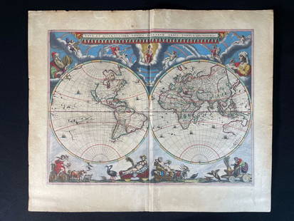
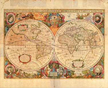
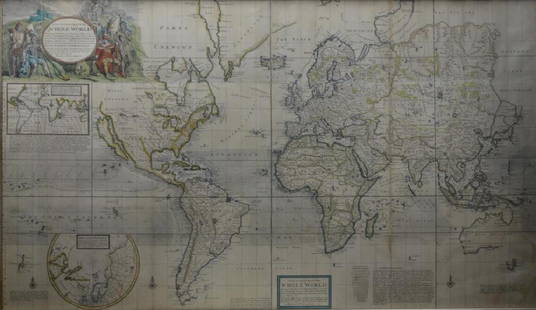
Copper-engraved double-hemisphere world map, hand-colored, with two colored celestial spheres; uncolored engraved pictorial surroundings, four columns of text at bottom. 48.5x55 cm (19x21¾").
Quite decorative eighteenth century world map - the two hemispheres are surrounded by vivid engravings of natural phenomena such as waterspouts, a rainbow, earthquakes, and a volcano. Wind heads occupy the starry heavens, and two cherubs hold the title banner aloft. The map itself shows a typical geographical view of the period with an incorrect northwest coastline in North America, labeled Terra Esonis, and most of the Pacific incompletely mapped. Thetext panels at bottom describe the natural phenomena.
Condition
Old split at centerfold repaired with paper on verso, with mild discoloration along centerfold, light stains at top of bottom of centerfold and at corners just extenending into image; overall very good.
Buyer's Premium
- 23%
Decprative world map 1720
Estimate $500 - $800
8 bidders are watching this item.
Shipping & Pickup Options
Item located in San Francisco, CA, usSee Policy for Shipping
Payment

Related Searches
TOP


![Ortelius' 1570 world map: Heading: Author: Ortelius, Abraham Title: Typus Orbis Terrarum Place Published: Antwerp Publisher: Date Published: 1570-[1584?] Description: Copper-engraved map, hand-color](https://p1.liveauctioneers.com/642/127929/65081054_1_x.jpg?height=310&quality=70&version=1537227236)


![Mercator World Map: *** START PRICE IS THE RESERVE *** [World] MERCATOR, Rumold (1545-1599). Orbis Terrae Compendiosa Descriptio Quam ex Magna Universali Mercatoris... Engraved Map with original hand color. Geneva, 1587.](https://p1.liveauctioneers.com/1968/163248/82424686_1_x.jpg?height=310&quality=70&version=1583340284)


![World.- Bordone (Benedetto di) [World Map], woodcut, [1522].: World.- Bordone (Benedetto di) [World Map], early map showing the recent developments in cartography and departing from Ptolemaic models, including open water between the two continents and not joinin](https://p1.liveauctioneers.com/5458/252576/131355887_1_x.jpg?height=310&quality=70&version=1655911671)
![Coronelli's elegant two-sheet hemispheric world map: [MAP - WORLD] CORONELLI, VINCENZO MARIA. Planisfero Del Mondo Vecchio; [and] Planisfero Del Mondo Nuovo. [Venice: circa 1691]. Two hand-colored engraved hemispheric world maps printed on separate shee](https://p1.liveauctioneers.com/292/326828/175962847_1_x.jpg?height=310&quality=70&version=1713473479)

![Zahn World Map: *** START PRICE IS THE RESERVE *** [World] ZAHN, Johann (1631-1707). Facies Una Hemispaerri Terrestris and Facies Altera Hemishpaerii Tarrastris... Double hemishperic world map on two engraved sheets.](https://p1.liveauctioneers.com/1968/163248/82424687_1_x.jpg?height=310&quality=70&version=1583340284)
![Homann World Map: *** START PRICE IS THE RESERVE *** [World] HOMANN, Heirs (18th century). Planiglobii Terrestris Mappa Universalis utrumque. Engraved map with original hand color in part. Nuremberg: Homann Heirs, 1746](https://p1.liveauctioneers.com/1968/163248/82424684_1_x.jpg?height=310&quality=70&version=1583340284)


![[Maps] Gio. Ant. Magnini, Italia, 1620: [Maps] Gio. Ant. Magnini, Italia, 1620, Giovanni Antonio Magnini. Italia, data in luce da Fabio suo figliuolo al Serenissimo Ferdinado Gonzaga Duca di Matoua edi Monserrato etc. Bologna, for Sebastian](https://p1.liveauctioneers.com/188/326797/176317457_1_x.jpg?height=310&quality=70&version=1713847031)
![[Maps] Martin Zeiler, Itinerarium Italiae, 1640: [Maps] Martin Zeiler, Itinerarium Italiae, 1640, Martini Zeilleri. Itinerarium Italiae Nov-Antiquae: oder, Raiss-Beschreibung durch Italien, Matthaus Merian, Frankfurt, 40 plates, most double-page, in](https://p1.liveauctioneers.com/188/326797/176317459_1_x.jpg?height=310&quality=70&version=1713847031)


![[MAP]. TODESCHI, Pietro. [Nova et Acurata Totius Americae Tabula auct. G.I. Blaeu] America quarta: [MAP]. TODESCHI, Pietro. [Nova et Acurata Totius Americae Tabula auct. G.I. Blaeu] America quarta pars orbis quam plerunq, nuvum orbem appellitant primo detecta est anno 1492 a Christophoro Columbo...](https://p1.liveauctioneers.com/197/329395/177650542_1_x.jpg?height=310&quality=70&version=1715364962)


