


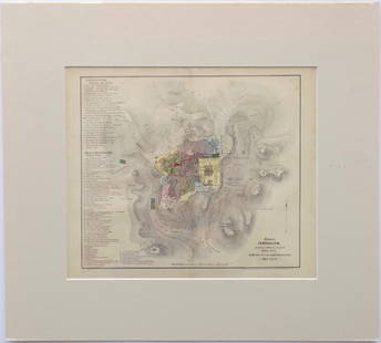
Map of travels of Israelites. Print in 1850.
Similar Sale History
View More Items in Maps & Atlases


Related Maps & Atlases


![[PICTORIAL MAPS – TRAVEL]. Three Pictorial Maps. 1940s/50s....: [PICTORIAL MAPS – TRAVEL]. Three Pictorial Maps. 1940s/50s. Three brochure sized foldout maps designed for travel including: Highroads to Happiness. Mexico City: Pemex Travel Club, ca. 1940s. &#](https://p1.liveauctioneers.com/928/325952/175495561_1_x.jpg?height=310&quality=70&version=1712935174)


More Items in Maps & Atlases
View More


![[Maps] Gio. Ant. Magnini, Italia, 1620: [Maps] Gio. Ant. Magnini, Italia, 1620, Giovanni Antonio Magnini. Italia, data in luce da Fabio suo figliuolo al Serenissimo Ferdinado Gonzaga Duca di Matoua edi Monserrato etc. Bologna, for Sebastian](https://p1.liveauctioneers.com/188/326797/176317457_1_x.jpg?height=310&quality=70&version=1713847031)
![[Maps] Martin Zeiler, Itinerarium Italiae, 1640: [Maps] Martin Zeiler, Itinerarium Italiae, 1640, Martini Zeilleri. Itinerarium Italiae Nov-Antiquae: oder, Raiss-Beschreibung durch Italien, Matthaus Merian, Frankfurt, 40 plates, most double-page, in](https://p1.liveauctioneers.com/188/326797/176317459_1_x.jpg?height=310&quality=70&version=1713847031)


Recommended Transportation & Travel Collectibles
View More


Item Details
Description
Print of steel engraving titled „Carte du voyages des Israelites “.
Author A. Houze.
Engraved by unknown.
From the „Atlas Universel Historique et Geographique“ by A. Houze, Paris. 1850.
The Israelites were a Semitic people of the Ancient Near East, who inhabited part of Canaan during the tribal and monarchic periods (15th to 6th centuries BCE), and lived in the region in smaller numbers after the fall of the monarchy. In the biblical narrative, the term "Israelites" refers to the direct descendants of the patriarch Jacob, who was also called Israel; historians use the term to refer to the historical populations of the United Kingdom of Israel and Judah. In the post-exilic period, beginning in the 5th century BCE, the two known remnants of the Israelite tribes came to be referred to as Jews and Samaritans, inhabiting the territories of Judea, Galilee and Samaria. Other terms sometimes used include the "Hebrews" and the "Twelve Tribes" (of Israel).
Approx. image size 22, 9 x 17, 6/33, 9 x 24, 8 cm.
Condition
Condition: good.
Buyer's Premium
- 0%
Map of travels of Israelites. Print in 1850.
Estimate €7 - €10
Shipping & Pickup Options
Item located in Vilnius, ltSee Policy for Shipping
Payment

Related Searches
TOP