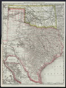
C. 1908 Montana Railroad Map by Rand McNally Large
Similar Sale History
View More Items in Maps & AtlasesRelated Maps & Atlases
More Items in Maps & Atlases
View MoreRecommended Transportation & Travel Collectibles
View More


Item Details
Description
Featured in this lot is a rare, first issue "Railroad Commission Map of Montana" published by the Rand McNally Company in 1908. This is a large format, fold out map of Montana issued for the Railroad Commission. The map covers all of Montana and parts of the adjacent lands in considerable detail, naming towns, Indian Reservations, rivers, National Forests, battlegrounds, Indian Agencies, counties and railroads. Along the bottom, roughly 1,000 towns are identified and referenced. In the early years of the 20th century, Montana went through a boom of growth and development, largely coinciding with the arrival of railroads and the development of large-scale mining around Butte and elsewhere. The Montana Railroad Commission was established in 1907. The fold out map is large, but when folded up, it is concealed within the bindings of the book. The cover is bound with red cloth and shows gold gilt lettering reading, "Railroad Commission Map of Montana". The railroads identified are as follows: Northern Pacific Railway (Red), Great Northern Railway (Green), Chicago, Milwaukee and Puget Sound Railway (Orange), Chicago, Burlington and Quincy Railroad (Teal), Oregon Short Line Railroad (Purple), Montana, Wyoming and Southern Railroad (Dark Green), Butte, Anaconda and Pacific Railway (Brown), Gilmore and Pittsburg Railroad (Black), Montana Rapid Transit Company (Blue Dashes), Gallatin Valley Electric Railway (Blue), Montana Western Railway (Yellow), Yellowstone Park Railway (Grey). The map was published by the Rand McNally Company for the Montana Railroad Commission. The map has provenance connecting it to Captain J. L. Tucker, an influential in the early development of the Montana National Guard. The map and cover show good condition overall, with some toning on the original fold lines but no obvious signs of damage are present. When folded up, it measures 8 9/16" L x 6 1/4" W x 1" D, when unfolded it measures 40 1/2" L x 53" W.*
Condition
For a complete representation of condition please review pictures. Some items may have additional images, if so please visit NaaBid.com our website directly. It is the buyer?s responsibility to view each image and preview the item to determine condition, origin and age. Shipping info is clearly stated on LA and our website diretly, please do not use LA messanger for shipping quotes, rather mark@naabid.com. North American Auction Company, naabid.com 800-686-4216.
Buyer's Premium
- 27%
C. 1908 Montana Railroad Map by Rand McNally Large
Estimate $800 - $1,200
4 bidders are watching this item.
Shipping & Pickup Options
Item located in Bozeman, MT, usSee Policy for Shipping
Payment
Accepts seamless payments through LiveAuctioneers

TOP


![1888 Rand McNally Map of Louisiana -- [Louisiana]: Title: 1888 Rand McNally Map of Louisiana -- [Louisiana] Cartographer: Rand McNally Year / Place: 1888, Chicaho Map Dimension (in.): 12.7 X 19.1 in. This is an excellent, large map of Louisiana. Plent](https://p1.liveauctioneers.com/5584/328338/176911517_1_x.jpg?height=310&quality=70&version=1715113718)


![1898 Rand McNally Map of Texas [verso] Indian Territory and Oklahoma -- Texas [verso] Oklahoma and: Title: 1898 Rand McNally Map of Texas [verso] Indian Territory and Oklahoma -- Texas [verso] Oklahoma and Indian Territory Cartographer: Rand McNally Year / Place: 1898, Chicago Map Dimension (in.): 9](https://p1.liveauctioneers.com/5584/328338/176911581_1_x.jpg?height=310&quality=70&version=1715113718)
![1914 Rand McNally Map of Austria-Hungary [verso] German Empire -- Austria-Hungary [verso] German: Title: 1914 Rand McNally Map of Austria-Hungary [verso] German Empire -- Austria-Hungary [verso] German Empire Cartographer: Rand McNally Year / Place: 1914, Chicago Map Dimension (in.): 9.2 X 13 in.](https://p1.liveauctioneers.com/5584/328338/176911532_1_x.jpg?height=310&quality=70&version=1715113718)


![[Maps] Gio. Ant. Magnini, Italia, 1620: [Maps] Gio. Ant. Magnini, Italia, 1620, Giovanni Antonio Magnini. Italia, data in luce da Fabio suo figliuolo al Serenissimo Ferdinado Gonzaga Duca di Matoua edi Monserrato etc. Bologna, for Sebastian](https://p1.liveauctioneers.com/188/326797/176317457_1_x.jpg?height=310&quality=70&version=1713847031)
![[Maps] Martin Zeiler, Itinerarium Italiae, 1640: [Maps] Martin Zeiler, Itinerarium Italiae, 1640, Martini Zeilleri. Itinerarium Italiae Nov-Antiquae: oder, Raiss-Beschreibung durch Italien, Matthaus Merian, Frankfurt, 40 plates, most double-page, in](https://p1.liveauctioneers.com/188/326797/176317459_1_x.jpg?height=310&quality=70&version=1713847031)


