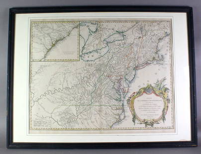
Antique Map - Oceania - Papua New Guinea - New Britain - New Ireland - J. Cook
Similar Sale History
View More Items in Maps & Atlases
Related Maps & Atlases
More Items in Maps & Atlases
View MoreRecommended Transportation & Travel Collectibles
View More


Item Details
Description
Embark on a captivating voyage through the waters of the South Pacific with this antique map titled 'Carte des découvertes du Cap.ne Carteret dans la Nle. Bretagne avec une partie de du passage du Cap.ne Cook à travers les Détroits Endeavour et de la route et des découvertes du Cap.ne Dampierre dans la Nle. Guinée et la Nle. Bretagne en 1699 et 1700.' (A Chart of Captain Carteret’s Discoveries at New Britain, with part of Captain Cooke’s Passage thro Endeavour Streights, & of Captain Dampier’s tract & discoveries in 1699 & 1700, at New Guinea and New Britain) This remarkable sea chart unveils the newfound territories explored by the intrepid Captains Cook, Carteret, and Dampier, unveiling the mysteries of New Guinea, New Britain, and New Ireland. This chart meticulously illustrates the routes taken by these legendary explorers. Captain Cook's transformative voyage along the southwestern coast of the island of New Guinea, in what is now known as Irian Jaya, Indonesia's easternmost province, takes center stage. His expedition between Australia and New Guinea confirmed the existence of the fabled Torres Strait, forever altering our understanding of the region. The chart also sheds light on the intrepid journeys of Captain Carteret and William Dampier. Their expeditions, focusing on the northern reaches of New Guinea and the neighboring Pacific islands, offer invaluable insights into the uncharted realms of this vast archipelago. The map showcases Dampier's journey from 1699 to 1700 through the Bismarck Archipelago, while Carteret's explorations in 1767 between New Britain and New Ireland leave an indelible mark on the historical record. The reverse side is blank. This is an original print, not a modern reproduction.
Buyer's Premium
- 23%
Antique Map - Oceania - Papua New Guinea - New Britain - New Ireland - J. Cook
Estimate €900 - €1,000
3 bidders are watching this item.
Get approved to bid.
Shipping & Pickup Options
Item located in Bromma, Stockholm County, seOffers In-House Shipping
Payment

TOP


![COLTON, George Woolworth (1827-1901). Map of the: COLTON, George Woolworth (1827-1901). Map of the Country Thirty Three Miles Around the City of New York. New York: J. H. Colton, 1846 [i.e., 1865]. Hand-colored lithographed map, visible area 23 3/4 b](https://p1.liveauctioneers.com/197/151909/76680338_1_x.jpg?height=310&quality=70&version=1570472488)


![RAPKIN - New York Manhattan Map 1852: [NEW YORK CITY] - J. Rapkin. New York. London and New York: John Tallis & Co., [1852]. Engraved map by Rapkin within an ornamental border, with six engraved inset views by H. Winkles. Sheet size: 21 3](https://p1.liveauctioneers.com/7533/208644/106251124_1_x.jpg?height=310&quality=70&version=1624641782)


![1761 NEW DICTIONARY OF TRADE & COMMERCE R. ROLT antique FOLIO ILLUSTRATED w/MAPS: A New Dictionary of Trade and Commerce... The Second edition [preface by Samuel Johnson] With the Addition of a New and Accurate Set of Maps... by Mr. Bowen. London: 1761 by Richard ROLT. Folio: 9.5 b](https://p1.liveauctioneers.com/5584/331097/178483567_1_x.jpg?height=310&quality=70&version=1716924779)

![[MAP]. TODESCHI, Pietro. [Nova et Acurata Totius Americae Tabula auct. G.I. Blaeu] America quarta: [MAP]. TODESCHI, Pietro. [Nova et Acurata Totius Americae Tabula auct. G.I. Blaeu] America quarta pars orbis quam plerunq, nuvum orbem appellitant primo detecta est anno 1492 a Christophoro Columbo...](https://p1.liveauctioneers.com/197/329395/177650542_1_x.jpg?height=310&quality=70&version=1715364962)


![[MAPS]. HOMANN, Johann Baptist, HOMANN HEIRS, and Georg Matthäus SEUTTER. [Composite Atlas].: [MAPS]. HOMANN, Johann Baptist (1663-1724), HOMANN HEIRS, and Georg Matthäus SEUTTER (1678-1757). [Composite Atlas]. [Nuremberg, Augsburg, and others: Homann Heirs and others, maps dated between](https://p1.liveauctioneers.com/197/329395/177650530_1_x.jpg?height=310&quality=70&version=1715364962)

![[MAP]. ORTELIUS, Abraham. Americae Sive Novi Orbis, Nova Descriptio. 1573.: [MAP]. ORTELIUS, Abraham (1527-1598). Americae Sive Novi Orbis, Nova Descriptio. Antwerp, 1573. Engraved map with hand-coloring. Framed and double glazed, visible area 375 x 521 mm (unexamined out of](https://p1.liveauctioneers.com/197/329395/177650534_1_x.jpg?height=310&quality=70&version=1715364962)
![Set of Twelve Satirical Anthropomorphic Maps of Europe: [SATIRICAL MAPS] A set of twelve satirical anthropomorphic maps of Europe. London: circa 1868. A set of 12 (believed complete) lithographed maps by Vincent Brooks, Day & Son, London, each offering](https://p1.liveauctioneers.com/292/330597/178279264_1_x.jpg?height=310&quality=70&version=1716409282)


![[MAP]. ORTELIUS, Abraham. Turcici Imperii Descriptio.1592.: [MAP]. ORTELIUS, Abraham (1527-1598). Turcici Imperii Descriptio. Antwerp, 1592. Engraved map with hand-coloring. Matted, framed, and double glazed, sight 406 x 521 mm (unexamined out of frame). Decor](https://p1.liveauctioneers.com/197/329395/177650538_1_x.jpg?height=310&quality=70&version=1715364962)


![[FLAGS]. 31-star American parade flag. Ca 1850-1859.: [FLAGS]. 31-star American parade flag. Ca 1850-1859. 22 x 36 1/2 in. cotton flag with 31 printed stars, configured in a double medallion surrounding a much larger central star, that is haloed in both](https://p1.liveauctioneers.com/197/329785/177758218_1_x.jpg?height=310&quality=70&version=1715625218)


