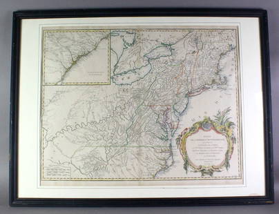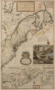
An important historical map by Montanus and Ogilby depicting New York, New England, and Virginia,
Similar Sale History
View More Items in Maps & Atlases

Related Maps & Atlases
More Items in Maps & Atlases
View MoreRecommended Transportation & Travel Collectibles
View More


Item Details
Description
An important historical map by Montanus and Ogilby depicting New York, New England, and Virginia, published in 1671. This map from a Jansson-Visscher map of the Northeast, extending from the St. Laurence and New England to the Chesapeake and centered on Long Island. John Ogilby (1600-1676) and Arnoldus Montanus ( circa 1625-1683), engraving on laid paper with old hand-coloring, titled "NOVA BEGII / Quod nune NOVI JORCK vocatur. / NOVAE qe. ANGLIAE & Partis / Virginae / Accuratissima et Novissima / Delineatio.". Total frame size 20 7/8" x 18 1/8" and sight size 15" x 12". Fold marks, professionally framed and in very good condition.
Buyer's Premium
- 25%
An important historical map by Montanus and Ogilby depicting New York, New England, and Virginia,
Estimate $1,000 - $2,000
19 bidders are watching this item.
Shipping & Pickup Options
Item located in Poughkeepsie, NY, usSee Policy for Shipping
Local Pickup Available
Payment
Accepts seamless payments through LiveAuctioneers

Related Searches
TOP


![[NEW YORK CITY – PICTORIAL MAPS]. Group of 3 pictorial maps...: [NEW YORK CITY – PICTORIAL MAPS]. Group of 3 pictorial maps. Including: ANNAND, George (1890—1980). Sinclair Pictorial Map of New York/New York World’s Fair. 26 ¾ x 27 5/8”](https://p1.liveauctioneers.com/928/325952/175495562_1_x.jpg?height=310&quality=70&version=1712935174)


![[Maps] Gio. Ant. Magnini, Italia, 1620: [Maps] Gio. Ant. Magnini, Italia, 1620, Giovanni Antonio Magnini. Italia, data in luce da Fabio suo figliuolo al Serenissimo Ferdinado Gonzaga Duca di Matoua edi Monserrato etc. Bologna, for Sebastian](https://p1.liveauctioneers.com/188/326797/176317457_1_x.jpg?height=310&quality=70&version=1713847031)
![[Maps] Martin Zeiler, Itinerarium Italiae, 1640: [Maps] Martin Zeiler, Itinerarium Italiae, 1640, Martini Zeilleri. Itinerarium Italiae Nov-Antiquae: oder, Raiss-Beschreibung durch Italien, Matthaus Merian, Frankfurt, 40 plates, most double-page, in](https://p1.liveauctioneers.com/188/326797/176317459_1_x.jpg?height=310&quality=70&version=1713847031)


