


1925 Map of Los Angeles and Vicinity -- Map of Los Angeles and Vicinity
Similar Sale History
View More Items in Maps & Atlases


![Two 1920's California & Los Angeles Maps [136019]: Two (2) 1920's era maps, one for Southern California (13"x 21") and the other of Los Angeles (12"x 17"). While the California map is dated in the 1920's, the Los Angeles map can be aged by the fact th](https://p1.liveauctioneers.com/2699/211814/108066482_1_x.jpg?height=310&quality=70&version=1626720358)
![Los Angeles Maps and Ephemera [148417]: Lot of 22 One Souvenir Sombrero (2") pin ad for L.A. Times (possibly 1920's). 7 road maps from AAA, Mobile gas, Texaco, Rand McNally. Pictorial postcard 12 pack (1948), Four Gray Line tour schedules (](https://p1.liveauctioneers.com/2699/274457/144083332_1_x.jpg?height=310&quality=70&version=1672962673)
![Untitled. [E-Z Guide Map of Los Angeles California With: Publication Date: c1918 Title: Untitled. [E-Z Guide Map of Los Angeles California With Patent Indicator... (Cover Title)]. Cartographer: BAIN FRED C. Height (inches): 12.5 Width (inches): 16.4 Round s](https://p1.liveauctioneers.com/5584/230001/118987354_1_x.jpg?height=310&quality=70&version=1639520429)


Related Maps & Atlases


![Extremité Meridionale de l'Amérique Tierra del Fuego Magellan Str BONNE 1788 map: TITLE/CONTENT OF MAP: [Cook 2e Voyage] Extremité Meridionale de l'Amérique // Partie Est de la Terre de Feu, le Détroit de Le Maire et partie ouest de la terre des Etats // Canal de No&](https://p1.liveauctioneers.com/5584/330116/177980441_1_x.jpg?height=310&quality=70&version=1716324705)

More Items in Maps & Atlases
View More

![[MAP]. TODESCHI, Pietro. [Nova et Acurata Totius Americae Tabula auct. G.I. Blaeu] America quarta: [MAP]. TODESCHI, Pietro. [Nova et Acurata Totius Americae Tabula auct. G.I. Blaeu] America quarta pars orbis quam plerunq, nuvum orbem appellitant primo detecta est anno 1492 a Christophoro Columbo...](https://p1.liveauctioneers.com/197/329395/177650542_1_x.jpg?height=310&quality=70&version=1715364962)


![[MAPS]. HOMANN, Johann Baptist, HOMANN HEIRS, and Georg Matthäus SEUTTER. [Composite Atlas].: [MAPS]. HOMANN, Johann Baptist (1663-1724), HOMANN HEIRS, and Georg Matthäus SEUTTER (1678-1757). [Composite Atlas]. [Nuremberg, Augsburg, and others: Homann Heirs and others, maps dated between](https://p1.liveauctioneers.com/197/329395/177650530_1_x.jpg?height=310&quality=70&version=1715364962)

![[MAP]. ORTELIUS, Abraham. Americae Sive Novi Orbis, Nova Descriptio. 1573.: [MAP]. ORTELIUS, Abraham (1527-1598). Americae Sive Novi Orbis, Nova Descriptio. Antwerp, 1573. Engraved map with hand-coloring. Framed and double glazed, visible area 375 x 521 mm (unexamined out of](https://p1.liveauctioneers.com/197/329395/177650534_1_x.jpg?height=310&quality=70&version=1715364962)


![[MAP]. ORTELIUS, Abraham. Turcici Imperii Descriptio.1592.: [MAP]. ORTELIUS, Abraham (1527-1598). Turcici Imperii Descriptio. Antwerp, 1592. Engraved map with hand-coloring. Matted, framed, and double glazed, sight 406 x 521 mm (unexamined out of frame). Decor](https://p1.liveauctioneers.com/197/329395/177650538_1_x.jpg?height=310&quality=70&version=1715364962)

![[MAP]. ORTELIUS, Abraham. Aevi Veteris, Typus Geographicus. 1601.: [MAP]. ORTELIUS, Abraham (1527-1598). Aevi Veteris, Typus Geographicus. Antwerp, 1601. Engraved map with hand-coloring. Matted, framed, and double glazed, visible area 343 x 470 mm (unexamined out of](https://p1.liveauctioneers.com/197/329395/177650532_1_x.jpg?height=310&quality=70&version=1715364962)
Recommended Transportation & Travel Collectibles
View More


![[FLAGS]. 31-star American parade flag. Ca 1850-1859.: [FLAGS]. 31-star American parade flag. Ca 1850-1859. 22 x 36 1/2 in. cotton flag with 31 printed stars, configured in a double medallion surrounding a much larger central star, that is haloed in both](https://p1.liveauctioneers.com/197/329785/177758218_1_x.jpg?height=310&quality=70&version=1715625218)


Item Details
Description
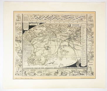
This is an excellent large folding map of Greater Los Angeles as a promotional item for the Security-First National Bank. The map covers from Inglewood to Burbank, Pasadena and (La Canada/) Flintridge, and from Beverly Hills and West Hollywod east to San Marino and San Gabriel. Auto routes are noted in red and the sponsor bank’s branches are noted by gree circles. The reverse side has a birds' eye view of greater Los Angeles from Malibu to west past Redlands and south to past Laguna Beach. The San Gabriel Mountains and the San Fernando Valley are the northern boundaries. The map has very nice representation of the topography and major roads and includes a mileage chart. Inset Los Angeles and Long Beach Harbors. Much detail is offered as to topography, rivers, lakes, roads, railroads, settlement details, etc.
Reserve: $60.00
Shipping:
Your purchase is protected:
Photos, descriptions, and estimates were prepared with the utmost care by a fully certified expert and appraiser. All items in this sale are guaranteed authentic.
In the rare event that the item did not conform to the lot description in the sale, Jasper52 specialists are here to help. Buyers may return the item for a full refund provided you notify Jasper52 within 5 days of receiving the item.
Condition
Fair. Significant damp staining and discoloration. Splits in issued folds, with many closed. A few voids. Toning. Colored.
Buyer's Premium
- 15%
1925 Map of Los Angeles and Vicinity -- Map of Los Angeles and Vicinity
Estimate $70 - $80
2 bidders are watching this item.
Get approved to bid.
Shipping & Pickup Options
Item located in Ohio, US$18 shipping in the US
Payment
Accepts seamless payments through LiveAuctioneers
See More Items From This Jasper52 Seller

TOP