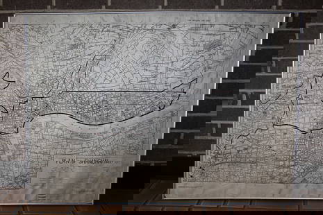
Road map of Southern California 1918
Similar Sale History
View More Items in Maps & AtlasesRelated Maps & Atlases
More Items in Maps & Atlases
View MoreRecommended Transportation & Travel Collectibles
View More


Item Details
Description
Heading: (California)
Author:
Title: Automobile Road Map of Los Angeles, Orange, Riverside and San Bernardino Counties
Place Published: Los Angeles
Publisher:Security Trust & Savings Bank
Date Published: 1918
Description:
Author:
Title: Automobile Road Map of Los Angeles, Orange, Riverside and San Bernardino Counties
Place Published: Los Angeles
Publisher:Security Trust & Savings Bank
Date Published: 1918
Description:
Map printed in red & black; on the back are three smaller maps. Sheet size 43.5x71 cm (17¼x28"), folding.
With maps on the verso: "Motor Routes and Connecting Roads of San Diego County"; "Motor Routes between Los Angeles, San Francisco, Sacramento and Reno"; and "Motor Routes, Los Angeles to Yuma". OCLC lists two copies, at the California Historical Society and the University of California Berkeley, the former designate first edition, the latter second edition, both dated 1916; the present example has the 1916 date, but overprinted in red with 1918 date, and with slightly different panel title.
Condition
Neatly repaired crease tea; very good.
Buyer's Premium
- 25%
Road map of Southern California 1918
Estimate $700 - $1,000
2 bidders are watching this item.
Shipping & Pickup Options
Item located in Berkeley, CA, usOffers In-House Shipping
Local Pickup Available
Payment

Related Searches
TOP


![Large Map of California: Large Map of California With map of Arizona and Nevada [separately] on versos Cartographer: George Franklin Cram Dated: Circa 1900 Type: Color Lithograph Dimensions: 14](https://p1.liveauctioneers.com/5614/330257/178045314_1_x.jpg?height=310&quality=70&version=1716032806)


![[MAP]. TODESCHI, Pietro. [Nova et Acurata Totius Americae Tabula auct. G.I. Blaeu] America quarta: [MAP]. TODESCHI, Pietro. [Nova et Acurata Totius Americae Tabula auct. G.I. Blaeu] America quarta pars orbis quam plerunq, nuvum orbem appellitant primo detecta est anno 1492 a Christophoro Columbo...](https://p1.liveauctioneers.com/197/329395/177650542_1_x.jpg?height=310&quality=70&version=1715364962)


![[MAPS]. HOMANN, Johann Baptist, HOMANN HEIRS, and Georg Matthäus SEUTTER. [Composite Atlas].: [MAPS]. HOMANN, Johann Baptist (1663-1724), HOMANN HEIRS, and Georg Matthäus SEUTTER (1678-1757). [Composite Atlas]. [Nuremberg, Augsburg, and others: Homann Heirs and others, maps dated between](https://p1.liveauctioneers.com/197/329395/177650530_1_x.jpg?height=310&quality=70&version=1715364962)

![[MAP]. ORTELIUS, Abraham. Turcici Imperii Descriptio.1592.: [MAP]. ORTELIUS, Abraham (1527-1598). Turcici Imperii Descriptio. Antwerp, 1592. Engraved map with hand-coloring. Matted, framed, and double glazed, sight 406 x 521 mm (unexamined out of frame). Decor](https://p1.liveauctioneers.com/197/329395/177650538_1_x.jpg?height=310&quality=70&version=1715364962)


