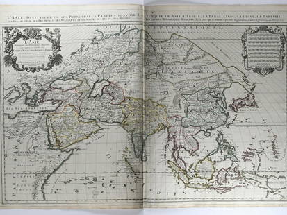
NICHOLAS SANSON, HAND COLORED MAP OF THE POLES
Similar Sale History
View More Items in Maps & AtlasesRelated Maps & Atlases
More Items in Maps & Atlases
View MoreRecommended Transportation & Travel Collectibles
View More


Item Details
Description
Nicholas Sanson (French 1600-1667), "Les deux poles arctique ou septentrional, et Antarctique ou meridional, ou description des terres arctiques et antarctiques, et des pays circomvoisins jusques aux 45 degres de latitude...", circa 1679, hand colored map of the poles, the First Dual Polar Projection, unframed.
Provenance: From the Estate of C.T. and William Biggers, Atlanta, Georgia.
Approximate dimensions: image h. 15.125", w. 21"; mat h. 23", w. 28".
Provenance: From the Estate of C.T. and William Biggers, Atlanta, Georgia.
Approximate dimensions: image h. 15.125", w. 21"; mat h. 23", w. 28".
Buyer's Premium
- 25%
NICHOLAS SANSON, HAND COLORED MAP OF THE POLES
Estimate $300 - $500
5 bidders are watching this item.
Shipping & Pickup Options
Item located in Atlanta, GA, usOffers In-House Shipping
Local Pickup Available
Payment
Accepts seamless payments through LiveAuctioneers

Related Searches
TOP


![[ARCTIC]. BOWEN, Emanuel. A New & Accurate Map of the North...: [ARCTIC]. BOWEN, Emanuel. A New & Accurate Map of the North Pole. London, [ca. 1746]. Copper-plate map, hand-colored, of the regions north of 50 degrees. The western side of North America is marked Pa](https://p1.liveauctioneers.com/928/318880/171360917_1_x.jpg?height=310&quality=70&version=1707501302)

![Sanson map of ancient Asia 1650: Heading: Author: Sanson, Nicolas Title: Asia Vetus Place Published: Paris Publisher: Date Published: [1650] Description: Copper-engraved map, hand-colored in outline; colored decor](https://p1.liveauctioneers.com/642/310901/166355383_1_x.jpg?height=310&quality=70&version=1701367957)
![Mercator map of the North Pole 1619: Heading: Author: Mercator, Gerard Title: Septentrionalium Terrarum descriptio Place Published: Amsterdam Publisher: Date Published: 1595-[1619] Description: Copper-engraved](https://p1.liveauctioneers.com/642/122092/62169135_1_x.jpg?height=310&quality=70&version=1526256630)


![Pyramid Lake Print Pair & 1885 NM & UT Territory Map [179398]: 1855 J H Colton hand colored map of New Mexico and Utah Territories, complete with Pyramid Lake in a shape that is very different as compared to the lake today. Did the cartographer mess up or has the](https://p1.liveauctioneers.com/2699/331495/178785761_1_x.jpg?height=310&quality=70&version=1717094933)


![[MAPS]. HOMANN, Johann Baptist, HOMANN HEIRS, and Georg Matthäus SEUTTER. [Composite Atlas].: [MAPS]. HOMANN, Johann Baptist (1663-1724), HOMANN HEIRS, and Georg Matthäus SEUTTER (1678-1757). [Composite Atlas]. [Nuremberg, Augsburg, and others: Homann Heirs and others, maps dated between](https://p1.liveauctioneers.com/197/329395/177650530_1_x.jpg?height=310&quality=70&version=1715364962)
![[MAP]. TODESCHI, Pietro. [Nova et Acurata Totius Americae Tabula auct. G.I. Blaeu] America quarta: [MAP]. TODESCHI, Pietro. [Nova et Acurata Totius Americae Tabula auct. G.I. Blaeu] America quarta pars orbis quam plerunq, nuvum orbem appellitant primo detecta est anno 1492 a Christophoro Columbo...](https://p1.liveauctioneers.com/197/329395/177650542_1_x.jpg?height=310&quality=70&version=1715364962)

![[MAP]. ORTELIUS, Abraham. Americae Sive Novi Orbis, Nova Descriptio. 1573.: [MAP]. ORTELIUS, Abraham (1527-1598). Americae Sive Novi Orbis, Nova Descriptio. Antwerp, 1573. Engraved map with hand-coloring. Framed and double glazed, visible area 375 x 521 mm (unexamined out of](https://p1.liveauctioneers.com/197/329395/177650534_1_x.jpg?height=310&quality=70&version=1715364962)


![Set of Twelve Satirical Anthropomorphic Maps of Europe: [SATIRICAL MAPS] A set of twelve satirical anthropomorphic maps of Europe. London: circa 1868. A set of 12 (believed complete) lithographed maps by Vincent Brooks, Day & Son, London, each offering](https://p1.liveauctioneers.com/292/330597/178279264_1_x.jpg?height=310&quality=70&version=1716409282)


![[MAP]. ORTELIUS, Abraham. Turcici Imperii Descriptio.1592.: [MAP]. ORTELIUS, Abraham (1527-1598). Turcici Imperii Descriptio. Antwerp, 1592. Engraved map with hand-coloring. Matted, framed, and double glazed, sight 406 x 521 mm (unexamined out of frame). Decor](https://p1.liveauctioneers.com/197/329395/177650538_1_x.jpg?height=310&quality=70&version=1715364962)
![[MAP]. ORTELIUS, Abraham. Romani Imperii Imago. 1592.: [MAP]. ORTELIUS, Abraham (1527-1598). Romani Imperii Imago. Antwerp, 1592. Engraved map with hand-coloring. Matted, framed, and double glazed, visible area 381 x 521 mm (unexamined out of frame). 6 de](https://p1.liveauctioneers.com/197/329395/177650537_1_x.jpg?height=310&quality=70&version=1715364962)
![[MAP]. SPEED, John. A New Mappe of the Romane Empire. 1676.: [MAP]. SPEED, John (ca 1551-1629). A New Mappe of the Romane Empire. London: Basset & Chiswell, 1676. Engraved map with hand-coloring. Framed and double glazed, sight 419 x 559 mm. Decorative cartouch](https://p1.liveauctioneers.com/197/329395/177650541_1_x.jpg?height=310&quality=70&version=1715364962)
![[MAP]. ORTELIUS, Abraham. Aevi Veteris, Typus Geographicus. 1601.: [MAP]. ORTELIUS, Abraham (1527-1598). Aevi Veteris, Typus Geographicus. Antwerp, 1601. Engraved map with hand-coloring. Matted, framed, and double glazed, visible area 343 x 470 mm (unexamined out of](https://p1.liveauctioneers.com/197/329395/177650532_1_x.jpg?height=310&quality=70&version=1715364962)


