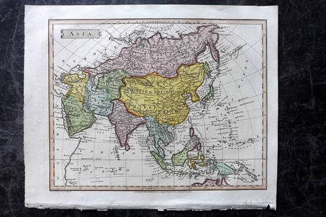
Russell & Barclay 1839 Hand Col Map. Chart of the East India Islands
John Russell Sale History
View Price Results for John Russell
Related Maps & Atlases
More Items from John Russell
View MoreRecommended Transportation & Travel Collectibles
View More


Item Details
Description
Hand Colored Copper Engraved Map Published 1823-40, by Fisher & Son, "A Complete Atlas of the World" by John Russell et al. A Very Rare Work which is compiled from the same plates used in different editions of Barclay's Dictionary. The Maps are dated from 1823-40 and are a mixture of copper and steel engravings. The Atlas was published in 1839-40, but the plates are stock plates of the publisher, printed in the 1820's and 1830's. Paper Size: 10.5 x 8 inch (27 x 21cm) Good Condition
Buyer's Premium
- 22%
Russell & Barclay 1839 Hand Col Map. Chart of the East India Islands
Estimate $60 - $90
4 bidders are watching this item.
Shipping & Pickup Options
Item located in Chesterfield, Derbyshire, ukOffers In-House Shipping
Payment

TOP


