


1950s PanAm Route Map of South America's East Coast -- Pan American Flight Map, South America East
Similar Sale History
View More Items in Maps & Atlases


Related Maps & Atlases


More Items in Maps & Atlases
View More


![[Maps] Gio. Ant. Magnini, Italia, 1620: [Maps] Gio. Ant. Magnini, Italia, 1620, Giovanni Antonio Magnini. Italia, data in luce da Fabio suo figliuolo al Serenissimo Ferdinado Gonzaga Duca di Matoua edi Monserrato etc. Bologna, for Sebastian](https://p1.liveauctioneers.com/188/326797/176317457_1_x.jpg?height=310&quality=70&version=1713847031)

Recommended Transportation & Travel Collectibles
View More


Item Details
Description
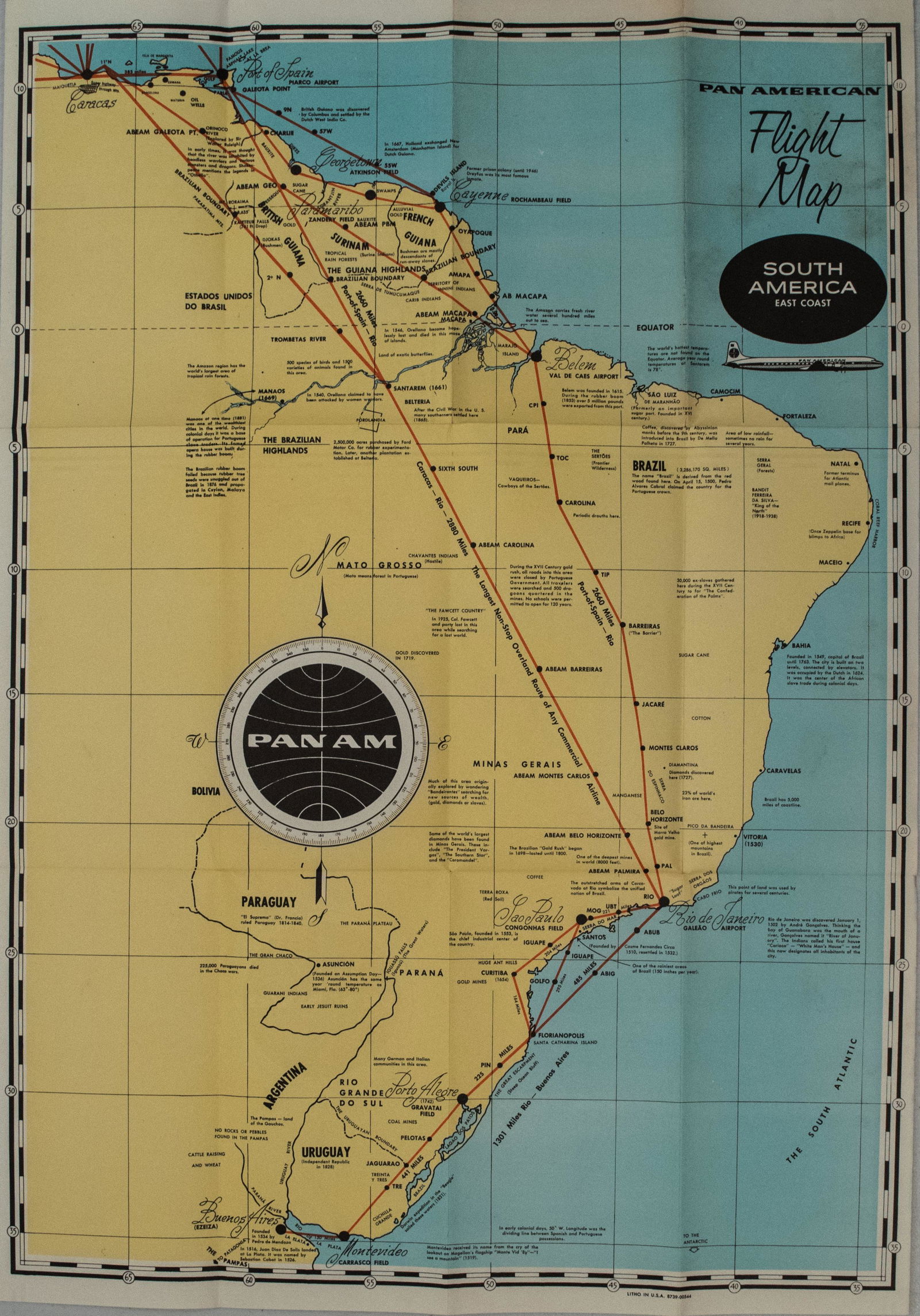
A very nice route map of Pan Am within South America's east coast: cities between and including Caracas and Buenos Aires. The distances are noted between destinations. Interesting historical facts are provided for a number of destination cities and other locations. A DC-7 airplaine is shown by the cartouche.
Reserve: $80.00
Shipping:
Your purchase is protected:
Photos, descriptions, and estimates were prepared with the utmost care by a fully certified expert and appraiser. All items in this sale are guaranteed authentic.
In the rare event that the item did not conform to the lot description in the sale, Jasper52 specialists are here to help. Buyers may return the item for a full refund provided you notify Jasper52 within 5 days of receiving the item.
Condition
Very good. Slight soiling in one panel. Issued folds. Nice color.
Buyer's Premium
- 15%
1950s PanAm Route Map of South America's East Coast -- Pan American Flight Map, South America East
Estimate $100 - $120
2 bidders are watching this item.
Shipping & Pickup Options
Item located in Ohio, US$17 shipping in the US
Payment
Accepts seamless payments through LiveAuctioneers
See More Items From This Jasper52 Seller

Related Searches
TOP