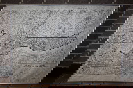
Colored engraving REGNORUM HISPANIAE ET PORTUGALLIAE: …. in their provinces currency. General
Similar Sale History
View More Items in Maps & AtlasesRelated Maps & Atlases
More Items in Maps & Atlases
View MoreRecommended Transportation & Travel Collectibles
View More


Item Details
Description
Colored engraving REGNORUM HISPANIAE ET PORTUGALLIAE: …. in their provinces currency. General Letter D'ESPAGNE ET DE PORTUGAL. Homann. Nuremberg 1782. Map engraved on copper by Güssefeld, after T. López. Title on architectural cartouche flanked by plant motifs and at the foot, various symbolic elements: art, religion, military, etc. Five scales and legend, Color by hand Measurements: Measurements: 44 x 58 cm.
Buyer's Premium
- 27%
Colored engraving REGNORUM HISPANIAE ET PORTUGALLIAE: …. in their provinces currency. General
Estimate €210 - €280
Shipping & Pickup Options
Item located in Madrid, Madrid, esSee Policy for Shipping
Local Pickup Available
Payment

TOP


![Cartagène, Ste. Marthe et Venezuela'. Colombia. Cartagena. BELLIN 1754 map: CAPTION PRINTED BELOW PICTURE: Carte des Provinces de Cartagène, Ste. Marthe et Venezuela [Map of Provinces of Cartagena, Santa Marta and Venezuela] DATE PRINTED: 1754 IMAGE SIZE: Approx 20.5 x 3](https://p1.liveauctioneers.com/5584/330116/177980520_1_x.jpg?height=310&quality=70&version=1716324705)

![Tabasco, Chiapa, Verapaz, Guatimala, Honduras & Yucatan' Mexico BELLIN 1754 map: CAPTION PRINTED BELOW PICTURE: Carte des Provinces de Tabasco, Chiapa, Verapaz, Guatimala, Honduras et Yucatan [Map of the provinces of Tabasco, Chiapas, Verapaz, Guatemala, Honduras and Yucatan] DATE](https://p1.liveauctioneers.com/5584/330116/177980521_1_x.jpg?height=310&quality=70&version=1716324705)
![Carte des Provinces de Tierra Firme, Darien…' Panama Colombia. BELLIN 1756 map: CAPTION PRINTED BELOW PICTURE: Carte des Provinces de Tierra Firme, Darien, Cartagene et Nouvelle Grenade [Map of the provinces of Tierra Firme, Darien, Cartagena and New Granada] DATE PRINTED: 1756 I](https://p1.liveauctioneers.com/5584/330116/177980524_1_x.jpg?height=310&quality=70&version=1716324705)


![[MAP]. SARTINE, Antoine Plan de la Barre et du Havre de Charles-Town...1778. RARE REVOLUTIONARY WAR: [MAP]. SARTINE, Antoine (1729-1801). Plan de la Barre et du Havre de Charles-Town d'apres un plan Anglois leve en 1776... Paris: Depot de la Marine for M. de Sartine, 1778. Copperplate engraving, matt](https://p1.liveauctioneers.com/197/329395/177650540_1_x.jpg?height=310&quality=70&version=1715364962)


![[MAP]. TODESCHI, Pietro. [Nova et Acurata Totius Americae Tabula auct. G.I. Blaeu] America quarta: [MAP]. TODESCHI, Pietro. [Nova et Acurata Totius Americae Tabula auct. G.I. Blaeu] America quarta pars orbis quam plerunq, nuvum orbem appellitant primo detecta est anno 1492 a Christophoro Columbo...](https://p1.liveauctioneers.com/197/329395/177650542_1_x.jpg?height=310&quality=70&version=1715364962)


![[MAPS]. HOMANN, Johann Baptist, HOMANN HEIRS, and Georg Matthäus SEUTTER. [Composite Atlas].: [MAPS]. HOMANN, Johann Baptist (1663-1724), HOMANN HEIRS, and Georg Matthäus SEUTTER (1678-1757). [Composite Atlas]. [Nuremberg, Augsburg, and others: Homann Heirs and others, maps dated between](https://p1.liveauctioneers.com/197/329395/177650530_1_x.jpg?height=310&quality=70&version=1715364962)


![[MAP]. ORTELIUS, Abraham. Turcici Imperii Descriptio.1592.: [MAP]. ORTELIUS, Abraham (1527-1598). Turcici Imperii Descriptio. Antwerp, 1592. Engraved map with hand-coloring. Matted, framed, and double glazed, sight 406 x 521 mm (unexamined out of frame). Decor](https://p1.liveauctioneers.com/197/329395/177650538_1_x.jpg?height=310&quality=70&version=1715364962)


