


 Discovery- InteriorsBonhamsSponsored.Your ad here?
Discovery- Interiors
Bonhams
Sponsored.Your ad here?


Discovery- InteriorsBonhamsSponsored.Your ad here?
Discovery- Interiors
Bonhams
Sponsored.Your ad here?

Des Barres, Pierie & Newton View of Boston taken on the road to Dorchester
Similar Sale History
View More Items in Art


Related Art


More Items in Art
View More


Item Details
Description
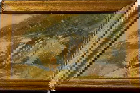
DES BARRES, Joseph Frederick Wallet (1721-1824), after PIERIE, William (fl. late 18th century) & James NEWTON (1748-1804). View of Boston taken on the road to Dorchester. Copperplate engraving. London: F.W. DeBarres, 1776. 21 1/4" x 32" sheet, 33" x 43 1/2" framed.First edition. Engraved by Newton after the drawing by British soldier and artist Pierie. ?The artist William Pierie (Pierrie is presumably a misspelling by the engraver) was a British artillery officer who drew a series of views of the town and environs of Boston in 1773" (Deak, p. 87). ?Some sense of Boston?s early geography as a peninsula is gained from a British officer?s rendering of it not long before the outbreak of hostilities with England. The view, taken from Dorchester to the southwest, embraces a wide ring of the town?s bucolic surroundings while clearly showing its peninsular formation?It was connected to the mainland by a narrow neck that just prevented it from being and island. By the end of the next century, the insular quality of this strategic spit of land had already begun to erode when new routes of access by land were created. As the population increased and space grew scarce on the peninsula, not only were landfill projects steadily undertaken, but Boston?s three large hills were cut down to provide the landfill. The hills formed a high rugged mass extending through the center of the peninsula, known as the Trimountain?In this carefully drawn ?Atlantic Neptune? engraving, an image of the Trimountain has been nicely preserved. Visible on one of its hills (originally called Sentry Hill) is the beacon erected by order of the General Court in 1634 to warn the inhabitants of any danger. Known as Beacon Hill today, this topographic elevation, massively cut down, serves as a pale reminder of Boston?s earlier humped formation. ?In 1773, English drawings and engravings focused on Boston for several reasons. Boston was not only one of England?s thriving colonial seaports, it was also the city where disenchantment toward the mother country was most clearly in evidence. The Boston Massacre had only recently taken place; the defiant Boston Tea Party would soon be staged. Deak 132. Gloria Gilda Deak, ?Picturing America, 1497-1899.
Buyer's Premium
- 25%
Des Barres, Pierie & Newton View of Boston taken on the road to Dorchester
Estimate $10,000 - $15,000
2 bidders are watching this item.
Shipping & Pickup Options
Item located in New York, NY, usOffers In-House Shipping
Local Pickup Available
Payment

Related Searches
TOP