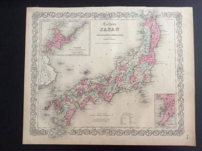
1867 Coltons New York Pocket Atlas Folding Map
Similar Sale History
View More Items in Maps & Atlases
Related Maps & Atlases
More Items in Maps & Atlases
View MoreRecommended Transportation & Travel Collectibles
View More


Item Details
Description
Historic Maps
1867 "New York" Map Pocket Atlas Book by Colton & Co
1867 Colton's New York Map Pocket Atlas, Hardcover Booklet, Published by G. W. & C. B. Colton & Co, Very Fine.
This is an original colorful 1867 Folding Map showing the State of New York and all its different counties. The open Map measures 13.25" x 15.25" and folds up into a 3.25" x 5" within this thin hardcover booklet. Slight a separation at bottom of one fold within the lower right hand corner of the printed map. There is no other damage or repairs to this Post Civil War 1867 Colton's Map of New York.
Buyer's Premium
- 30%
1867 Coltons New York Pocket Atlas Folding Map
Estimate $400 - $500
6 bidders are watching this item.
Shipping & Pickup Options
Item located in Rancho Santa Fe, CA, usOffers In-House Shipping
Payment

Related Searches
TOP


![[EXPLORATION]. STANLEY, Henry M. (1841-1904]. In Darkest Af...: [EXPLORATION]. STANLEY, Henry M. (1841-1904]. In Darkest Africa. New York: Charles Scribner’s Sons, 1891. 2 volumes, 8vo. Illustrated, with 3 folding maps housed in rear pockets (each volume wit](https://p1.liveauctioneers.com/928/265343/138523364_1_x.jpg?height=310&quality=70&version=1666130009)


![Maps of Europe, c1800's (4) [180165]: (4) Maps of Europe from atlas. 1. Map of Europe, borders colored in purple, legend includes railways, submarine telegraphs, boundaries of countries, capitals. Images of ships indicate oceans. 27.5 x 1](https://p1.liveauctioneers.com/2699/331495/178785788_1_x.jpg?height=310&quality=70&version=1717094933)

![Map of Southeastern New York.: Publication Date: 1884 Title: Map of Southeastern New York. Cartographer: [RAND, MCNALLY & CO.] Publisher: H.H. HARDESTY & CO. Height: 19.5 Width: 13.3 Double-page map from a scarce Hardesty atlas. In](https://p1.liveauctioneers.com/5584/331064/178466313_1_x.jpg?height=310&quality=70&version=1716924723)

![Map of Western New York.: Publication Date: 1884 Title: Map of Western New York. Cartographer: [RAND, MCNALLY & CO.] Publisher: H.H. HARDESTY & CO. Height: 12.75 Width: 20 Double-page map from a scarce Hardesty atlas. Letterpr](https://p1.liveauctioneers.com/5584/331064/178466481_1_x.jpg?height=310&quality=70&version=1716924723)


![Pittsburg [Sic] Business District Rand, McNally & Co's New Business Atlas Map of Pittsburg. [Sic]: Publication Date: 1911 Title: Pittsburg [Sic] Business District Rand, McNally & Co's New Business Atlas Map of Pittsburg. [Sic] Cartographer: RAND, MCNALLY & CO. Publisher: RAND, MCNALLY & CO. Height:](https://p1.liveauctioneers.com/5584/331064/178466494_1_x.jpg?height=310&quality=70&version=1716924723)


![[MAPS]. HOMANN, Johann Baptist, HOMANN HEIRS, and Georg Matthäus SEUTTER. [Composite Atlas].: [MAPS]. HOMANN, Johann Baptist (1663-1724), HOMANN HEIRS, and Georg Matthäus SEUTTER (1678-1757). [Composite Atlas]. [Nuremberg, Augsburg, and others: Homann Heirs and others, maps dated between](https://p1.liveauctioneers.com/197/329395/177650530_1_x.jpg?height=310&quality=70&version=1715364962)
![[MAP]. TODESCHI, Pietro. [Nova et Acurata Totius Americae Tabula auct. G.I. Blaeu] America quarta: [MAP]. TODESCHI, Pietro. [Nova et Acurata Totius Americae Tabula auct. G.I. Blaeu] America quarta pars orbis quam plerunq, nuvum orbem appellitant primo detecta est anno 1492 a Christophoro Columbo...](https://p1.liveauctioneers.com/197/329395/177650542_1_x.jpg?height=310&quality=70&version=1715364962)

![[MAP]. ORTELIUS, Abraham. Americae Sive Novi Orbis, Nova Descriptio. 1573.: [MAP]. ORTELIUS, Abraham (1527-1598). Americae Sive Novi Orbis, Nova Descriptio. Antwerp, 1573. Engraved map with hand-coloring. Framed and double glazed, visible area 375 x 521 mm (unexamined out of](https://p1.liveauctioneers.com/197/329395/177650534_1_x.jpg?height=310&quality=70&version=1715364962)


![Set of Twelve Satirical Anthropomorphic Maps of Europe: [SATIRICAL MAPS] A set of twelve satirical anthropomorphic maps of Europe. London: circa 1868. A set of 12 (believed complete) lithographed maps by Vincent Brooks, Day & Son, London, each offering](https://p1.liveauctioneers.com/292/330597/178279264_1_x.jpg?height=310&quality=70&version=1716409282)

![[MAP]. ORTELIUS, Abraham. Turcici Imperii Descriptio.1592.: [MAP]. ORTELIUS, Abraham (1527-1598). Turcici Imperii Descriptio. Antwerp, 1592. Engraved map with hand-coloring. Matted, framed, and double glazed, sight 406 x 521 mm (unexamined out of frame). Decor](https://p1.liveauctioneers.com/197/329395/177650538_1_x.jpg?height=310&quality=70&version=1715364962)
![[MAP]. SPEED, John. A New Mappe of the Romane Empire. 1676.: [MAP]. SPEED, John (ca 1551-1629). A New Mappe of the Romane Empire. London: Basset & Chiswell, 1676. Engraved map with hand-coloring. Framed and double glazed, sight 419 x 559 mm. Decorative cartouch](https://p1.liveauctioneers.com/197/329395/177650541_1_x.jpg?height=310&quality=70&version=1715364962)
![[MAP]. ORTELIUS, Abraham. Aevi Veteris, Typus Geographicus. 1601.: [MAP]. ORTELIUS, Abraham (1527-1598). Aevi Veteris, Typus Geographicus. Antwerp, 1601. Engraved map with hand-coloring. Matted, framed, and double glazed, visible area 343 x 470 mm (unexamined out of](https://p1.liveauctioneers.com/197/329395/177650532_1_x.jpg?height=310&quality=70&version=1715364962)


