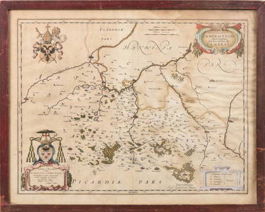
JOAN BLAEU (NETHERLANDS, 1596-1673) MAP OF HAMPSHIRE,
Similar Sale History
View More Items in Maps & Atlases
Related Maps & Atlases
More Items in Maps & Atlases
View MoreRecommended Transportation & Travel Collectibles
View More


Item Details
Description
"Hantonia Sive Southantonensis Comitatus Vulgo Hant-shire". Orig. copper-engraving, J. Blaeu, Amsterdam, 1645. Original old coloring. With decorative title-cartouche, royal and English coats of arms, 8 family coats of arms (including 1 blank shield) and several ships. A very decorative map of Hampshire, a county on the southern coast of England in the United Kingdom. In mahogany box frame, glazed, OS: 21" x 25", impression: 16 1/2" x 19 1/2". Toned, foxing upper left margin.
Buyer's Premium
- 20%
JOAN BLAEU (NETHERLANDS, 1596-1673) MAP OF HAMPSHIRE,
Estimate $300 - $500
5 bidders are watching this item.
Shipping & Pickup Options
Item located in Thomaston, ME, usOffers In-House Shipping
Local Pickup Available
Payment
Accepts seamless payments through LiveAuctioneers

TOP


![Carte des Royaumes de Belgique & Hollande. Belgium Netherlands. LAPIE 1833 map: CAPTION PRINTED BELOW PICTURE: Carte des Royaumes de Belgique et de Hollande [The Kingdoms of Belgium and Holland] DATE PRINTED: The publication date of the atlas within which this map was printed is](https://p1.liveauctioneers.com/5584/328641/177014272_1_x.jpg?height=310&quality=70&version=1715113718)


![Belgique et de Hollande. Belgium & Netherlands. Benelux. MALTE-BRUN c1871 map: TITLE/CONTENT OF MAP: Carte des Royaumes de Belgique et de Hollande [Map of the Kingdoms of Belgium and Holland] DATE PRINTED: c1871 IMAGE SIZE: Approx 33.0 x 24.0cm, 13 x 9.5 inches (Large) TYPE: Ant](https://p1.liveauctioneers.com/5584/328641/177014293_1_x.jpg?height=310&quality=70&version=1715113718)

![1890s Cram Map of Vermont [verso] New Hampshire -- Vermont [verso] New Hampshire: Title: 1890s Cram Map of Vermont [verso] New Hampshire -- Vermont [verso] New Hampshire Cartographer: G Cram Year / Place: 1890 c., Chicago Map Dimension (in.): 12.9 X 9.8 in. This is a very nice map](https://p1.liveauctioneers.com/5584/328338/176911596_1_x.jpg?height=310&quality=70&version=1715113718)
![Les XVII Provinces des Pays-Bas. Netherlands & Belgium. BUFFIER c1818 old map: CAPTION PRINTED BELOW PICTURE: Les XVII Provinces des Pays-Bas [The 17 Provinces of the Netherlands] DATE PRINTED: c1818 IMAGE SIZE: Approx 18.5 x 14.0cm, 7.25 x 5.5 inches (Medium); Please note that](https://p1.liveauctioneers.com/5584/328641/177014241_1_x.jpg?height=310&quality=70&version=1715113718)


![[Maps] Gio. Ant. Magnini, Italia, 1620: [Maps] Gio. Ant. Magnini, Italia, 1620, Giovanni Antonio Magnini. Italia, data in luce da Fabio suo figliuolo al Serenissimo Ferdinado Gonzaga Duca di Matoua edi Monserrato etc. Bologna, for Sebastian](https://p1.liveauctioneers.com/188/326797/176317457_1_x.jpg?height=310&quality=70&version=1713847031)
![[Maps] Martin Zeiler, Itinerarium Italiae, 1640: [Maps] Martin Zeiler, Itinerarium Italiae, 1640, Martini Zeilleri. Itinerarium Italiae Nov-Antiquae: oder, Raiss-Beschreibung durch Italien, Matthaus Merian, Frankfurt, 40 plates, most double-page, in](https://p1.liveauctioneers.com/188/326797/176317459_1_x.jpg?height=310&quality=70&version=1713847031)


