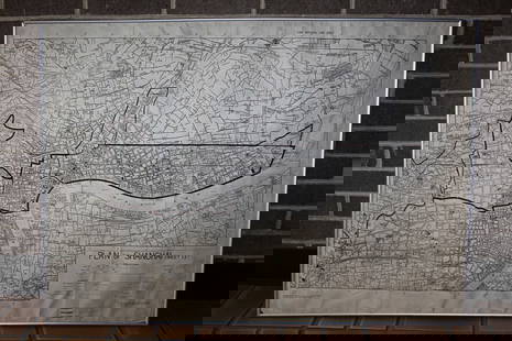
MAP, Caucasus, Ptolemy
Similar Sale History
View More Items in Maps & Atlases
Related Maps & Atlases
More Items in Maps & Atlases
View MoreRecommended Transportation & Travel Collectibles
View More


Item Details
Description
Caucasus. Ptolemy/Fries, [Title on Verso] Tabula II. Asiae, from Claudii Ptolemaei Alexandrini Geographicae…, 1535 (circa). Black & White. This woodblock Ptolemaic map illustrates ancient Sarmatia located northeast of the Black Sea. Mountain ranges dominate the map, and three gates are shown in the Caucasus Mountains, which in ancient times used to be a caravan route to the ancient Orient. The Alexandri Column is shown in present day Georgia. Latin text and ornate woodblock illustrations on verso.
Condition
On watermarked paper with light toning, show-through of text on verso, and minor soiling along the centerfold. There are a few small areas of loss along the centerfold that have been professionally repaired with minor image loss. Grade: B+
Dimensions
11.9 x 15.7 in
Buyer's Premium
- 20% up to $5,000.00
- 15% above $5,000.00
MAP, Caucasus, Ptolemy
Estimate $230 - $275
1 bidder is watching this item.
Get approved to bid.
Shipping & Pickup Options
Item located in Richmond, VA, usOffers In-House Shipping
Local Pickup Available
Payment
Accepts seamless payments through LiveAuctioneers

Related Searches
TOP


![[MAP]. ORTELIUS, Abraham. Aevi Veteris, Typus Geographicus. 1601.: [MAP]. ORTELIUS, Abraham (1527-1598). Aevi Veteris, Typus Geographicus. Antwerp, 1601. Engraved map with hand-coloring. Matted, framed, and double glazed, visible area 343 x 470 mm (unexamined out of](https://p1.liveauctioneers.com/197/329395/177650532_1_x.jpg?height=310&quality=70&version=1715364962)


![Tartaria by Bertius / Langenes. Tartary. Asia. Great Wall of China 1603 map: CAPTION PRINTED BELOW PICTURE: Descriptio Tartariae / Tartaria [Tartary] The map depicts the Great Wall of China DATE PRINTED: 1603 IMAGE SIZE: Approx 10.5 x 17.0cm, 4.25 x 6.5 inches (Small) TYPE: An](https://p1.liveauctioneers.com/5584/329387/177649214_1_x.jpg?height=310&quality=70&version=1715717898)


![[MAP]. TODESCHI, Pietro. [Nova et Acurata Totius Americae Tabula auct. G.I. Blaeu] America quarta: [MAP]. TODESCHI, Pietro. [Nova et Acurata Totius Americae Tabula auct. G.I. Blaeu] America quarta pars orbis quam plerunq, nuvum orbem appellitant primo detecta est anno 1492 a Christophoro Columbo...](https://p1.liveauctioneers.com/197/329395/177650542_1_x.jpg?height=310&quality=70&version=1715364962)


![[MAPS]. HOMANN, Johann Baptist, HOMANN HEIRS, and Georg Matthäus SEUTTER. [Composite Atlas].: [MAPS]. HOMANN, Johann Baptist (1663-1724), HOMANN HEIRS, and Georg Matthäus SEUTTER (1678-1757). [Composite Atlas]. [Nuremberg, Augsburg, and others: Homann Heirs and others, maps dated between](https://p1.liveauctioneers.com/197/329395/177650530_1_x.jpg?height=310&quality=70&version=1715364962)


