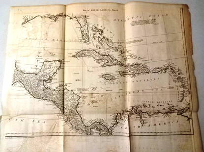
MAP, North America, Levasseur
Similar Sale History
View More Items in Maps & AtlasesRelated Maps & Atlases
More Items in Maps & Atlases
View MoreRecommended Transportation & Travel Collectibles
View More


Item Details
Description
North America. Victor Levasseur, Amerique Septentrionale, from Atlas Universel Illustre, 1835 (circa). Hand Color. This early version of Levasseur's decorative map of North America shows Mexico in control of Texas and the Southwest with Mexico's northern border drawn according to the Treaty of 1819 (here misprinted as 1810). The United State's claims into present-day British Columbia reflect James Polk's expansionist policies. The map is surrounded by beautifully engraved scenes of North and Central America including local animals, a ship stranded in the polar sea, and a Mayan temple.
Condition
Contemporary outline color with light soiling, a faint blind stamp in the bottom blank margin, and a binding strip at far left. Grade: B+
Dimensions
10.9 x 16.9 in
Buyer's Premium
- 20% up to $5,000.00
- 15% above $5,000.00
MAP, North America, Levasseur
Estimate $140 - $170
1 bidder is watching this item.
Shipping & Pickup Options
Item located in Richmond, VA, usOffers In-House Shipping
Local Pickup Available
Payment
Accepts seamless payments through LiveAuctioneers

TOP


![[Maps] Gio. Ant. Magnini, Italia, 1620: [Maps] Gio. Ant. Magnini, Italia, 1620, Giovanni Antonio Magnini. Italia, data in luce da Fabio suo figliuolo al Serenissimo Ferdinado Gonzaga Duca di Matoua edi Monserrato etc. Bologna, for Sebastian](https://p1.liveauctioneers.com/188/326797/176317457_1_x.jpg?height=310&quality=70&version=1713847031)
![[Maps] Martin Zeiler, Itinerarium Italiae, 1640: [Maps] Martin Zeiler, Itinerarium Italiae, 1640, Martini Zeilleri. Itinerarium Italiae Nov-Antiquae: oder, Raiss-Beschreibung durch Italien, Matthaus Merian, Frankfurt, 40 plates, most double-page, in](https://p1.liveauctioneers.com/188/326797/176317459_1_x.jpg?height=310&quality=70&version=1713847031)


