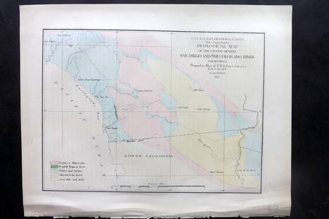
W. Coast of U. S. - Frisco to San Diego. 1852
Similar Sale History
View More Items in Maps & AtlasesRelated Maps & Atlases
More Items in Maps & Atlases
View MoreRecommended Transportation & Travel Collectibles
View More


Item Details
Description
Nicest example of this map I’ve seen in twenty years. Perhaps the most attractive and desirable of the original U.S. Coast Survey charts of the California Coast, with 17 painstakingly hand-colored vignettes. Shows the coast from San Diego and the Mexican border north as far north as Pt. Reyes and the San Francisco Bay. Details San Diego Bay, 'El Peublo de Los Angeles' and the Los Angeles Valley, the Mission of San Fernando and the San Fernando Valley, and the San Francisco Bay area including San Francisco itself, Oakland, San Jose, Union City and Alviso. By far this map's most dramatic quality is the inclusion of seventeen stunning coastal views including 'View of the Entrance to San Francisco Bay,' 'View Pt. Piedras,' 'View Pt. Ano Nuevo,' 'View of Pt. Pinos,' 'View of Pt. Sur,' 'View of Piedras Blancas,' 'View of Moro Rock,' 'Esteros Bay,' 'View of Pt. Sal,' ' View Pt. Arguila,' 'View Pt. Concepcion bearing W. by S.,' 'View of Pt. Concepcion bearing S.E. by E.,' 'View Pt. Duma,' 'View of the Town and Mission of Santa Barbara,' 'View of San Pedro, Pt. Fermin,' 'View showing initial point of boundary between the United States and Mexico,' 'View of Catalina Harbor,' and a 'View Pt. Loma.' Also offers numerous depth soundings along the coastline and between major islands and undersea dangers. Copious notes and sailing instructions in the upper right-hand quadrant of the map are an interesting read for the nautically inclined. Most mid-19th century Coastal Survey maps are browned at the folds. This example has almost none. The vignettes in this map have been carefully colored by a design professional so each is like a small painting, with subtle shading and choice of coloring that adds real depth to each composition. (Most examples of this map are not colored with this much care). Accompanying photo shows what it looked like before coloring. One repaired peanut-size chip at upper left margin where it had originally been bound into book. Few small edge tears (at folds) repaired using Japanese mulberry paper that lasts a thousand years and is reversible. Four small pieces of archival tape on reverse at fold junctions. 22.25 x 22.75
Reserve: $325.00
Shipping:Domestic: Flat-rate of $5.00 to anywhere within the contiguous U.S. International: Foreign shipping rates are determined by destination. International shipping may be subject to VAT. Combined shipping: Please ask about combined shipping for multiple lots before bidding. Location: This item ships from Ohio
Your purchase is protected:
Photos, descriptions, and estimates were prepared with the utmost care by a fully certified expert and appraiser. All items in this sale are guaranteed authentic.
In the rare event that the item did not conform to the lot description in the sale, Jasper52 specialists are here to help. Buyers may return the item for a full refund provided you notify Jasper52 within 5 days of receiving the item.
Reserve: $325.00
Shipping:
Your purchase is protected:
Photos, descriptions, and estimates were prepared with the utmost care by a fully certified expert and appraiser. All items in this sale are guaranteed authentic.
In the rare event that the item did not conform to the lot description in the sale, Jasper52 specialists are here to help. Buyers may return the item for a full refund provided you notify Jasper52 within 5 days of receiving the item.
Condition
Near fine
Buyer's Premium
- 15%
W. Coast of U. S. - Frisco to San Diego. 1852
Estimate $375 - $425
14 bidders are watching this item.
Shipping & Pickup Options
Item located in Ohio, US$5 shipping in the US
Payment
Accepts seamless payments through LiveAuctioneers
See More Items From This Jasper52 Seller

Related Searches
TOP


![Map California during the Conquest: Heading: Author: U.S. War Department Title: [Untitled map of California from Bodega Bay to San Diego, with inset of lower tip of Baja California and the Gulf of California] Place Published: [Washingt](https://p1.liveauctioneers.com/642/218849/112379356_1_x.jpg?height=310&quality=70&version=1631988625)


![[Maps] Gio. Ant. Magnini, Italia, 1620: [Maps] Gio. Ant. Magnini, Italia, 1620, Giovanni Antonio Magnini. Italia, data in luce da Fabio suo figliuolo al Serenissimo Ferdinado Gonzaga Duca di Matoua edi Monserrato etc. Bologna, for Sebastian](https://p1.liveauctioneers.com/188/326797/176317457_1_x.jpg?height=310&quality=70&version=1713847031)
![[Maps] Martin Zeiler, Itinerarium Italiae, 1640: [Maps] Martin Zeiler, Itinerarium Italiae, 1640, Martini Zeilleri. Itinerarium Italiae Nov-Antiquae: oder, Raiss-Beschreibung durch Italien, Matthaus Merian, Frankfurt, 40 plates, most double-page, in](https://p1.liveauctioneers.com/188/326797/176317459_1_x.jpg?height=310&quality=70&version=1713847031)


![[MAP]. TODESCHI, Pietro. [Nova et Acurata Totius Americae Tabula auct. G.I. Blaeu] America quarta: [MAP]. TODESCHI, Pietro. [Nova et Acurata Totius Americae Tabula auct. G.I. Blaeu] America quarta pars orbis quam plerunq, nuvum orbem appellitant primo detecta est anno 1492 a Christophoro Columbo...](https://p1.liveauctioneers.com/197/329395/177650542_1_x.jpg?height=310&quality=70&version=1715364962)


