Map California during the Conquest
Similar Sale History
View More Items in Maps & Atlases
Related Maps & Atlases
More Items in Maps & Atlases
View MoreRecommended Transportation & Travel Collectibles
View More


Item Details
Description
Heading:
Author: U.S. War Department
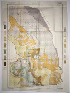
Title: [Untitled map of California from Bodega Bay to San Diego, with inset of lower tip of Baja California and the Gulf of California]
Place Published: [Washington, D.C.]
Publisher:
Date Published: [c.1848]
Description:
Author: U.S. War Department
Title: [Untitled map of California from Bodega Bay to San Diego, with inset of lower tip of Baja California and the Gulf of California]
Place Published: [Washington, D.C.]
Publisher:
Date Published: [c.1848]
Description:
Lithographed map, modern hand coloring. 36.2x30 cm (14½x11¾").
Map showing the disposition of U.S. troops in California (both location and number) following its occupation, also distances within California. Lithographed by P.S. Duval.
Condition
Old folds, a few marginal tears, lower right corner of margin chipped; lower portion os left margin trimmed to neat line for folding; light foxing, about very good.
Buyer's Premium
- 25%
Map California during the Conquest
Estimate $300 - $500
1 bidder is watching this item.
Shipping & Pickup Options
Item located in Berkeley, CA, usSee Policy for Shipping
Payment

Related Searches
TOP


![1703 Scherer - World Map [California as an Island]: Title: World Map [without title] "Map maker: Heinrich Scherer, Atlas Marianus" "Place and Year: Munich, 1703" "Dimensions: 23.6 x 35.5 cm (9.3 x 14 in)" "Technique: Copperplate engraving" "Coloring: U](https://p1.liveauctioneers.com/5584/112867/57947644_1_x.jpg?height=310&quality=70&version=1511920104)


![Map & Street Directory of Hollywood, 1919: Heading: (California - Los Angeles) Author: Title: Map of Hollywood and Street Directory. Also Outline Map of Southern California Place Published: [Hollywood, California] Publisher:Hollywood National](https://p1.liveauctioneers.com/642/326037/175553802_1_x.jpg?height=310&quality=70&version=1713477451)


![[Maps] Gio. Ant. Magnini, Italia, 1620: [Maps] Gio. Ant. Magnini, Italia, 1620, Giovanni Antonio Magnini. Italia, data in luce da Fabio suo figliuolo al Serenissimo Ferdinado Gonzaga Duca di Matoua edi Monserrato etc. Bologna, for Sebastian](https://p1.liveauctioneers.com/188/326797/176317457_1_x.jpg?height=310&quality=70&version=1713847031)


