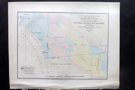
Land office report w/ large colored map 1867
Similar Sale History
View More Items in Maps & AtlasesRelated Maps & Atlases
More Items in Maps & Atlases
View MoreRecommended Transportation & Travel Collectibles
View More


Item Details
Description
Heading: (General Land Office)
Author:
Title: Report of the Commissioner of the General Land Office for the Year 1866.
Place Published: [Washington, D.C.]
Publisher:Government Printing Office
Date Published: 1867
Description:
Author:
Title: Report of the Commissioner of the General Land Office for the Year 1866.
Place Published: [Washington, D.C.]
Publisher:Government Printing Office
Date Published: 1867
Description:
43 pp. With large folding lithographed map titled "Map of the United States and Territories...", measuring 71x141 cm (28x55½"), with outlines and mineral deposits hand-colored. 22.8x14.5 cm (9x5¾"), original green cloth lettered in gilt.
The large map, prepared under the direction of John P. Wilson, shows all of the United States and territories, including western rail lines, Indian reservations, surveyed townships, mineral deposits, and other important geopolitical information. It is one of the largest and most complete maps issued to that time,
References: W-TW 1137. Goetzman, Exploration and Empire, p.539, 540 (Rep).
Condition
Slight wear and soiling to cloth; faint age-toning and some foxing to pages and map, 1-inch triangular piece lost from left margin of map off California coast, some ill-creasing and tears at folds, no other paper loss; very good.
Buyer's Premium
- 25%
Land office report w/ large colored map 1867
Estimate $300 - $500
3 bidders are watching this item.
Shipping & Pickup Options
Item located in Berkeley, CA, usSee Policy for Shipping
Payment

Related Searches
TOP


![6 Decorative Old Maps of 16th-18th Centuries: Set of six vintage "Decorative Old Maps of 16th, 17th, 18th Centuries" including colored maps of Europe, The Holy Land, Asia, Belgium, and Canada and the Great Lakes. [Sheets: 16" H x 20" W]. In good](https://p1.liveauctioneers.com/1221/316726/170695118_1_x.jpg?height=310&quality=70&version=1706931805)


![Beers Map of Deer Park Orange Co. New York: Beers Map of Deer Park, Orange County, New York Scarce [Map] Maker: F. W. Beers Dated: 1875 Type: Hand Colored Dimensions: 14 x 17 3/4"</](https://p1.liveauctioneers.com/5614/168598/85022156_1_x.jpg?height=310&quality=70&version=1589319429)
![Beers Map of Orange Co. New York 1875 - Rare: Beers Plan of Orange County, New York Scarce [Map] Maker: F. W. Beers Dated: 1875 Type: Hand Colored Dimensions: 14 x 17 3/4" Cond](https://p1.liveauctioneers.com/5614/168598/85022155_1_x.jpg?height=310&quality=70&version=1589319430)


![[Maps] Martin Zeiler, Itinerarium Italiae, 1640: [Maps] Martin Zeiler, Itinerarium Italiae, 1640, Martini Zeilleri. Itinerarium Italiae Nov-Antiquae: oder, Raiss-Beschreibung durch Italien, Matthaus Merian, Frankfurt, 40 plates, most double-page, in](https://p1.liveauctioneers.com/188/326797/176317459_1_x.jpg?height=310&quality=70&version=1713847031)


![[Maps] Gio. Ant. Magnini, Italia, 1620: [Maps] Gio. Ant. Magnini, Italia, 1620, Giovanni Antonio Magnini. Italia, data in luce da Fabio suo figliuolo al Serenissimo Ferdinado Gonzaga Duca di Matoua edi Monserrato etc. Bologna, for Sebastian](https://p1.liveauctioneers.com/188/326797/176317457_1_x.jpg?height=310&quality=70&version=1713847031)


