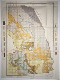
1867 map of Oakland, California
Similar Sale History
View More Items in Maps & Atlases
Related Maps & Atlases
More Items in Maps & Atlases
View MoreRecommended Transportation & Travel Collectibles
View More


Item Details
Description
Heading: (California)
Author: Boardman, W. F., Surveyor
Title: 100 Acre Tract Oakland (Alameda County)
Place Published: San Francisco
Publisher:Osborn & Sessions
Date Published: 1867
Description:
Author: Boardman, W. F., Surveyor
Title: 100 Acre Tract Oakland (Alameda County)
Place Published: San Francisco
Publisher:Osborn & Sessions
Date Published: 1867
Description:
15½x20½" map folded to approximately 9x12½".
Maps shows plots “For Sale.” Covers area generally bounded by Walsworth Ave., Oakland Ave., Lee Ave. and Bay Place, in Trestle Glen. An inset map shows the tract location. OCLC finds 1 (Bancroft).
Condition
Stained, foxed on verso, tear at fold; very good.
Buyer's Premium
- 25%
1867 map of Oakland, California
Estimate $300 - $500
Shipping & Pickup Options
Item located in Berkeley, CA, usOffers In-House Shipping
Local Pickup Available
Payment

Related Searches
TOP


![Rare map of Oakland with ms. transit lines 1893: Heading: (California - Oakland) Author: Dingee, William J. Title: William J. Dingee's Map of Oakland, showing the properties of the Mutual Investment Union. 1893 Place Published: [Oakland?] Publisher:](https://p1.liveauctioneers.com/642/218849/112379278_1_x.jpg?height=310&quality=70&version=1631923877)

![1703 Scherer - World Map [California as an Island]: Title: World Map [without title] "Map maker: Heinrich Scherer, Atlas Marianus" "Place and Year: Munich, 1703" "Dimensions: 23.6 x 35.5 cm (9.3 x 14 in)" "Technique: Copperplate engraving" "Coloring: U](https://p1.liveauctioneers.com/5584/112867/57947644_1_x.jpg?height=310&quality=70&version=1511920104)
![Map California during the Conquest: Heading: Author: U.S. War Department Title: [Untitled map of California from Bodega Bay to San Diego, with inset of lower tip of Baja California and the Gulf of California] Place Published: [Washingt](https://p1.liveauctioneers.com/642/218849/112379356_1_x.jpg?height=310&quality=70&version=1631988625)


![California Map by Colton in Frame, 1855 [180767]: 1855 colored map of California by J H Colton, NY. Lake Tahoe is identified by its original name, Bigler Lake. Upper right insert features San Francisco. Fine condition. Map 17x13", frame 23x20". Colto](https://p1.liveauctioneers.com/2699/331495/178785753_1_x.jpg?height=310&quality=70&version=1717094933)
![Early California Map c1856 [179290]: Map of routes by militar detachments in spring of 1855 from SLC to SF. 4 different routes were examined by Cap.t Ingalls, Col. Stepto, Lt Mowry. Printed by Akerman NY. Detail has the appearance of bei](https://p1.liveauctioneers.com/2699/331495/178785754_1_x.jpg?height=310&quality=70&version=1717094933)
![Large Map of California: Large Map of California With map of Arizona and Nevada [separately] on versos Cartographer: George Franklin Cram Dated: Circa 1900 Type: Color Lithograph Dimensions: 14](https://p1.liveauctioneers.com/5614/330257/178045314_1_x.jpg?height=310&quality=70&version=1716032806)


![Mining Districts-Sketch Gen. Reilly's Route 1849 [178901]: Sketch of Gen. Reilly's Route-Mining Districts, July and August 1849. Copied from the original sketch by Lieut. Derby in the office of the 10th military department by J Hollingsworth. Ackerman's litho](https://p1.liveauctioneers.com/2699/331495/178785791_1_x.jpg?height=310&quality=70&version=1717094933)
![Atlas Maps Report of Fortieth Parallel c1876 (14) [181041]: A collection of 14 rolled vertical atlas maps to accompany "The Report of the Fortieth Parallel," by Clarence King, c1876. Rolled for some time. Not bound. Some degradation on edges. Julius Bien lith.](https://p1.liveauctioneers.com/2699/331495/178785770_1_x.jpg?height=310&quality=70&version=1717094933)


![Map of Trinidad Bay by Bache, 1851 [180181]: Map of Trinidad Bay, California. By A. D. Bache. View of Trinidad Head and City. Published in 1851.10x11.5in.. Trinidad Salvatore Falcone Collection](https://p1.liveauctioneers.com/2699/331495/178785786_1_x.jpg?height=310&quality=70&version=1717094933)
![Map of Mare Island Straits California by Bache, 1851 [179999]: Map of Mare Island Straits California by A. D. Bache. Shaded relief with survey. Published in 1851. About 7x14in.. Mare Island Straits California Salvatore Falcone Collection](https://p1.liveauctioneers.com/2699/331495/178785781_1_x.jpg?height=310&quality=70&version=1717094933)
![[MAPS]. HOMANN, Johann Baptist, HOMANN HEIRS, and Georg Matthäus SEUTTER. [Composite Atlas].: [MAPS]. HOMANN, Johann Baptist (1663-1724), HOMANN HEIRS, and Georg Matthäus SEUTTER (1678-1757). [Composite Atlas]. [Nuremberg, Augsburg, and others: Homann Heirs and others, maps dated between](https://p1.liveauctioneers.com/197/329395/177650530_1_x.jpg?height=310&quality=70&version=1715364962)
![[MAP]. TODESCHI, Pietro. [Nova et Acurata Totius Americae Tabula auct. G.I. Blaeu] America quarta: [MAP]. TODESCHI, Pietro. [Nova et Acurata Totius Americae Tabula auct. G.I. Blaeu] America quarta pars orbis quam plerunq, nuvum orbem appellitant primo detecta est anno 1492 a Christophoro Columbo...](https://p1.liveauctioneers.com/197/329395/177650542_1_x.jpg?height=310&quality=70&version=1715364962)

![[MAP]. ORTELIUS, Abraham. Americae Sive Novi Orbis, Nova Descriptio. 1573.: [MAP]. ORTELIUS, Abraham (1527-1598). Americae Sive Novi Orbis, Nova Descriptio. Antwerp, 1573. Engraved map with hand-coloring. Framed and double glazed, visible area 375 x 521 mm (unexamined out of](https://p1.liveauctioneers.com/197/329395/177650534_1_x.jpg?height=310&quality=70&version=1715364962)


![Set of Twelve Satirical Anthropomorphic Maps of Europe: [SATIRICAL MAPS] A set of twelve satirical anthropomorphic maps of Europe. London: circa 1868. A set of 12 (believed complete) lithographed maps by Vincent Brooks, Day & Son, London, each offering](https://p1.liveauctioneers.com/292/330597/178279264_1_x.jpg?height=310&quality=70&version=1716409282)


![[MAP]. ORTELIUS, Abraham. Turcici Imperii Descriptio.1592.: [MAP]. ORTELIUS, Abraham (1527-1598). Turcici Imperii Descriptio. Antwerp, 1592. Engraved map with hand-coloring. Matted, framed, and double glazed, sight 406 x 521 mm (unexamined out of frame). Decor](https://p1.liveauctioneers.com/197/329395/177650538_1_x.jpg?height=310&quality=70&version=1715364962)
![[MAP]. ORTELIUS, Abraham. Romani Imperii Imago. 1592.: [MAP]. ORTELIUS, Abraham (1527-1598). Romani Imperii Imago. Antwerp, 1592. Engraved map with hand-coloring. Matted, framed, and double glazed, visible area 381 x 521 mm (unexamined out of frame). 6 de](https://p1.liveauctioneers.com/197/329395/177650537_1_x.jpg?height=310&quality=70&version=1715364962)
![[MAP]. SPEED, John. A New Mappe of the Romane Empire. 1676.: [MAP]. SPEED, John (ca 1551-1629). A New Mappe of the Romane Empire. London: Basset & Chiswell, 1676. Engraved map with hand-coloring. Framed and double glazed, sight 419 x 559 mm. Decorative cartouch](https://p1.liveauctioneers.com/197/329395/177650541_1_x.jpg?height=310&quality=70&version=1715364962)
![[MAP]. ORTELIUS, Abraham. Aevi Veteris, Typus Geographicus. 1601.: [MAP]. ORTELIUS, Abraham (1527-1598). Aevi Veteris, Typus Geographicus. Antwerp, 1601. Engraved map with hand-coloring. Matted, framed, and double glazed, visible area 343 x 470 mm (unexamined out of](https://p1.liveauctioneers.com/197/329395/177650532_1_x.jpg?height=310&quality=70&version=1715364962)


