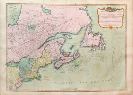
DE L'ISLE - French Map of North America 1742
Similar Sale History
View More Items in Maps & AtlasesRelated Maps & Atlases
More Items in French Maps & Atlases
View MoreRecommended Transportation & Travel Collectibles
View More


Item Details
Description
DE L'ISLE, Guillaume (1675-1726). L'Amerique Septentrionale Dressée sur les Observations de Mrs. de l'Academie Royale des Sciences.... Amsterdam: Pierre Schenk, 1708. Copper-engraved map, full period hand-colouring. Sheet size: 19 7/8 x 23 3/4 inches.
Schenk's rare derivative of De L'Isle's famed map.
In 1700, Claude and Guillaume D L'Isle [first] published their foundation map of North America. What better way to usher in the eighteenth century cartographically than with this significant and influential map. It encapsulates an era in which the French exemplified a reliance on scientific mapping and beautifully incorporated it into the earlier influence of decorative augmentation (Burden).
Tooley adds: A foundation map. The Great Lakes based on Coronelli show the French strong points at Tadousac, Quebec, Fort Sorel, Montreal & Fort Frontenac. the English settlements confined to the east of the Alleghenies, with Fort and River Kinibeki as the border between New England and Acadia. The Mississippi valley area is shown well developed with the recent French settlement of d'Iberville at Bilochy and forts at Bon Secours and St. Louis. In this map De l'Isle corrected longitude positions and was the first to revert to a peninsula form of California. Perhaps most significantly, in the second and subsequent states of the map the mouth of the Mississippi is accurately shown for the first time, being the first map to depict information from the surveys of the D'Iberville expedition.
Following the end of Renard's contract to sell De L'Isle's maps in Amsterdam, Petrus Schenk issued the present re-engraved derivative map of De l'Isle's original. Burden notes it to be an almost exact derivative..
Cf. Burden, The Mapping of North America 761; Tooley, French Mapping of the Americas 32 in Tooley, The Mapping of America.
Buyer's Premium
- 25%
DE L'ISLE - French Map of North America 1742
Estimate $1,200 - $1,400
1 bidder is watching this item.
Get approved to bid.
Shipping & Pickup Options
Item located in New York, NY, usOffers In-House Shipping
Payment

Auction Curated By

the founder of Donald Heald Rare Books, has been in the business for 49 years and worked with some of the most renowned auction houses in the world. He is a member of the American Antiquarian Society, the Grolier Club, and the ABAA
TOP


![Détroit de Magellan. Strait of Magellan. Chile. BONNE 1790 old antique map: TITLE/CONTENT OF MAP: [Voyage des Capitaines Byron, Vallis et Carteret] Détroit de Magellan avec les Plans des principaux Ports, Bayes &c. de ce Détroit // Havre Swalow ou de l'Hirondelle //](https://p1.liveauctioneers.com/5584/330116/177980527_1_x.jpg?height=310&quality=70&version=1716324705)
![Détroit de Magellan. Strait of Magellan. Chile. BONNE 1788 old antique map: TITLE/CONTENT OF MAP: [Voyage des Capitaines Byron, Vallis et Carteret] Détroit de Magellan avec les Plans des principaux Ports, Bayes &c. de ce Détroit // Havre Swalow ou de l'Hirondelle //](https://p1.liveauctioneers.com/5584/330116/177980442_1_x.jpg?height=310&quality=70&version=1716324705)


