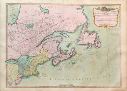
JAILLOT - North America/California 1719
Similar Sale History
View More Items in Maps & AtlasesRelated Maps & Atlases
More Items in French Maps & Atlases
View MoreRecommended Transportation & Travel Collectibles
View More


Item Details
Description
JAILLOT, Alexis- Hubert (1632-1712). - Bernard Jean Hyacinthe JAILLOT [1673-1739, publisher] . Amerique Septentrionale Divisee en Ses Principales Parties . . . François, Castillans, Anglois, Suedois, Danois, Hollandois Tirée des Relations de toutes ces Nations Par le Sr. Sanson. Paris: 1719. Copper-engraved map by Cordier on laid, watermarked paper, hand-coloured in outline, in very good condition. Sheet size: 21 x 29 3/4 inches.
A handsome copy of Burden's 5th issue of Jaillot's map of North America, revised to incorporate the best available information from Guillaume De L'Isle and others, and with strong outline color.
Hubert Jaillot's son Bernard carried on the family cartography business upon the death of his father in 1712, and in 1713, he issued a much revised and improved map of North America, incorporating the new geographic knowledge procured by De L'Isle and De Fer. In 1719, he issued what would be the fifth state of the map on which California ceased to be an island and the Carolinas were shown as part of the French territory: Floride.
It is interesting to look at maps of North America at this period in terms of ambition competing with objectivity. One feels the emotional, political ambitions of England and France to have been boundless and liable to provoke quite pugnacious reactions, even though neither side really knew very well the geography of what they were claiming. The trials of exploration to ascertain actual facts were harsh and often not well rewarded, nor were the explorers always able to know: note LaSalle's account of the Mississippi wandering into Texas before finding the Gulf.
Nevertheless, this revised edition of Hubert Jaillot's 17th century map incorporates a great deal of important geographical information: a greatly improved delineation of the Great Lakes, the addition of tributary rivers to the Mississippi, the re-routing of the Rio Grande (R. del Norte) to the Gulf of Mexico and, of course, the re-attachment of California to the continent, though this is done in an equivocal way.
Burden, The Mapping of North America II, 709 (5th state); Karpinski, L.C. (MI) XXI; McLaughlin, The Mapping of California as an Island 113, state 2; Wheat, Mapping the Transmississippi West 74.
Buyer's Premium
- 25%
JAILLOT - North America/California 1719
Estimate $1,500 - $1,800
2 bidders are watching this item.
Shipping & Pickup Options
Item located in New York, NY, usOffers In-House Shipping
Payment

Auction Curated By

the founder of Donald Heald Rare Books, has been in the business for 49 years and worked with some of the most renowned auction houses in the world. He is a member of the American Antiquarian Society, the Grolier Club, and the ABAA
TOP


![Pair of Malte-Brun Manuscript Map, Canada & North Pole: MALTE-BRUN, Victor Adolphe (1816-1889). Untitled [Canada / North Pole] Brown and red pen and ink on chalk paper, with some pencil annotations. c. 1857-1865. 11 3/8" x 16" sheet. The map shows the Nort](https://p1.liveauctioneers.com/1968/242429/125658899_1_x.jpg?height=310&quality=70&version=1648486124)

![French Map of the North East U.S.: [After Overton & Nollin]. Carte des Colonies Anglaises dans l'Amerique Septentrionale Terminee par la Re. Ohio. Engraved map with hand color in outline. Paris: R. J. B. de Poilly. c. 1756. 17 1/4" x 1](https://p1.liveauctioneers.com/1968/148982/75279197_1_x.jpg?height=310&quality=70&version=1567102562)

![Thevet Map of the Americas: THEVET, Andre (1516-1590). Quarte Partie du Monde [North and South America]. Woodcut Engraving. Paris: c. 1575. 14 1/4" x 18 1/2" sheet.](https://p1.liveauctioneers.com/1968/148982/75279232_1_x.jpg?height=310&quality=70&version=1567102562)


![[FLAGS]. 31-star American parade flag. Ca 1850-1859.: [FLAGS]. 31-star American parade flag. Ca 1850-1859. 22 x 36 1/2 in. cotton flag with 31 printed stars, configured in a double medallion surrounding a much larger central star, that is haloed in both](https://p1.liveauctioneers.com/197/329785/177758218_1_x.jpg?height=310&quality=70&version=1715625218)


